
Thanks to everyone who critiqued my route over in this post! I had an amazing time and the route was pretty much perfect! I wrote the trip up over on my blog so you can read it there as well. (Links to a few more photos there too.)
Day 0
Drive to Lodgepole
I drove to Lodgepole, picked up my permit from the ranger station, and did a little acclimation hike to Tokopah Falls to look for bears, but did not see any.
Day 1
Wolverton to Buck Creek via Panther Gap
11mi, +2,600ft/-2,700ft
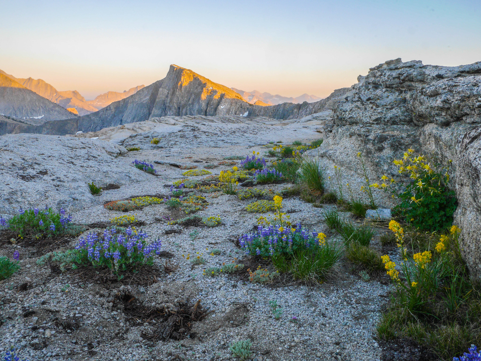
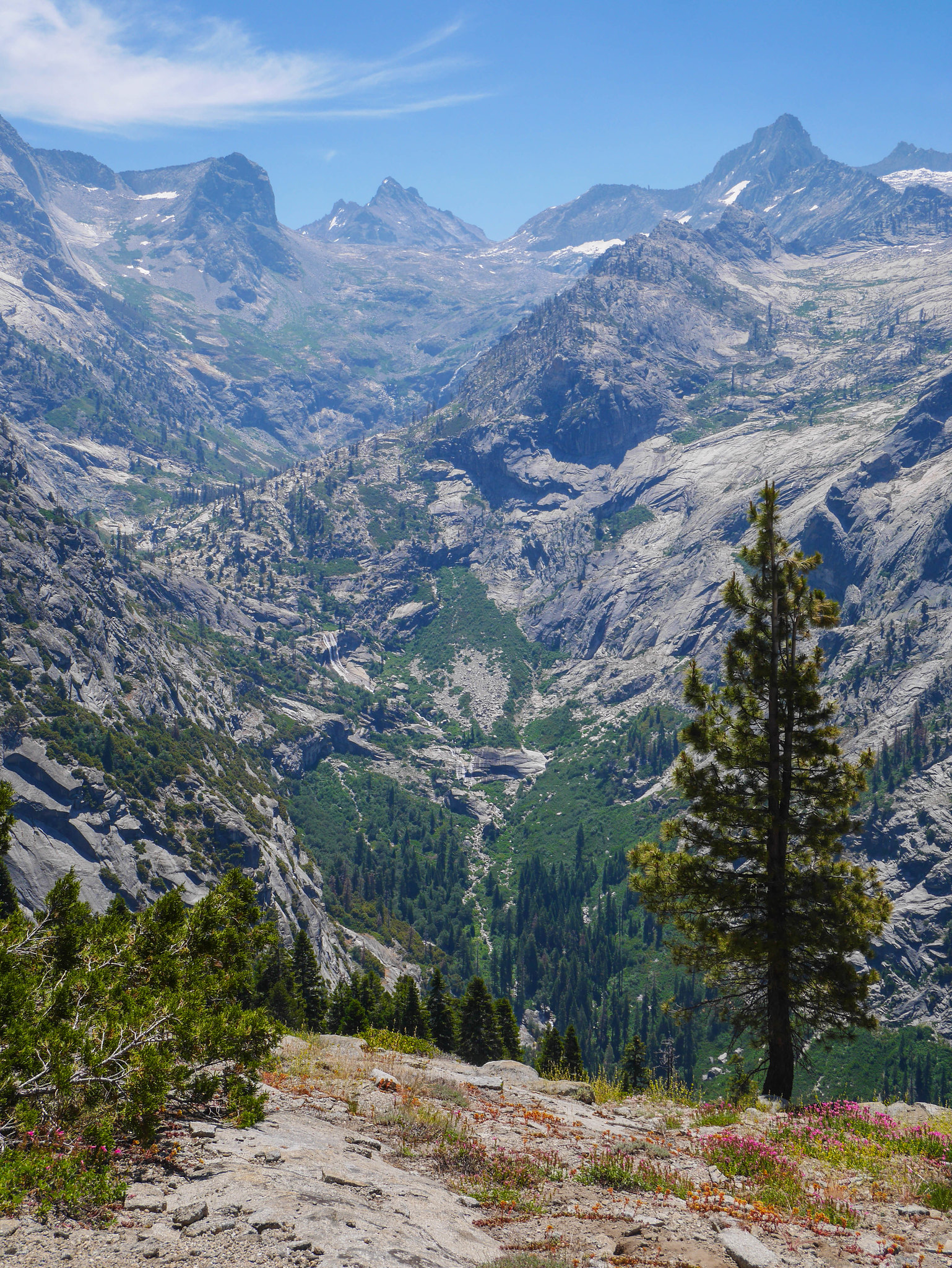
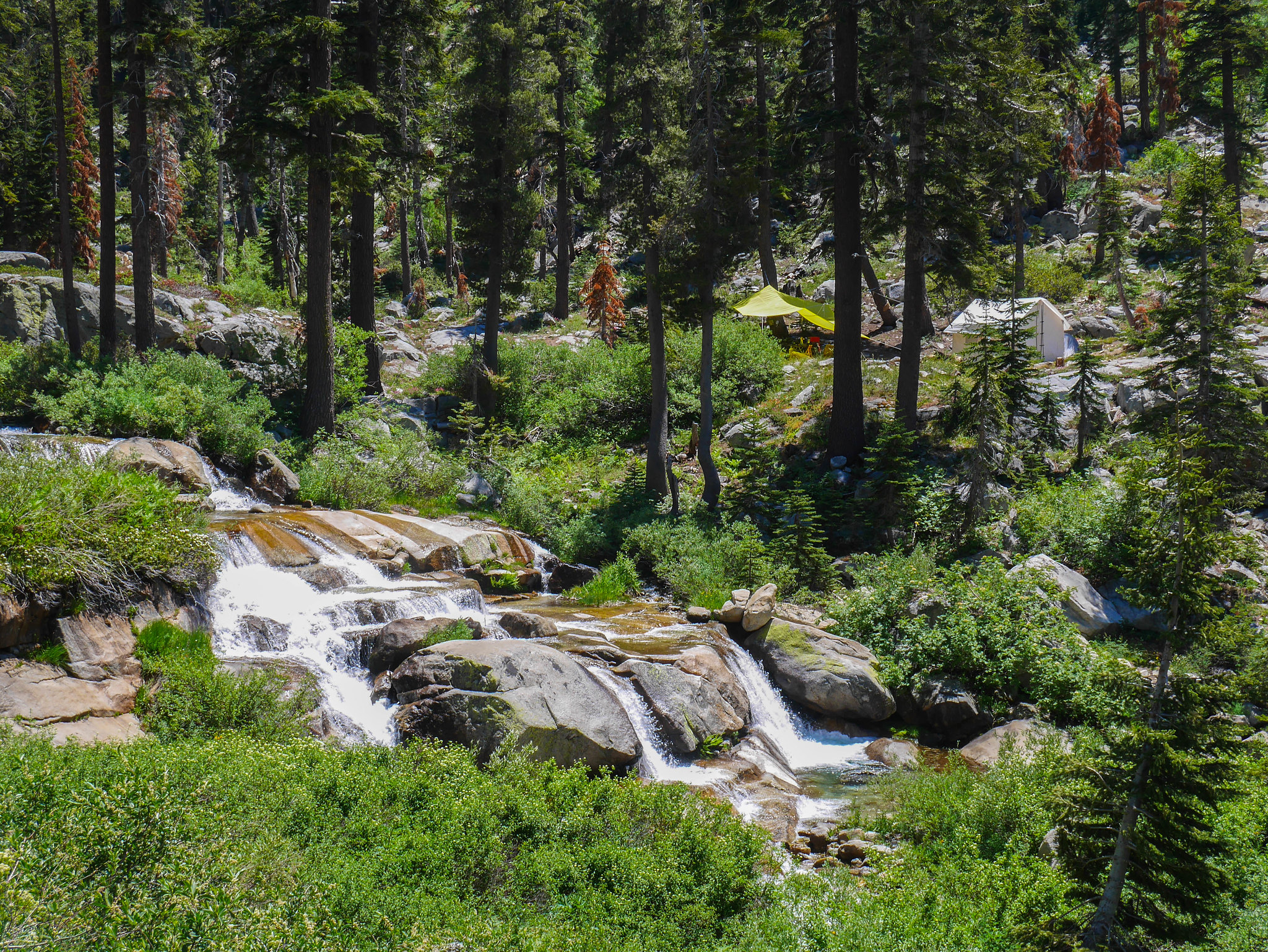
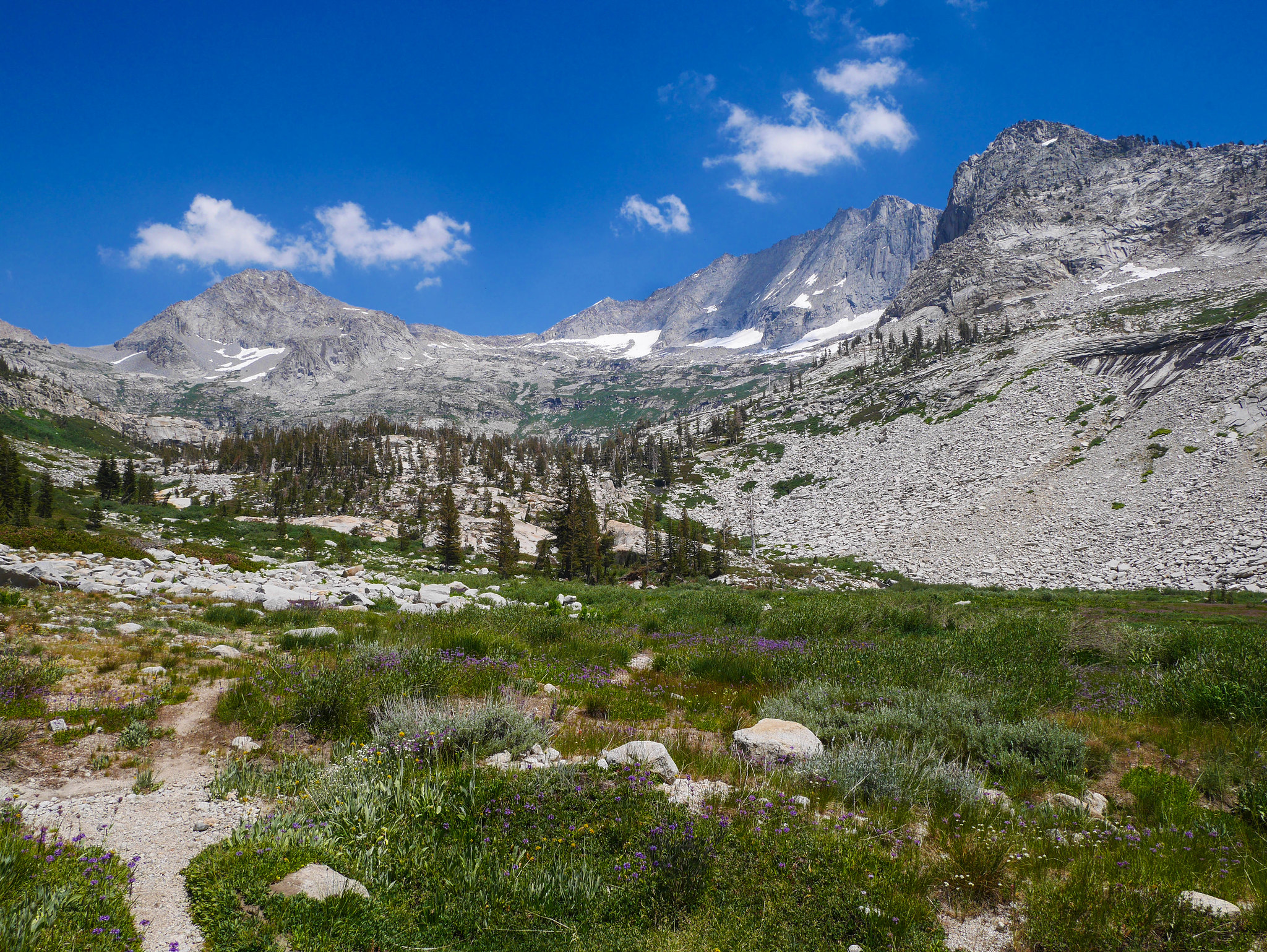
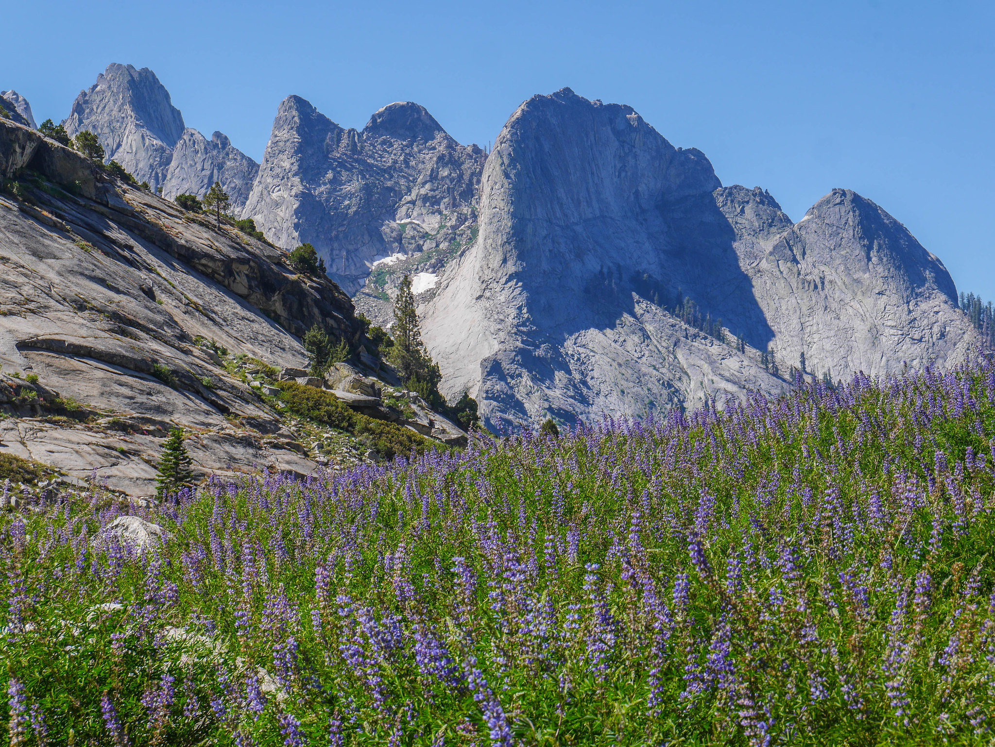
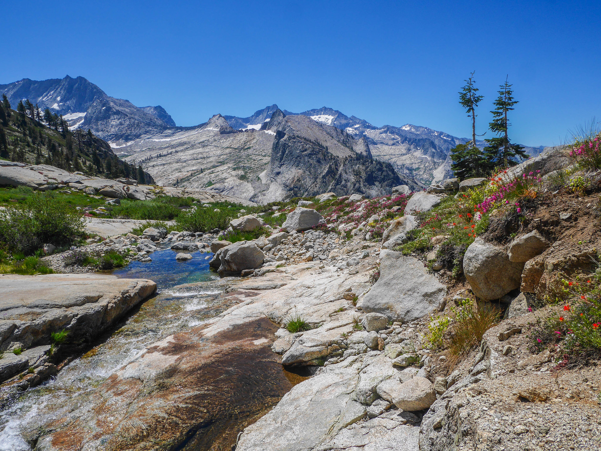
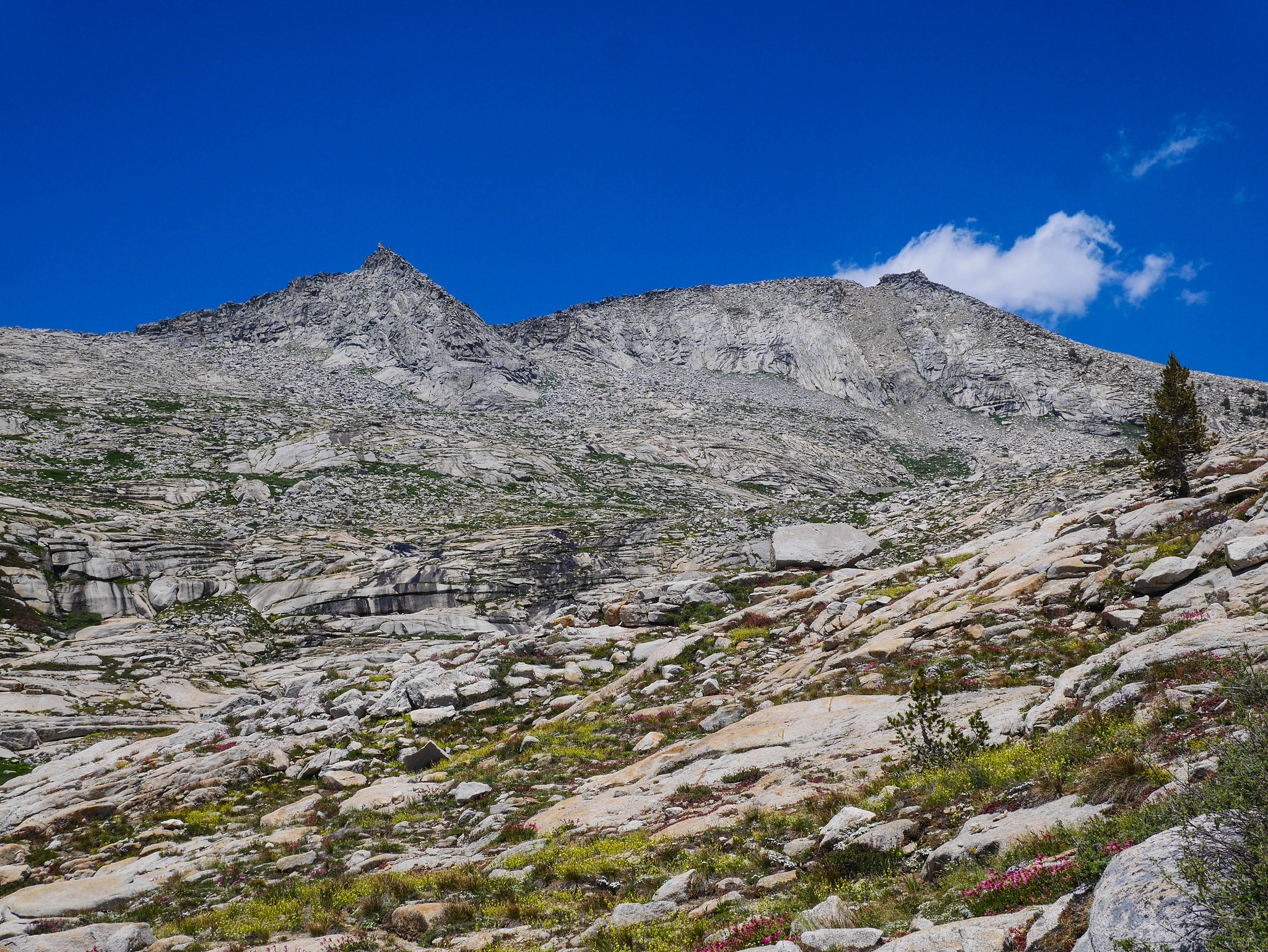
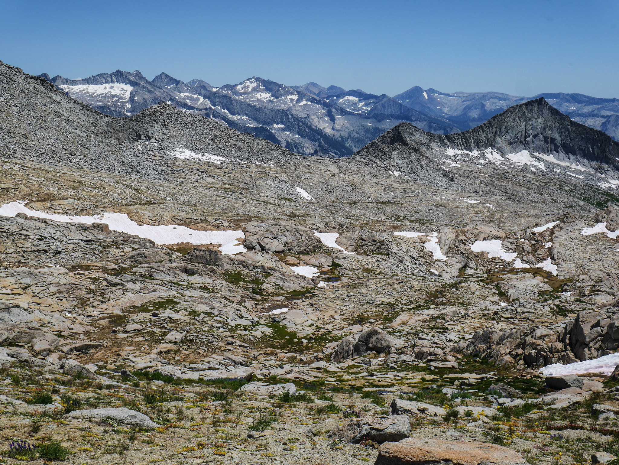
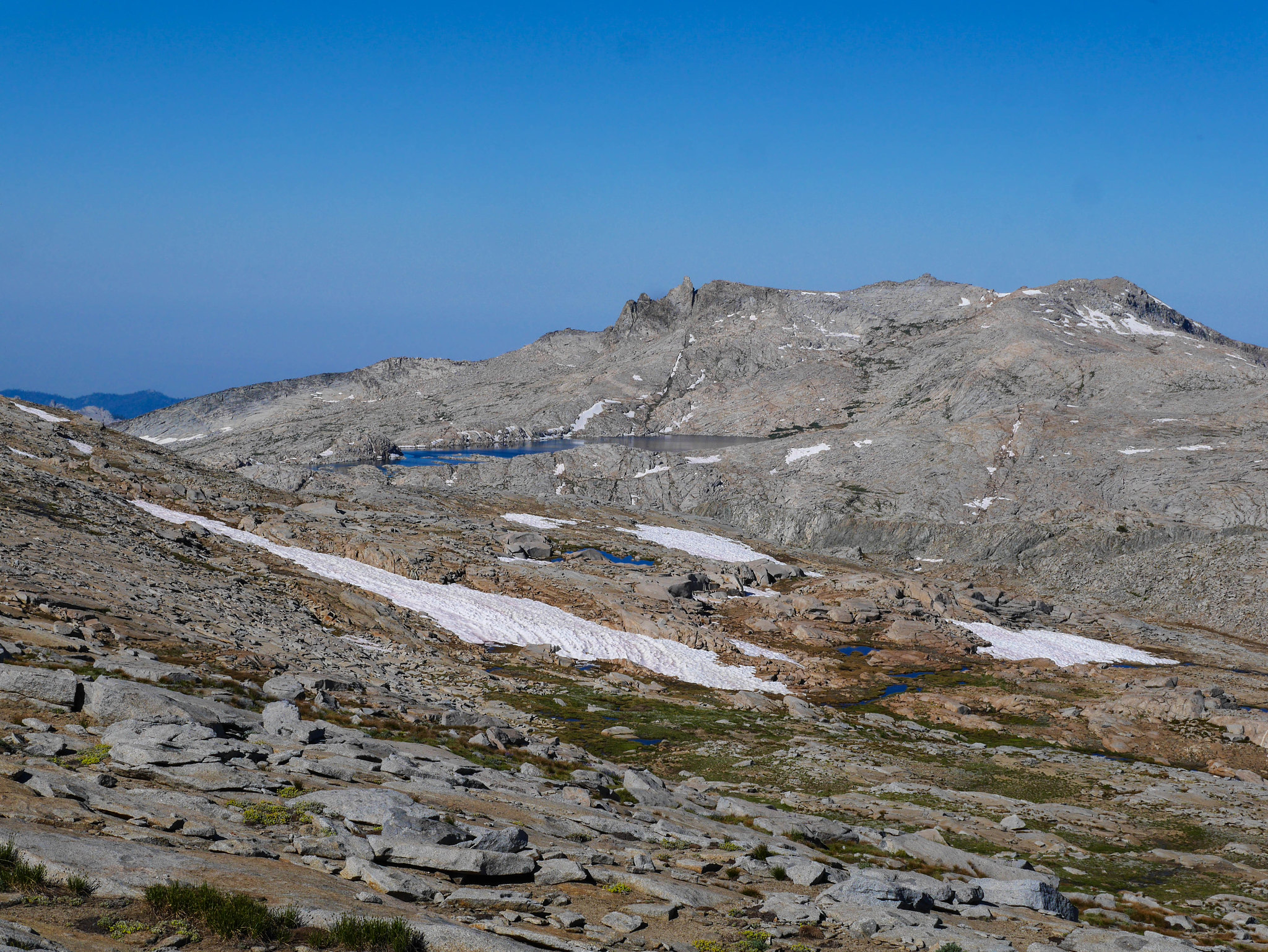
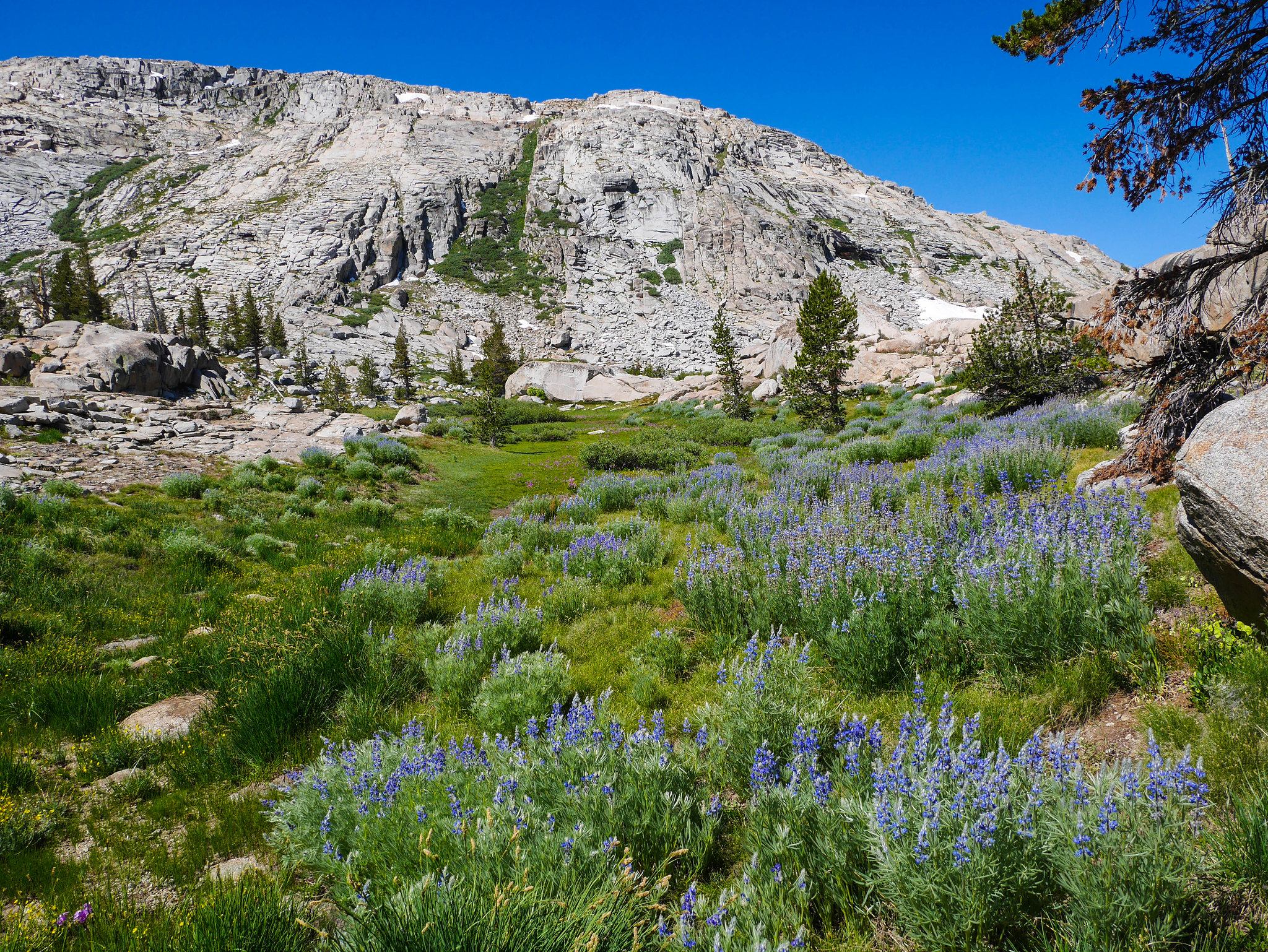
I let myself sleep in and got a late start, knowing that this day wouldn't be too long and that spending time at Buck Creek in the evening wouldn't warrant hours and hours. Plus, I was still a bit sore from riding a mechanical bull at the Alameda County Fair, and my thighs begged for a few hours extra rest. After packing up camp at Lodgepole, I drove over to the Wolverton trailhead and headed up through the familiar forested trail up to Panther Gap. The first couple miles I found myself passing resting day hikers on their way up to the lakes I'd circle back through on my way out, but once I reached Panther Gap I didn't see anyone else for miles. At Panther Gap, I continued on the Alta trail, which I've hiked a few times, but it's been a few years since I was last on it. I turned downhill (south) on the High Sierra Trail connector, which I'd never hiked before. The connector offered lovely views of the Great Western Divide and fields of wildflowers.
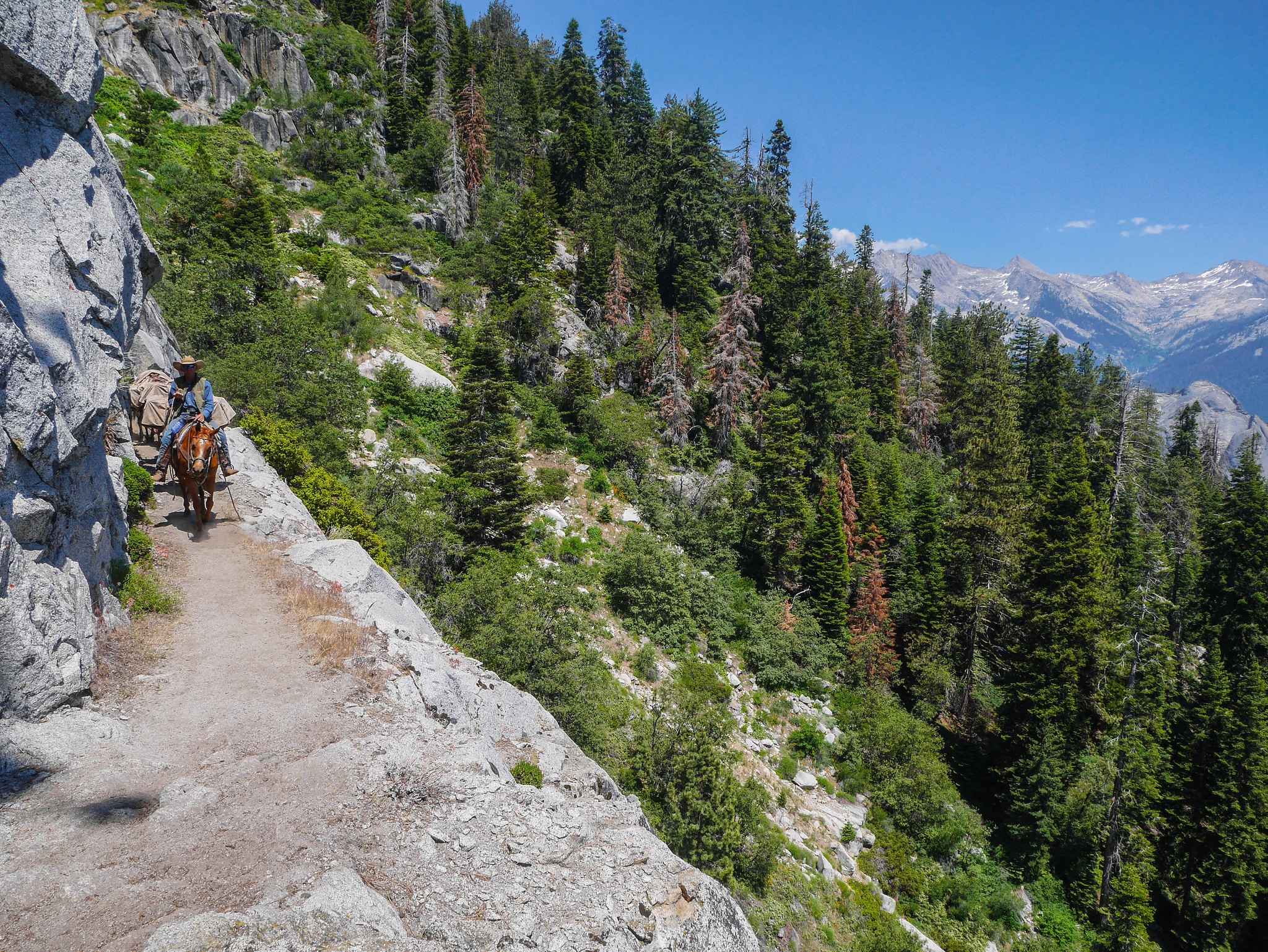
I guess all the High Sierra Trail hikers were well on their way to Bearpaw or Hamilton by now, because these packers on their way back from the Bearpaw High Sierra Camp were the only people I encountered before Buck Creek.
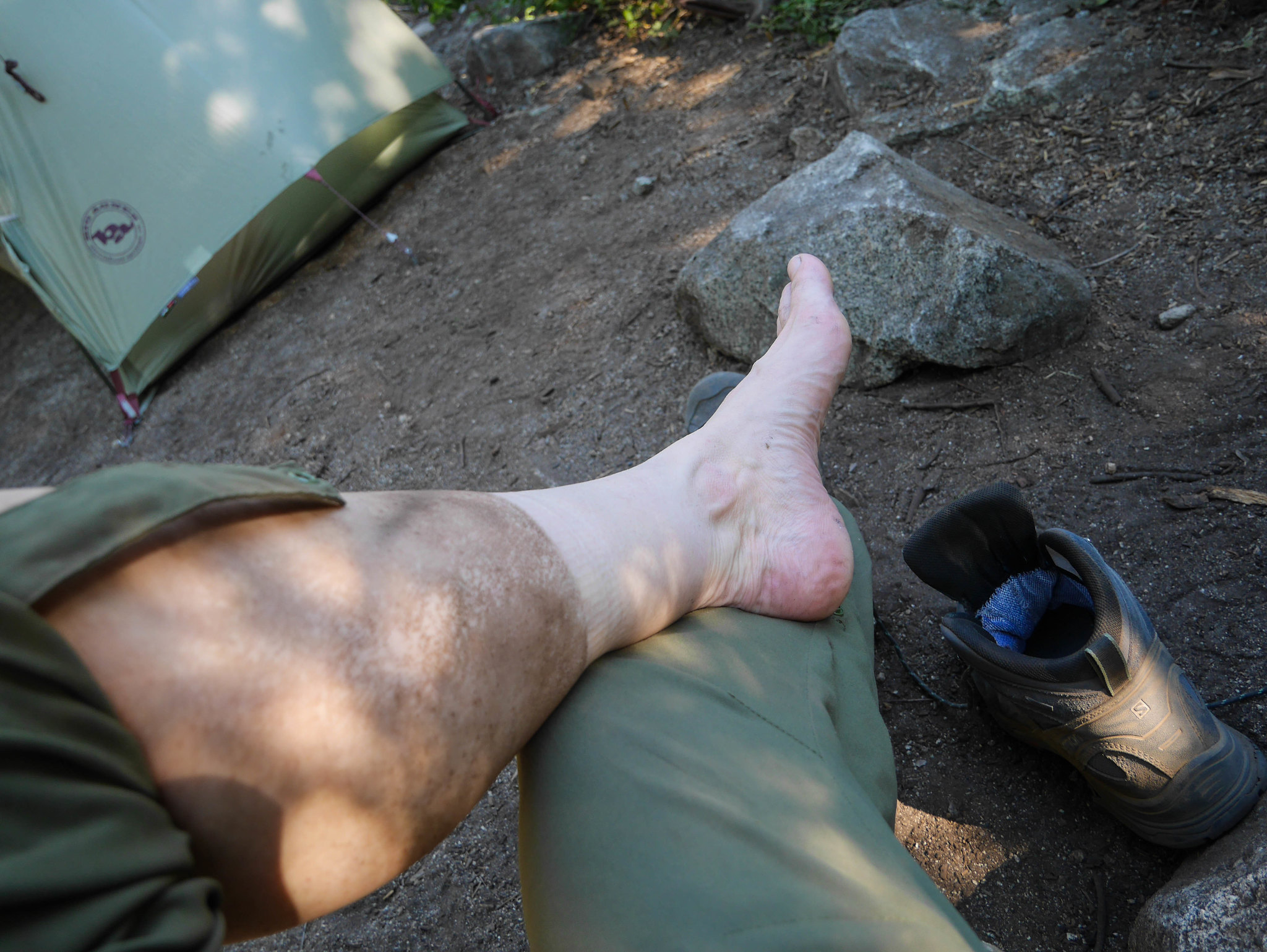
I camped at Buck Creek a few tent pads down from the bear box; the closest site was taken by a pair of women bailing on the High Sierra Trail due to one woman's foot issues, which indeed looked horrendous (why I looked I'll never know). I was dirty from the hoof-busted trail, so I bathed in Buck Creek and then sacked out to read Octavia Butler before drifting off to sleep.
Day 2
Buck Creek to Tamarack Lake
5.5mi, +2,900ft/-800ft
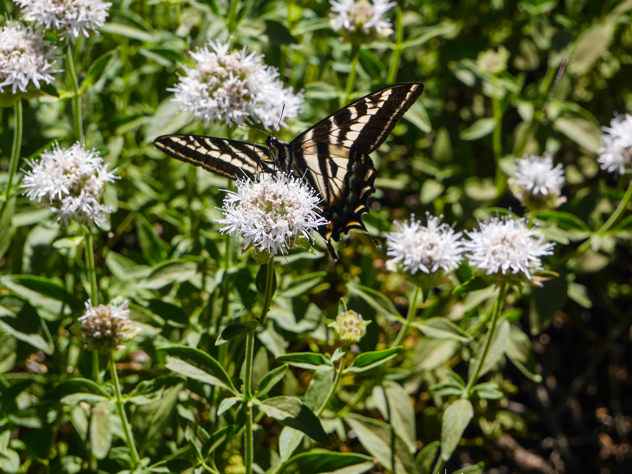
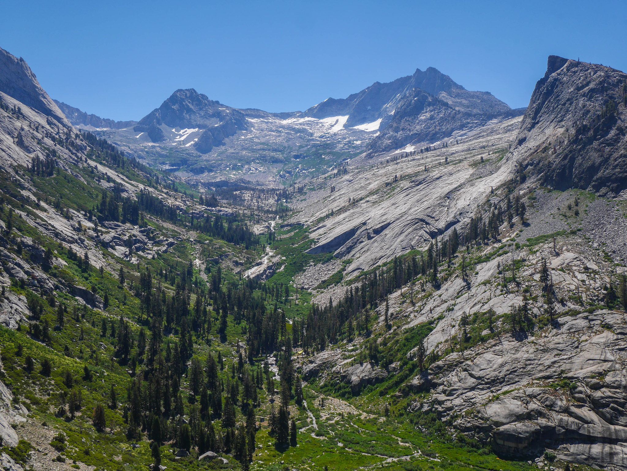
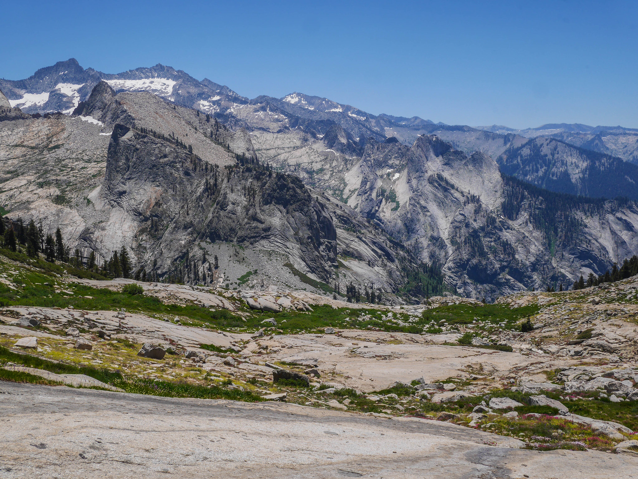
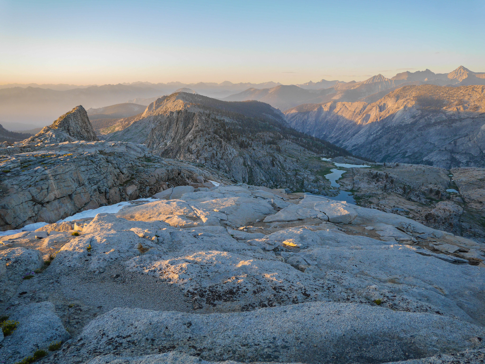
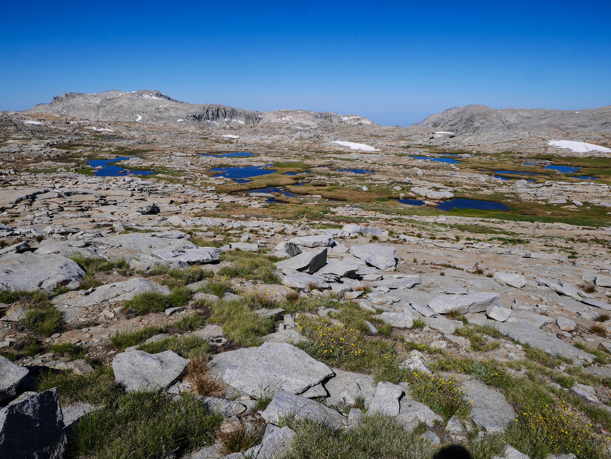
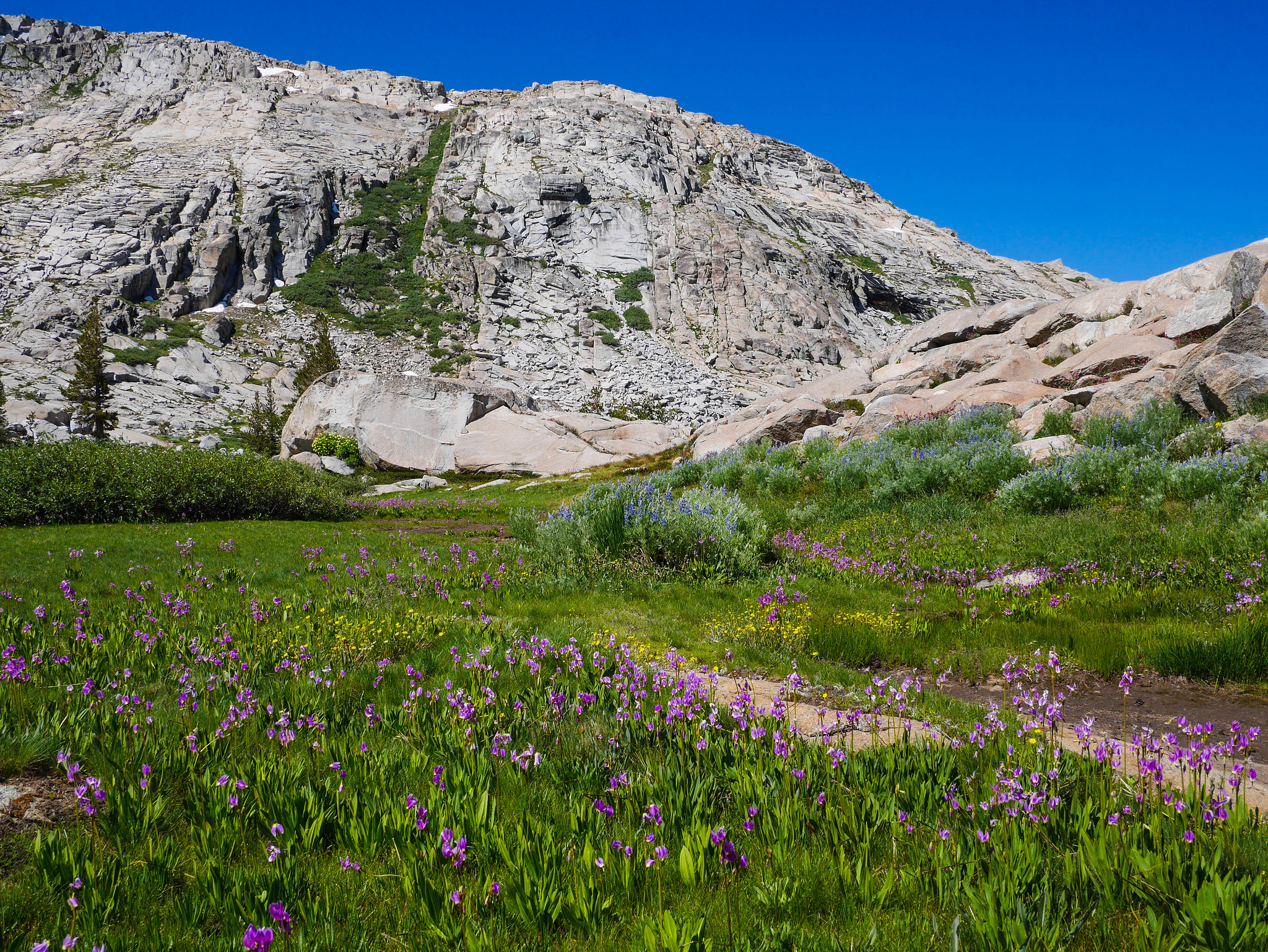
Again I slept in, not even crawling out of the tent until the sun crept over Buck Creek Canyon's east ridge to warm my tent. It wasn't even cold and I wasn't that tired, but I lazed about because I wanted a nice view of the Hamilton drainage and waiting to get started meant the sun would be a bit higher in the sky and the whole drainage wouldn't be both shadowed and backlit.The trail climbs gently out of Buck Creek to Bearpaw to a junction, where I headed north on the higher trail connecting over towards Tamarack. There were lots of butterflies and flowers.
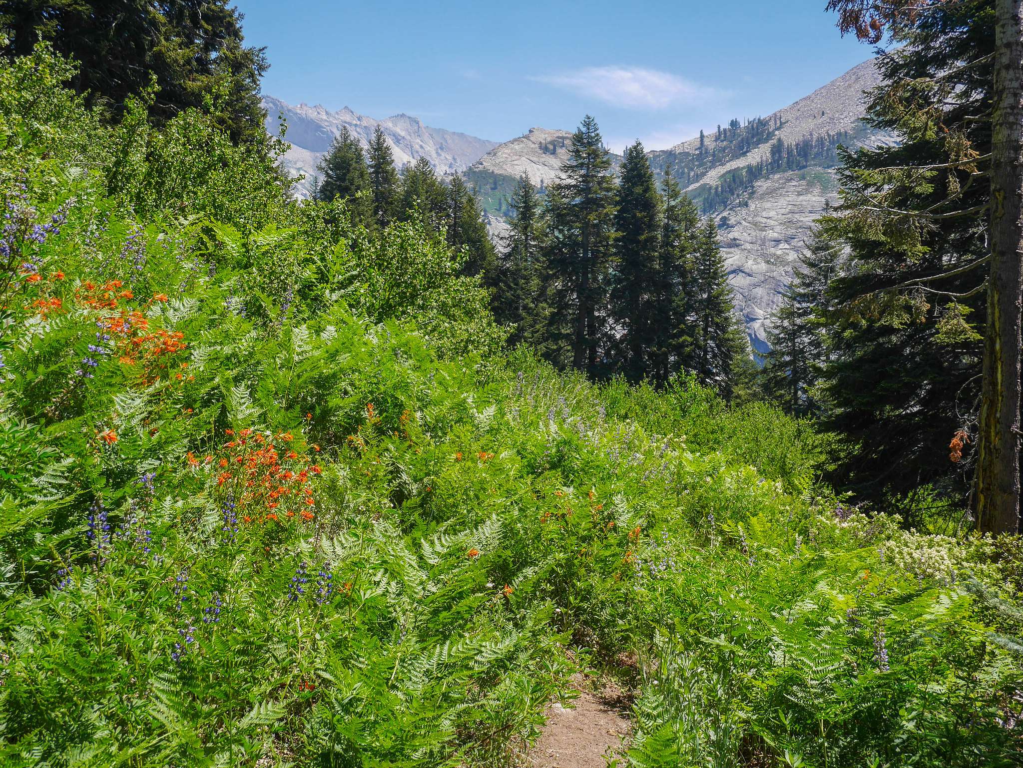
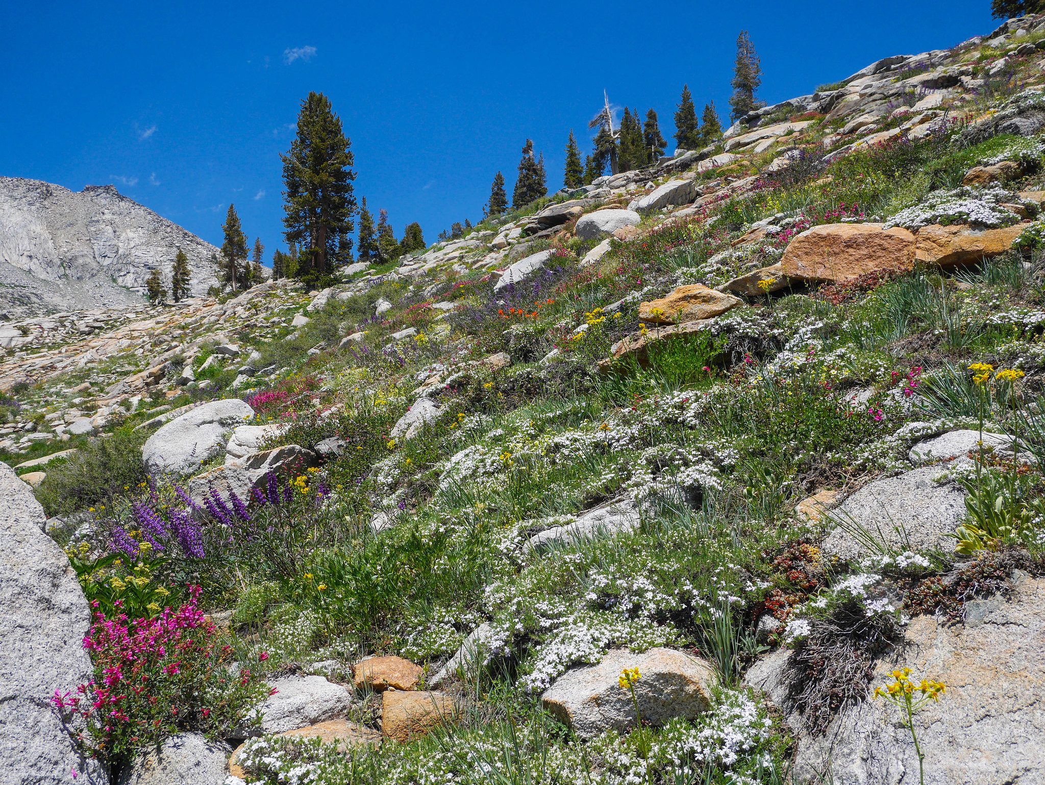
After huffing and puffing up the steep trail through the woods, I passed some people on a day hike from Bearpaw High Sierra Camp. The worst of the climbing was over when the trees thinned and I found myself hiking through waist-high lupine and paintbrush.
The views up Hamilton drainage get better and better and then come to a stunning climax in a clearing as the trail turns farther north. I took a break and snarfed some peanut butter pretzels and enjoyed the view. I could hear the double falls on Hamilton Creek, all the way across the canyon!
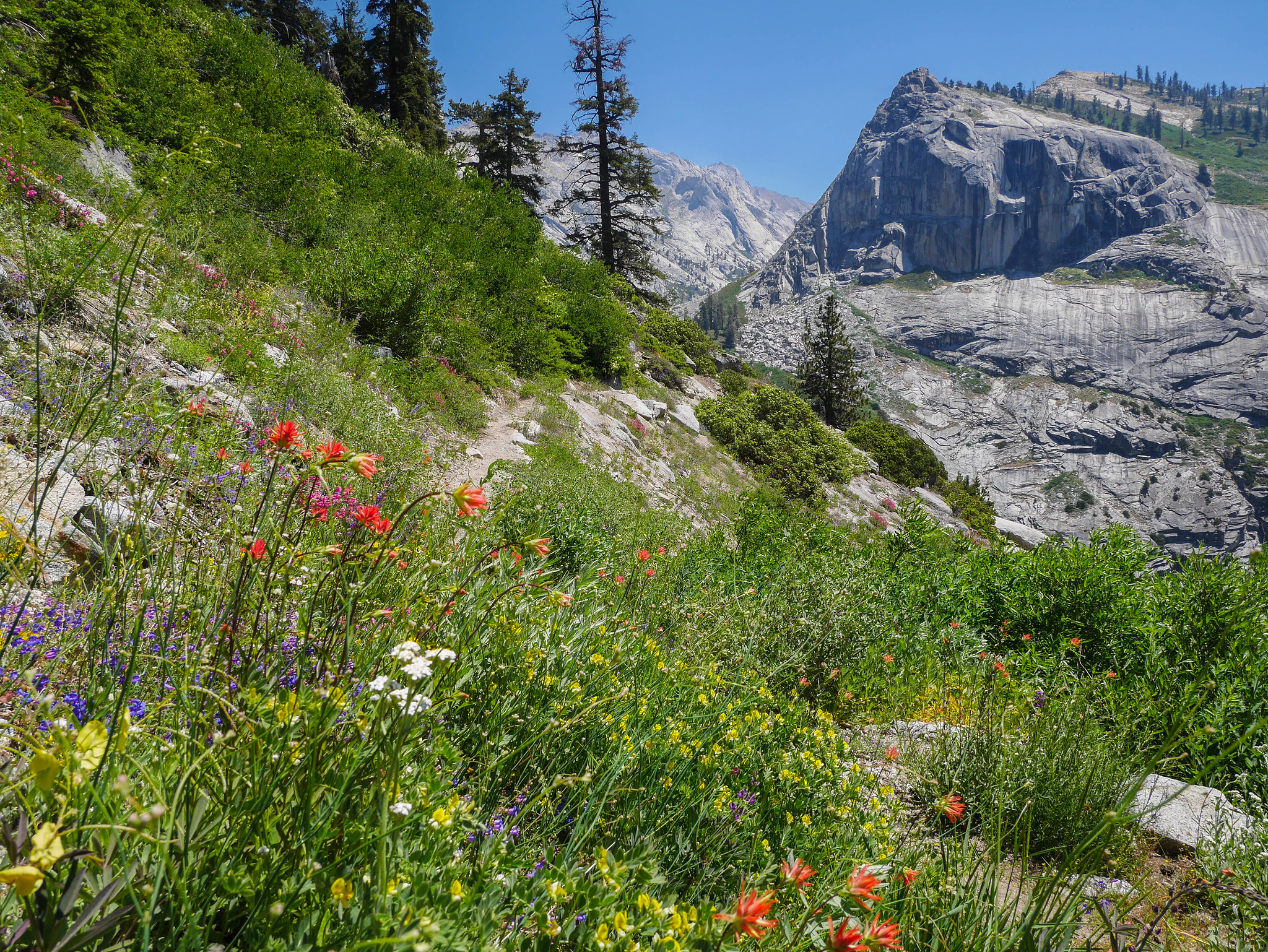
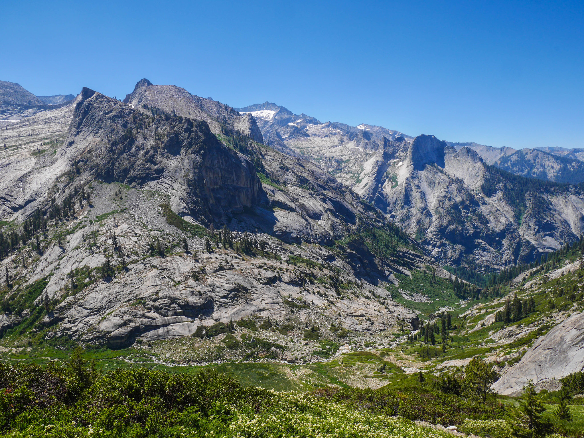
I'd heard that this trail was maybe not in such good condition because it's not frequently used, but I found it in fine condition. When I picked up my permit, I asked the ranger just to be sure, and she said that it was getting more use since the Bearpaw ranger is stationed up on the trail to Tamarack Lake now (I guess while they build the new ranger cabin.) The whole trail was really spectacular, made even more so by the crazy wildflower displays along the way. Before long I was at the junction to Tamarack Lake.
I turned east up the trail to Tamarack lake through fields of lupine going absolutely bananas and soon passed the temporary Bearpaw ranger camp.
I tromped up the trail, climbing more and lamenting the hot sun at my back, a price I was paying for that view up the Hamilton drainage. If you've ever hiked at all or even just read Wild by Cheryl Strayed (and god if you haven't what are you waiting for?!), you know how you can get a song stuck in your head for the whole trip, bits of verses you remember fading in and out of the front of your mind between thoughts of "wow it's hot" and "do I still have thighs" and ". . ..." Well, on this trip for me it was all
Hey now, you're an all star
Get your game on, go play
Hey now, you're a rock star
Get the show on, get paid
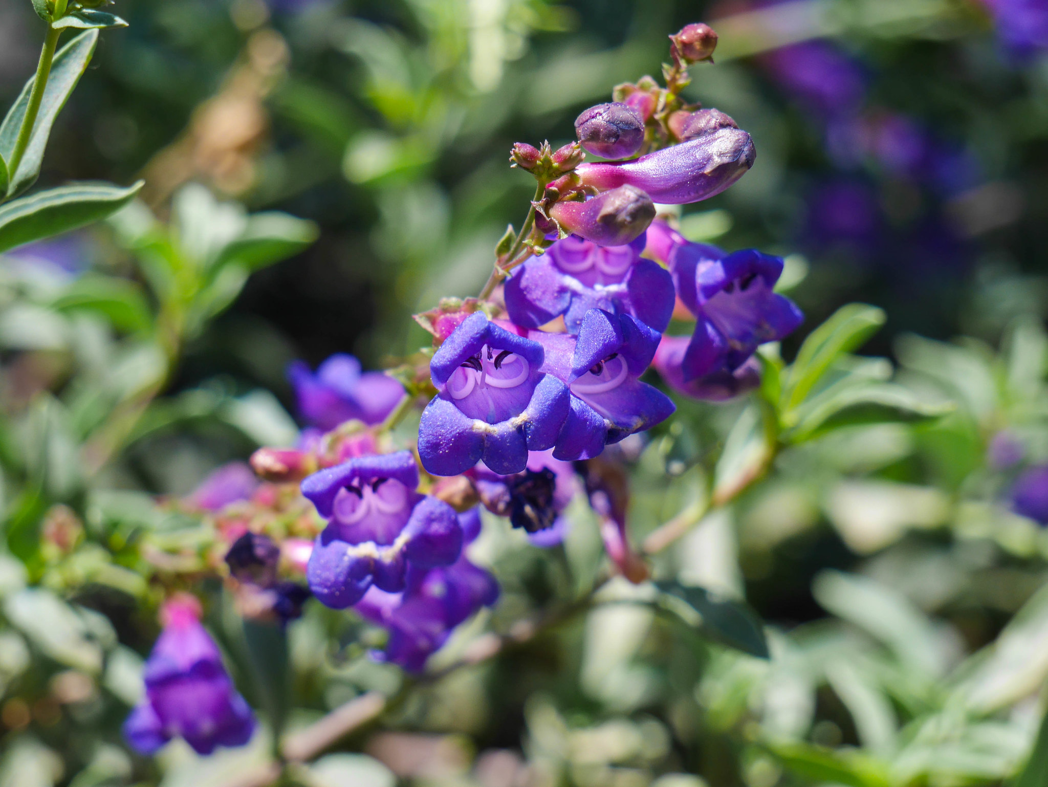
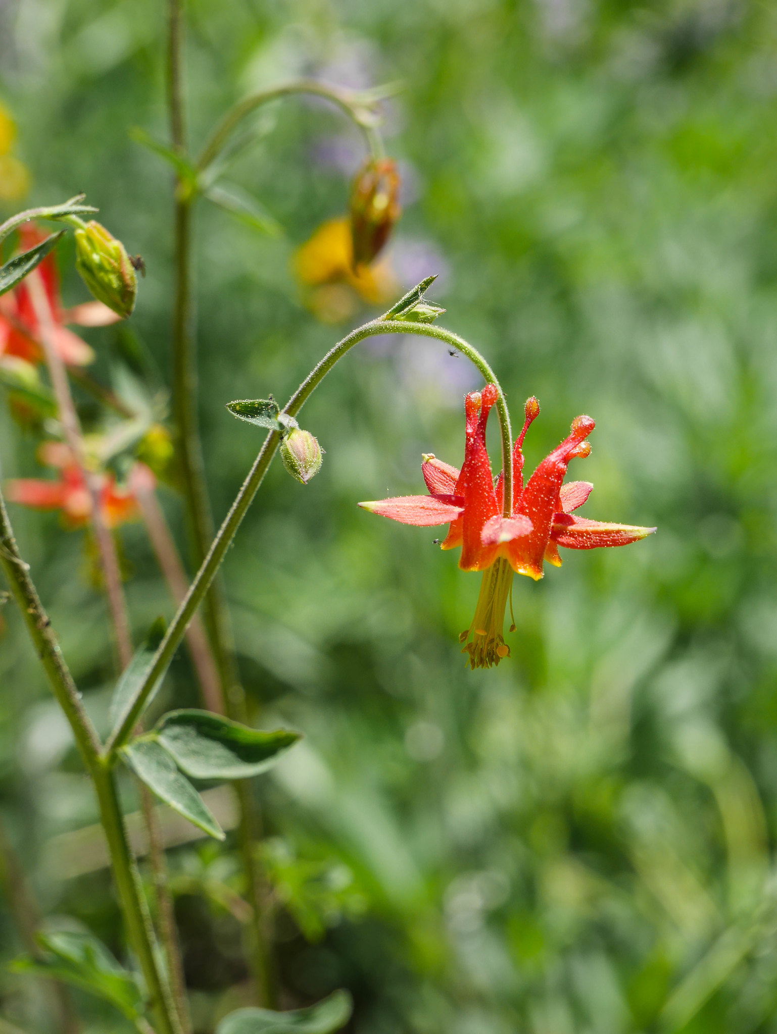
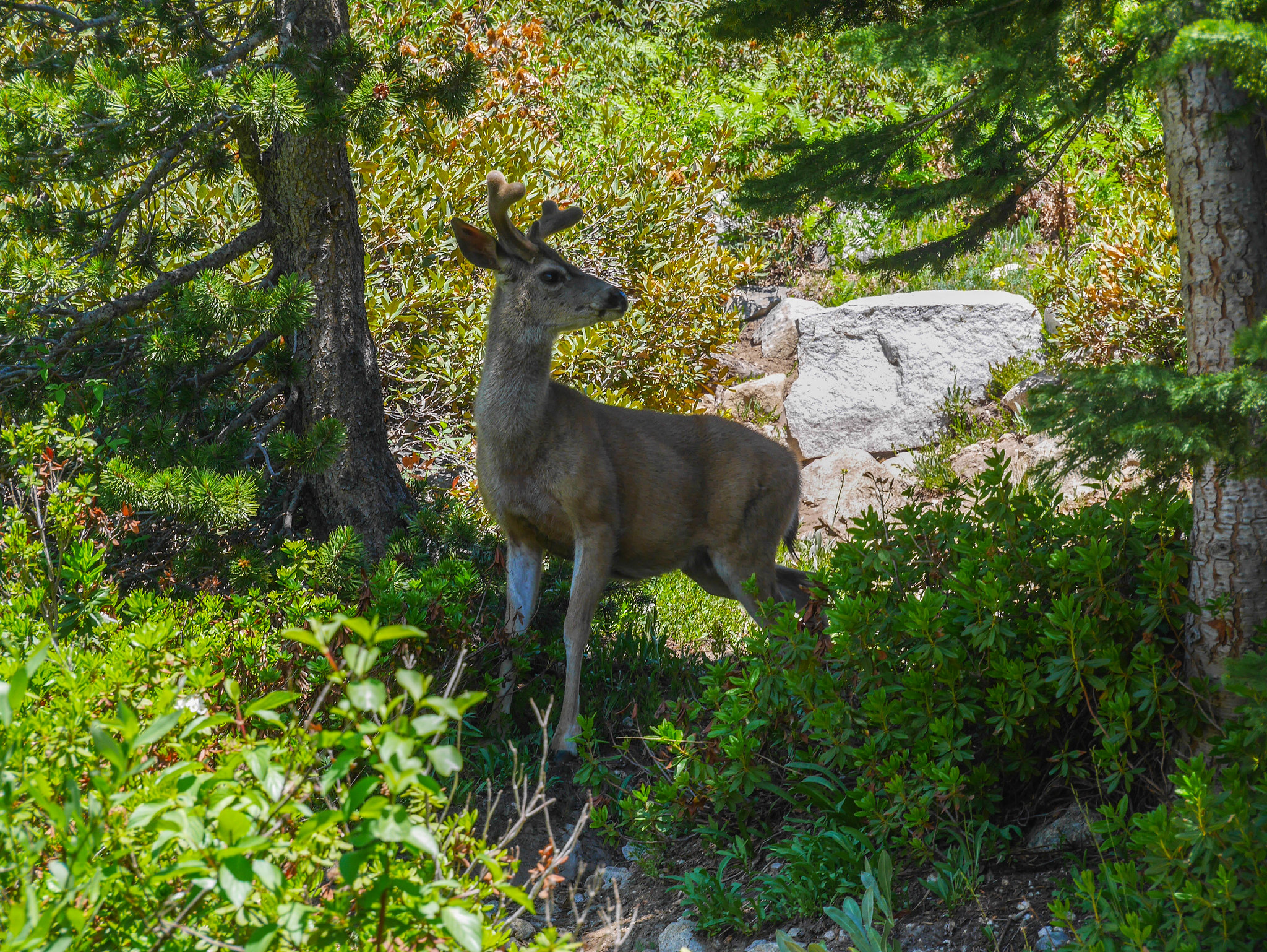
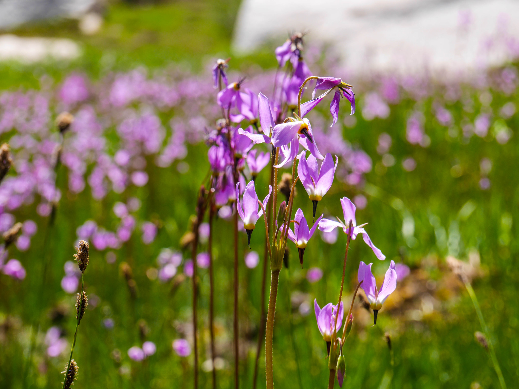
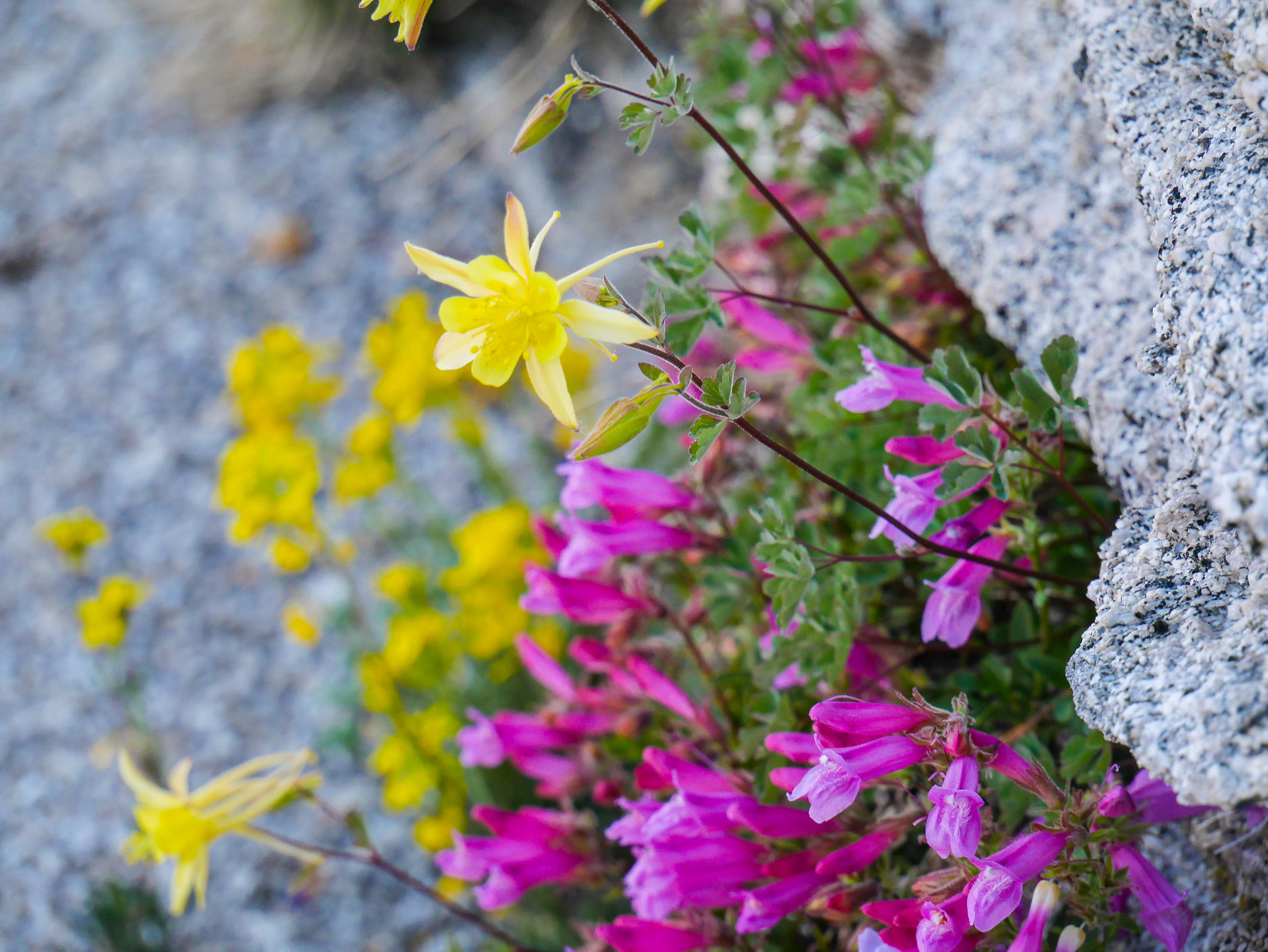
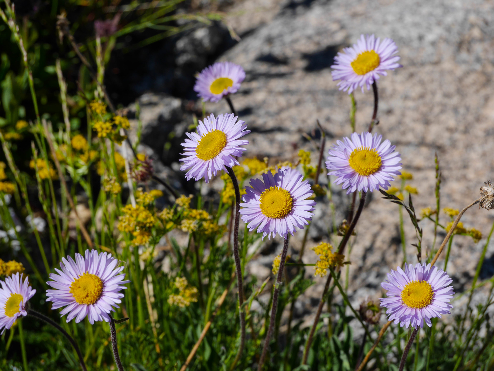
because in addition to riding a mechanical bull, we also saw local aging rock band Smash Mouth at the Alameda County Fair. lmao remember when @cakemittens recreated the entire chorus by retweeting randos sincerely tweeting different lines. Well anyway these cute purple flowers are called shooting stars. And only shooting stars break the mold.
There were other alive things, too. Like this columbine and li'l buck.
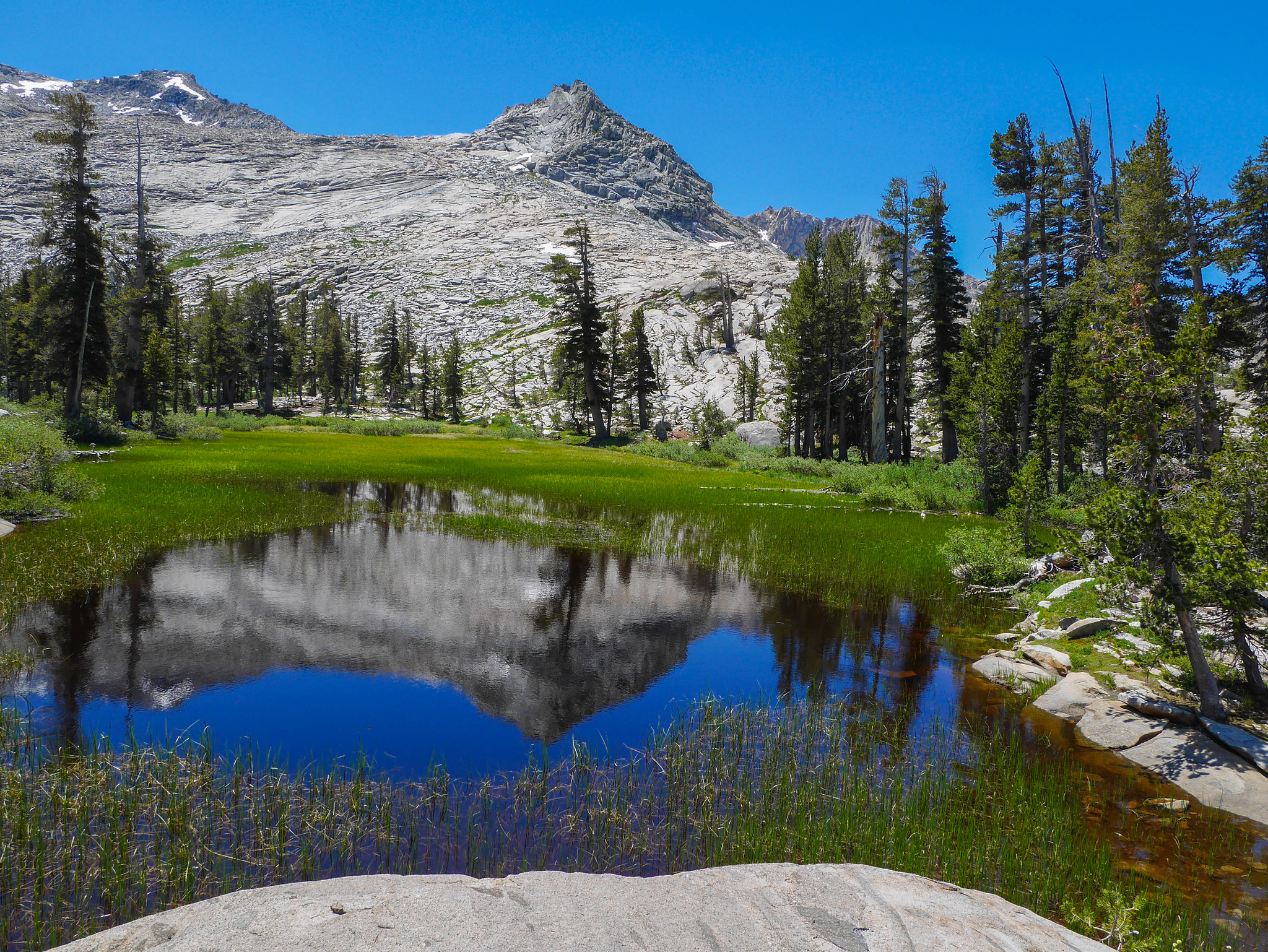
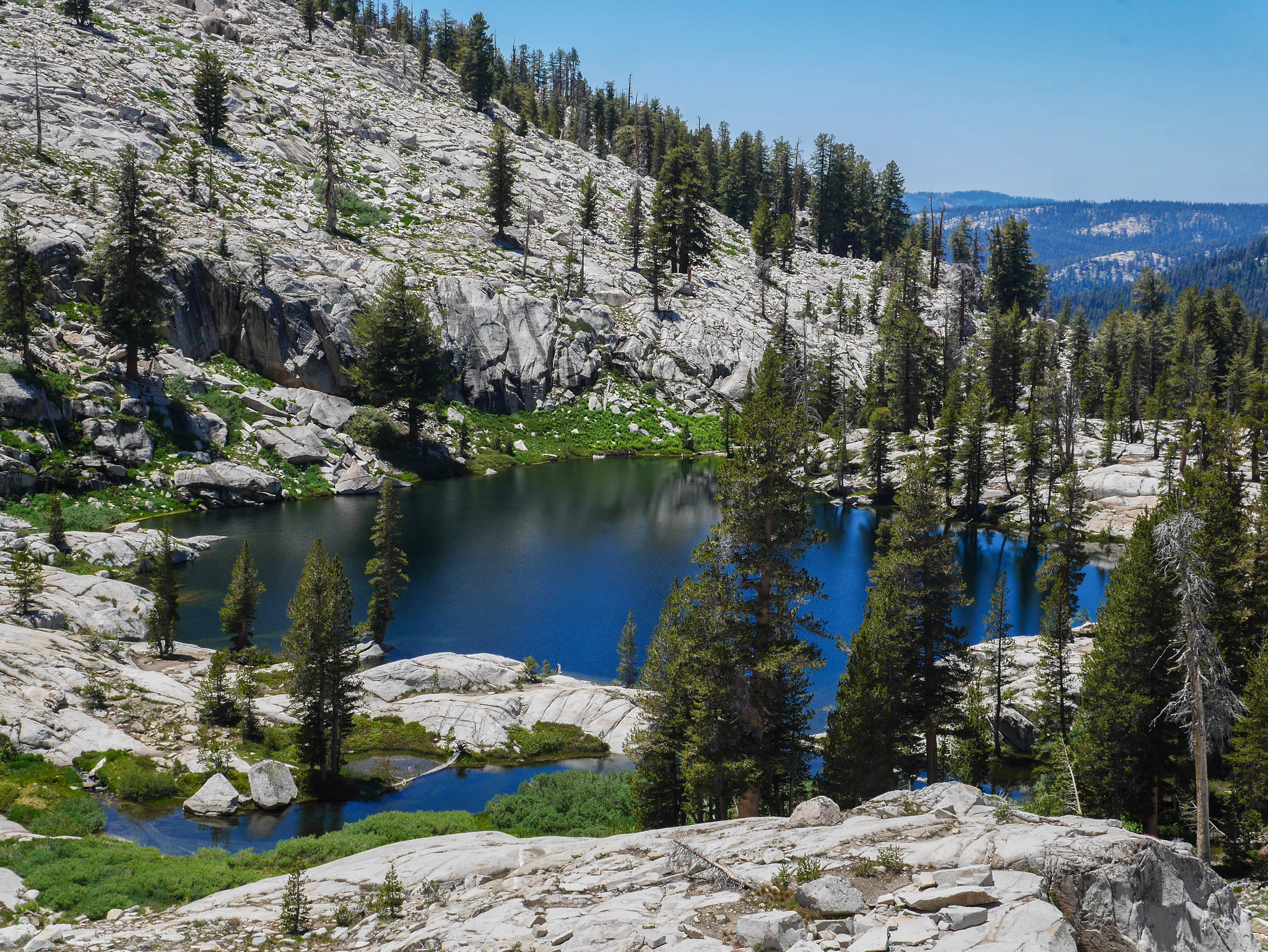
Soon a sign on a tree said I was in Lone Pine meadow, which my map I thought put much higher up towards Tamarack lake. I was surprised but happy to be so close! But why isn't the lake coming, then? This trail seems to continue endlessly. Ok now this is getting cruel. Surely the lake is just over that next little ridge where it flattens out. N O P E, it's this stupid meadow and you still have to cross two churning branches of the lake's outlet stream before you hit the final push.
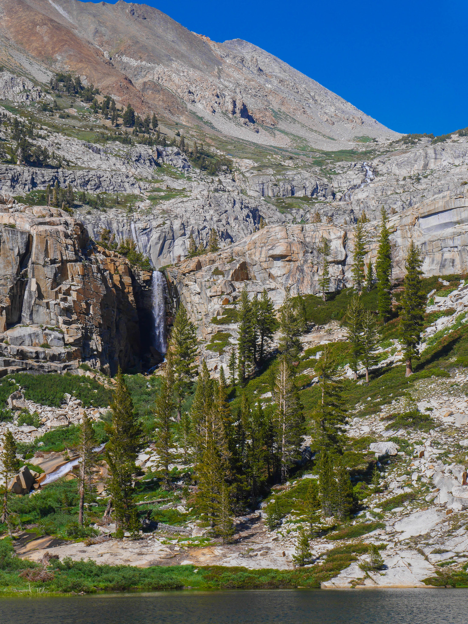
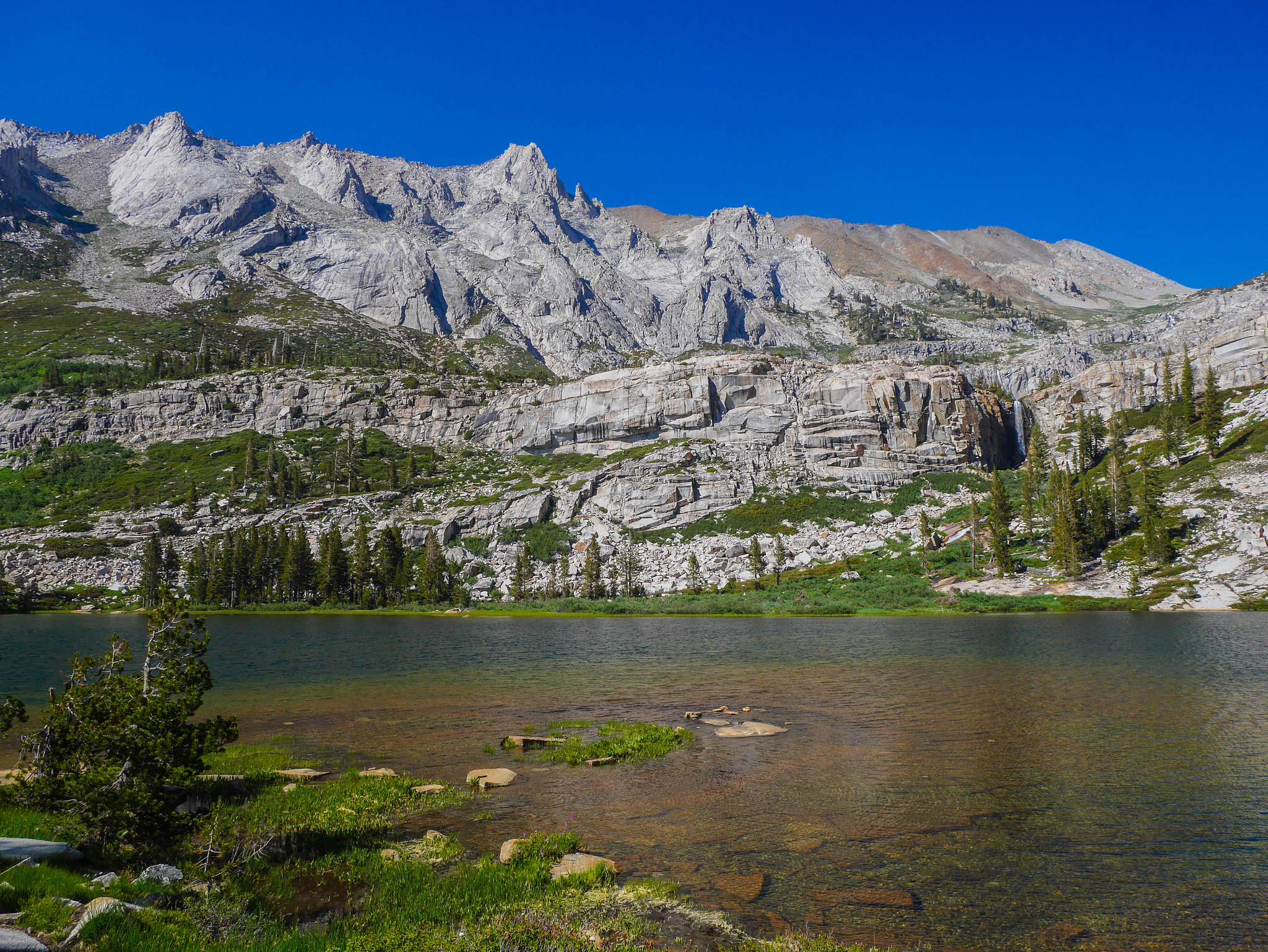
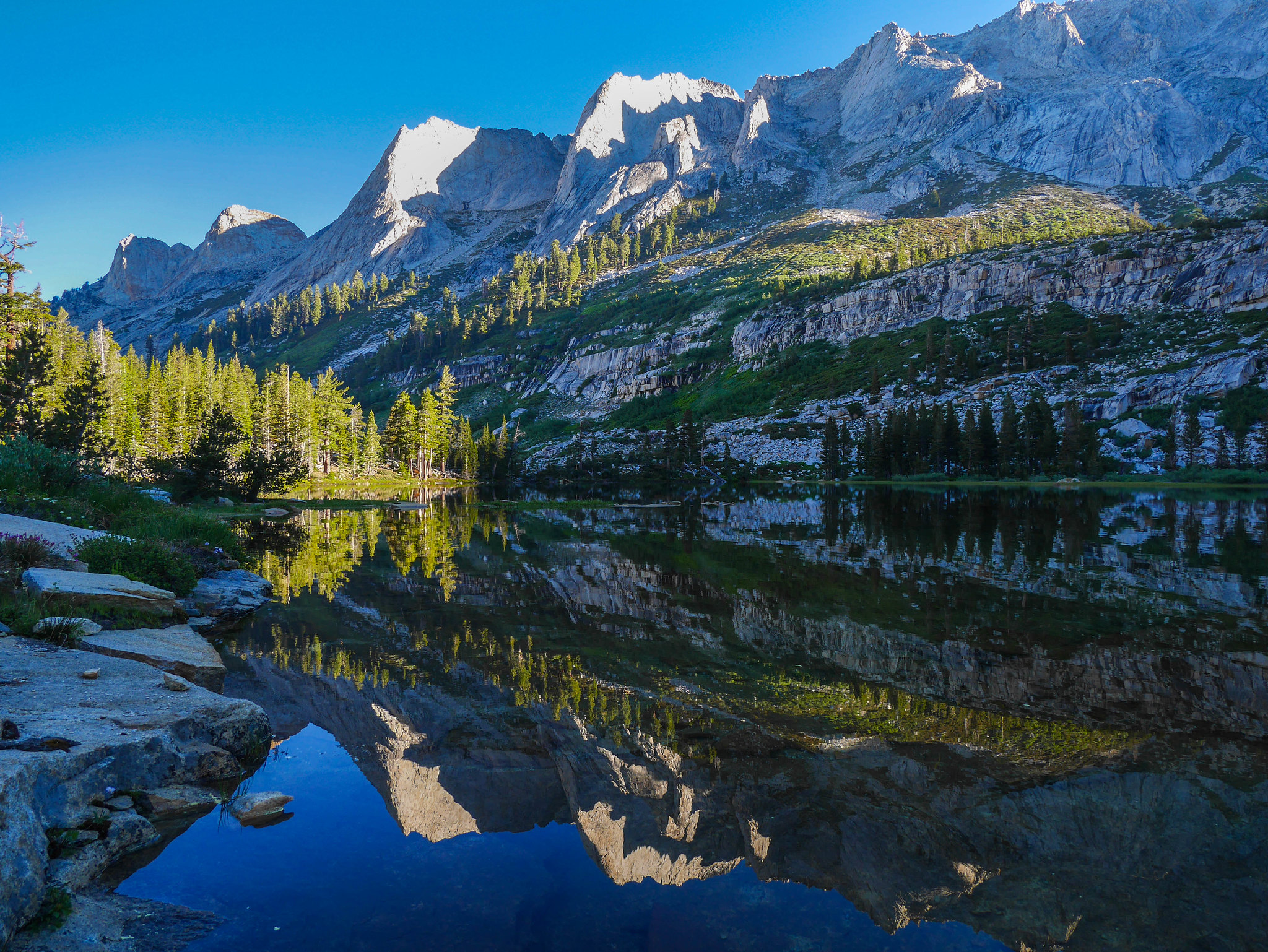
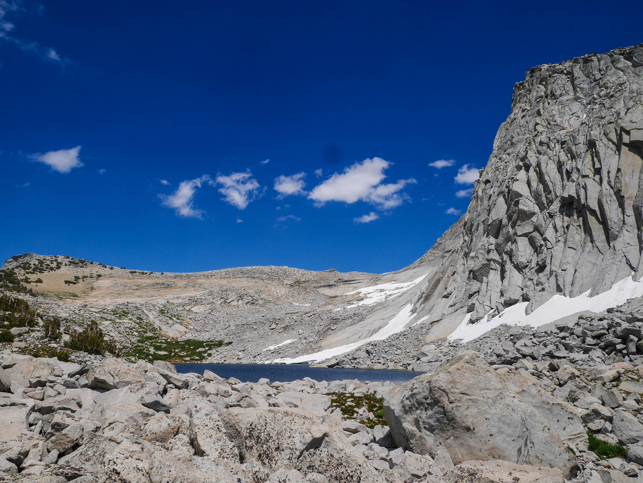
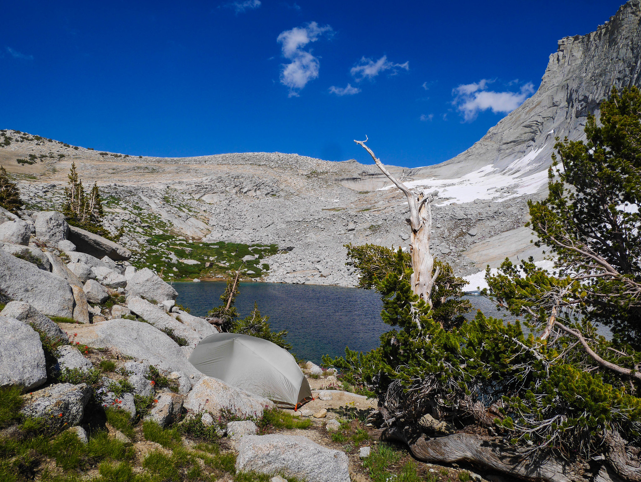
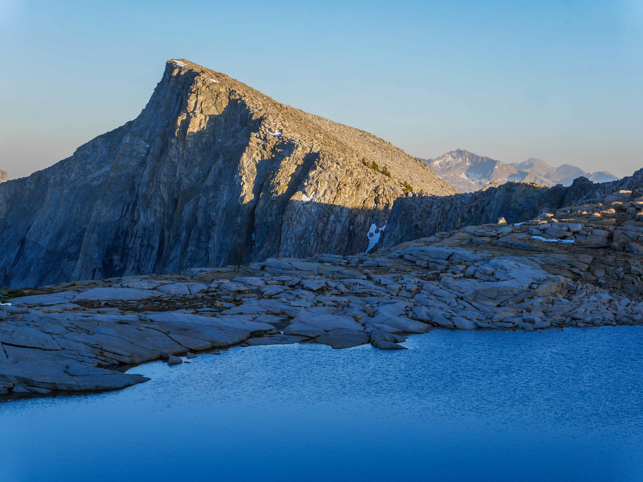
Well I finally made it, as was announced by a sign that also let me know campfires are not allowed. I circled around the southwest side of the lake, avoiding one already established camp (with chairs (!?)), heading towards a wide flat granite slab beach. I found a flat rock amidst the scatter and set up my camp with a perfect view of a truly magical waterfall across the lake. Fairies live in there for sure.
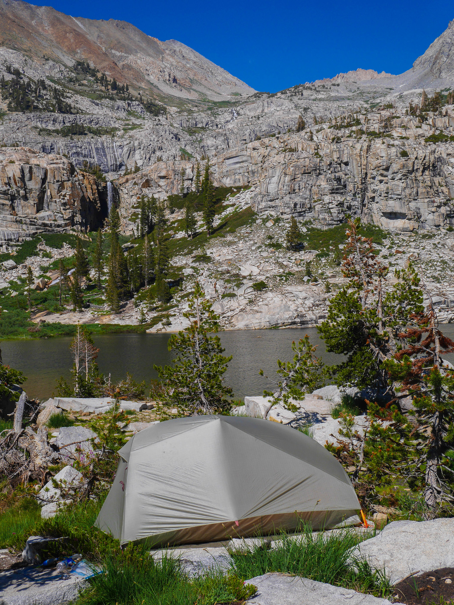
I got camp set up and then headed down to the lake for a swim. There's a really cool rock shelf there where you can walk clear out to the middle of the lake without getting your thighs wet. Then do a shallow dive off into the depths! This is a really great lake for swimming. I need to come back in August.
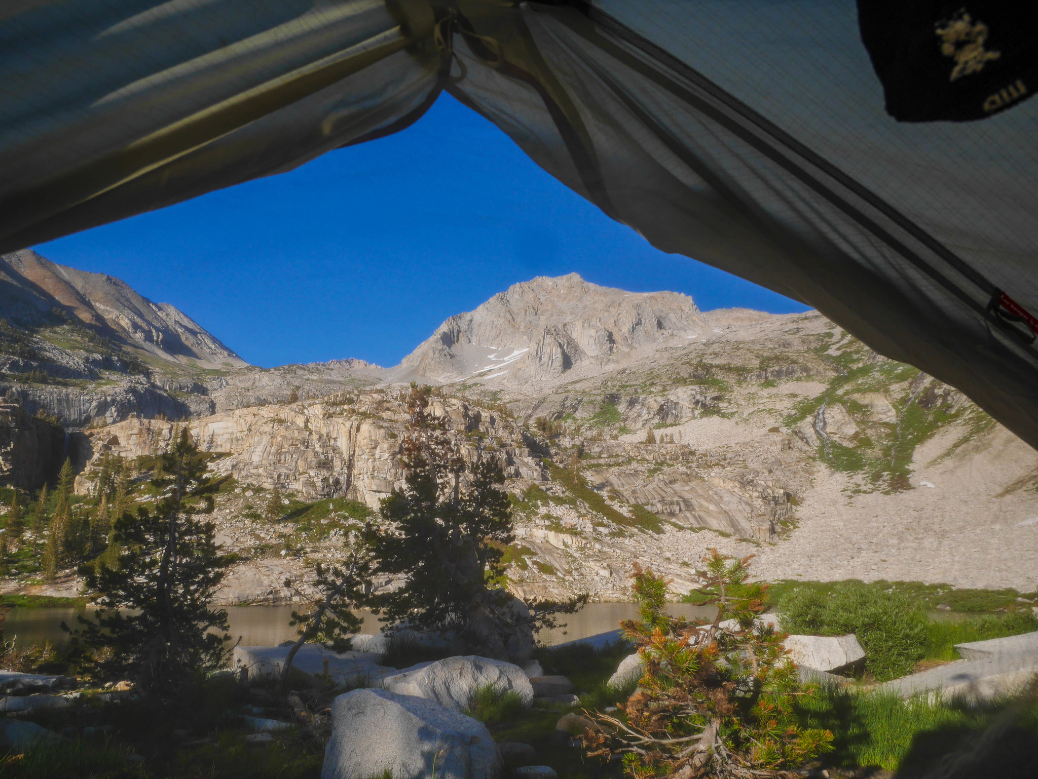
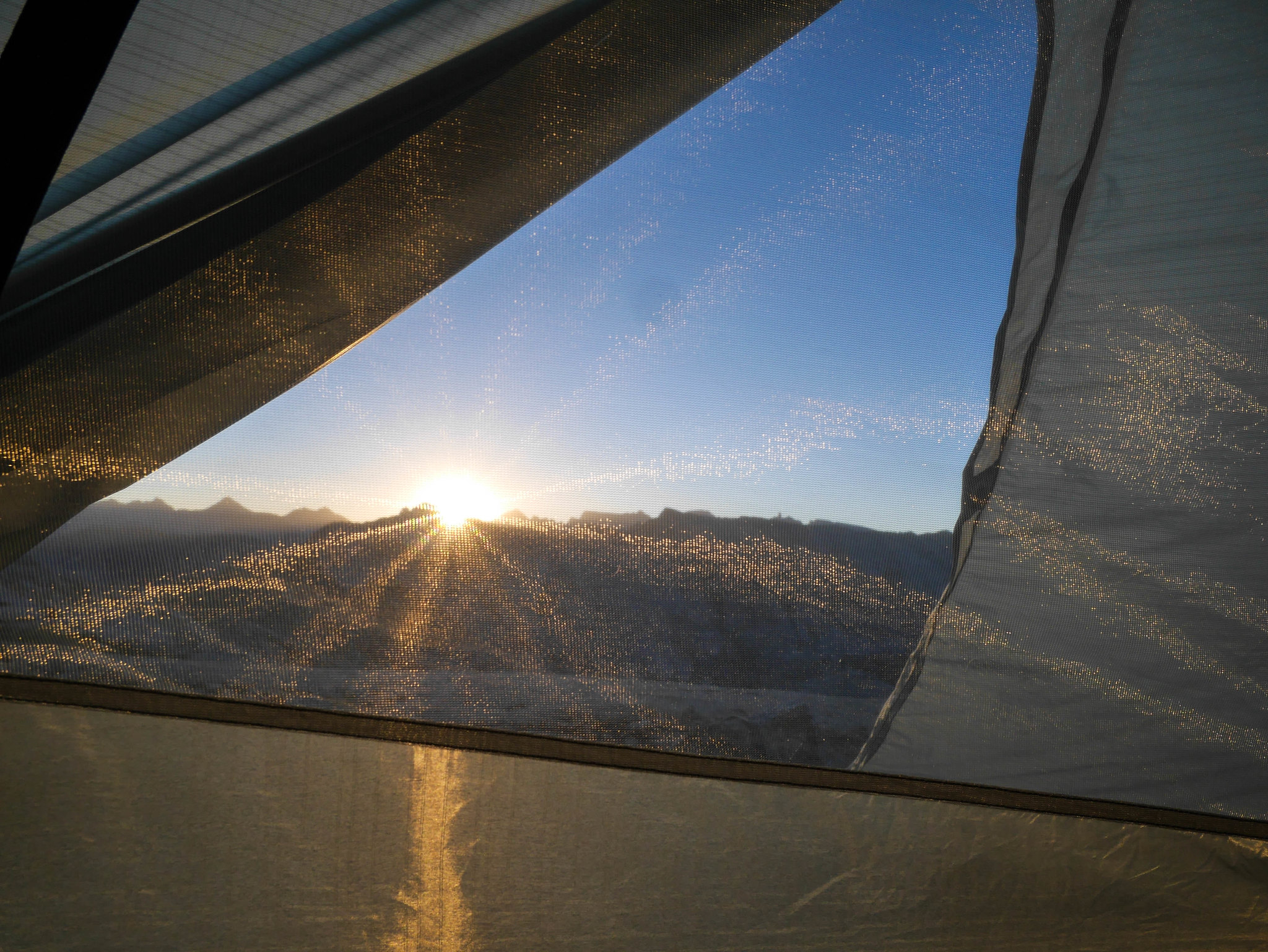
The skeeters were a bit annoying in the evening, but who cares when this is what you see from inside your tent.
Day 3
Tamarack Lake to Lonely Lake,
3.5mi, +1,200ft/-1,150ft on trail, plus 1.75mi, +1,600ft/-0ft off trail, plus 1.75mi, +700ft/-700ft packless ridgeline hike
Tamarack Lake did not get uglier overnight and I enjoyed the change in lighting during breakfast and packing up camp.
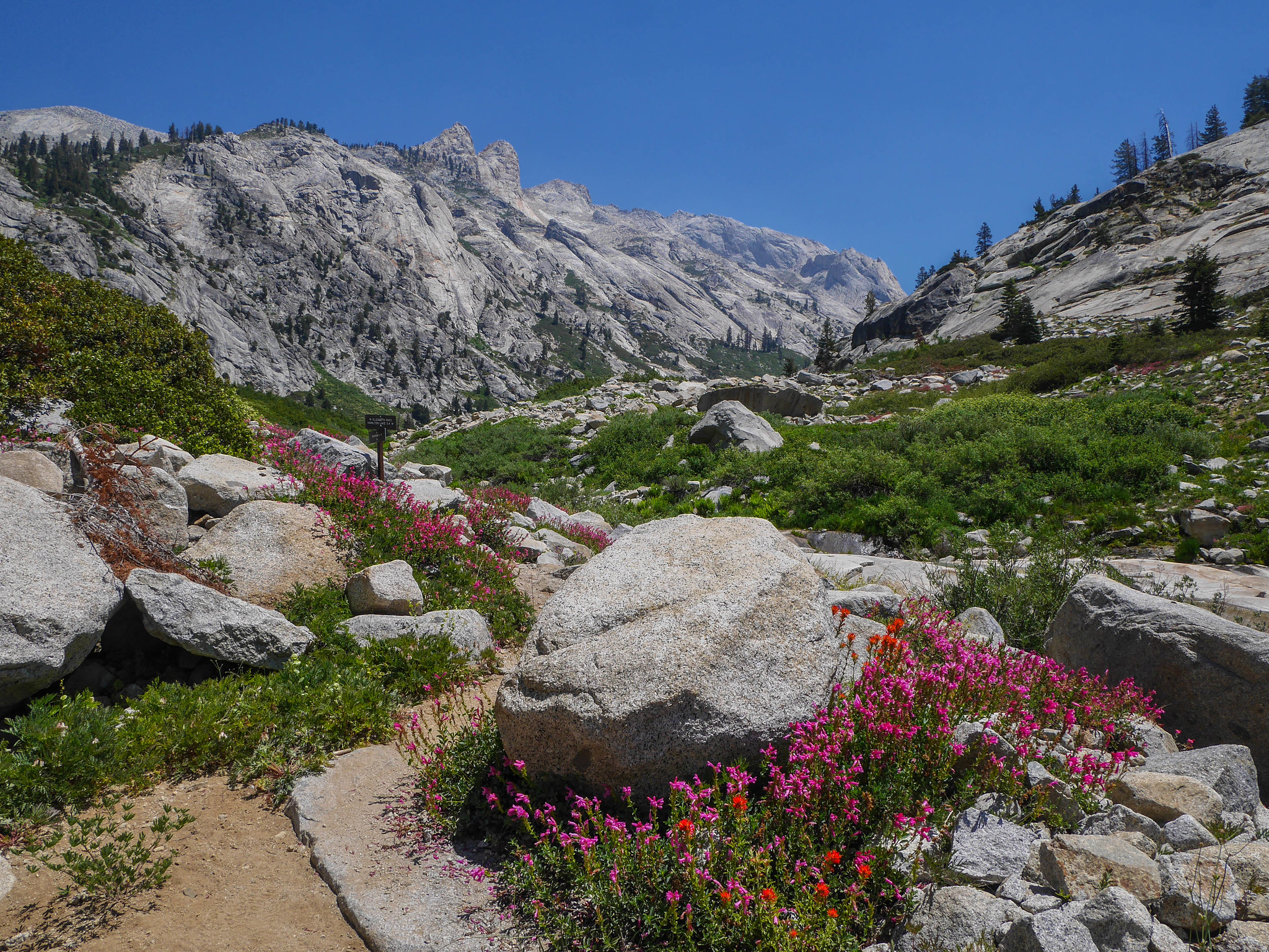
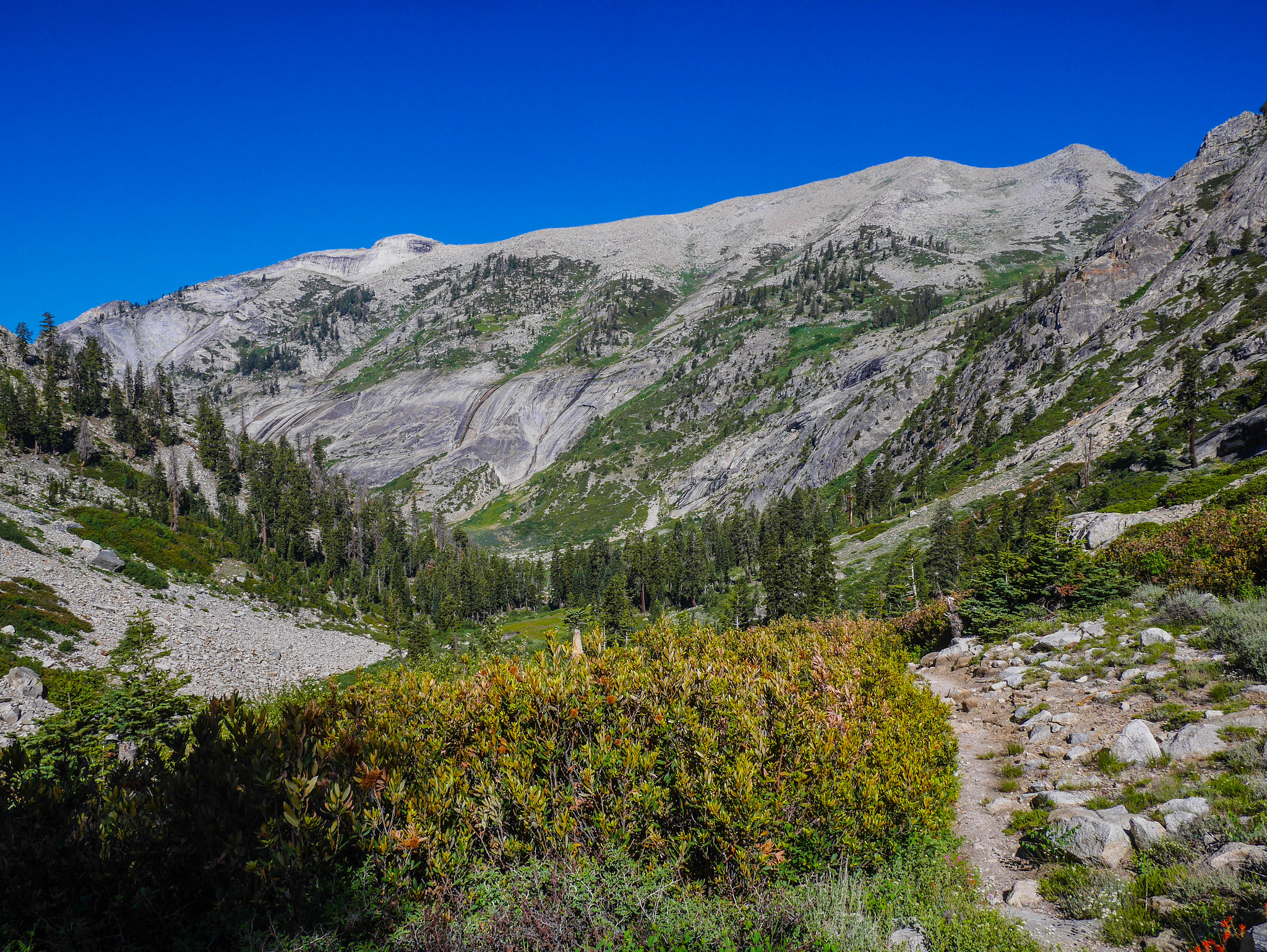
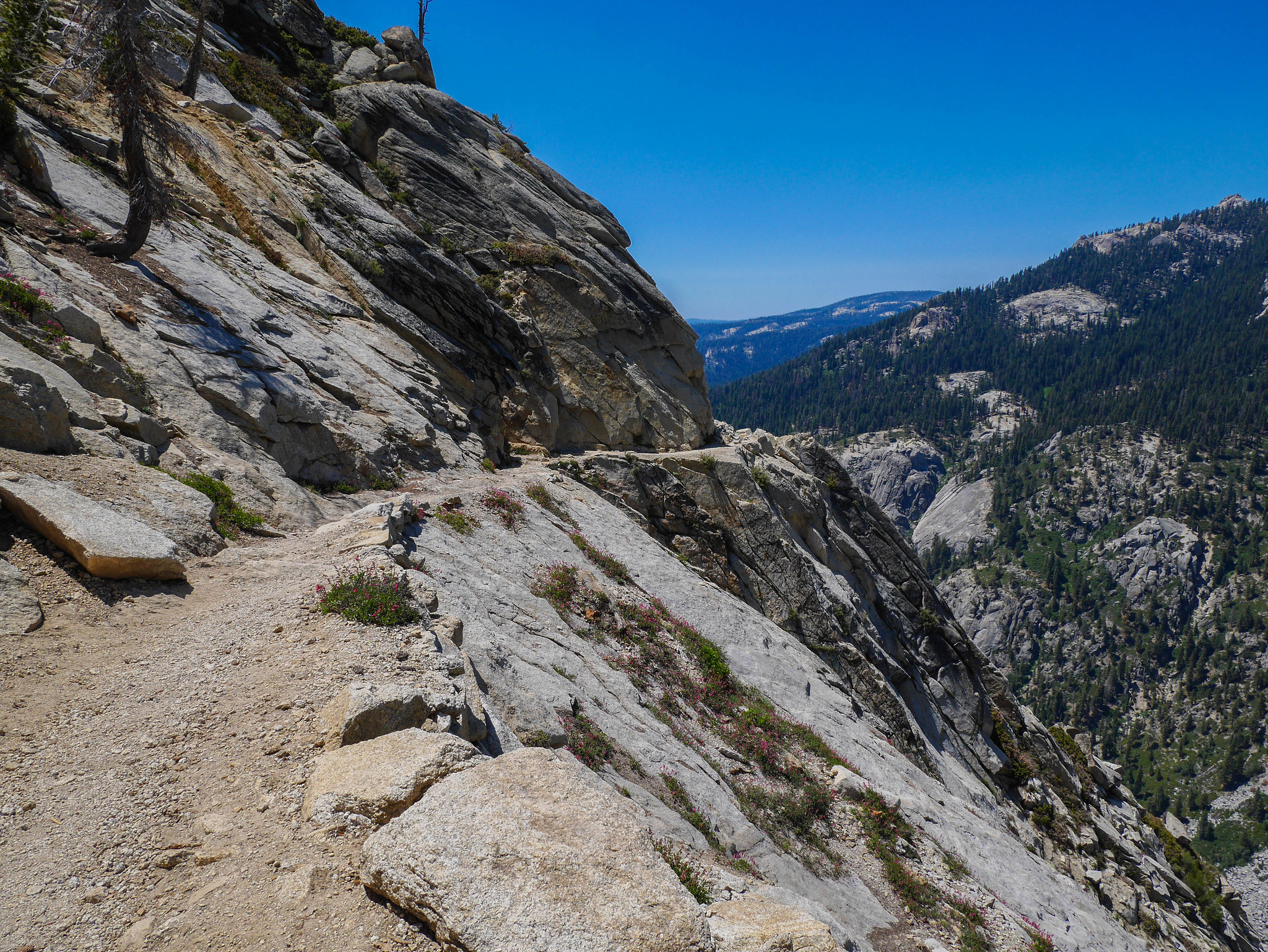
I headed back down the trail, across the annoying stream crossings, and down towards the junction with the Elizabeth Pass trail, which is a **** beast climbing 1,000ft per mile over nearly four miles from the junction to the pass. Lucky me, I'd only be on it for the first 1,200ft of that before turning off trail cross country to Lonely Lake. Hiking down the Tamarack Lake trail gives you a view of your future suffering the whole way. It's almost the same kind of dread I get watching a room full of students take exams, just knowing that every pencil stroke is one I'll have to read. But I guess this is prettier.
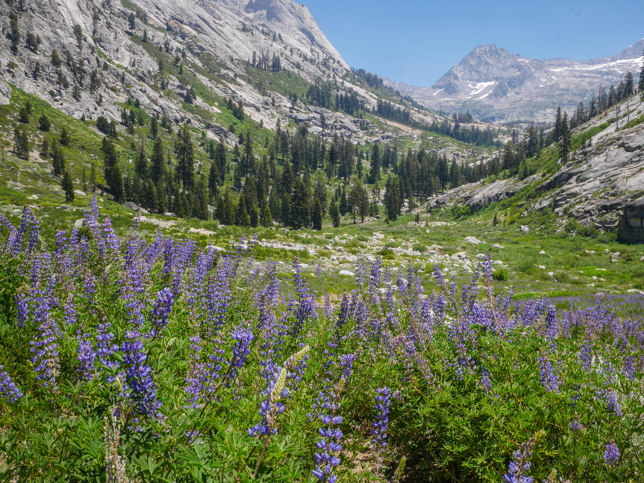
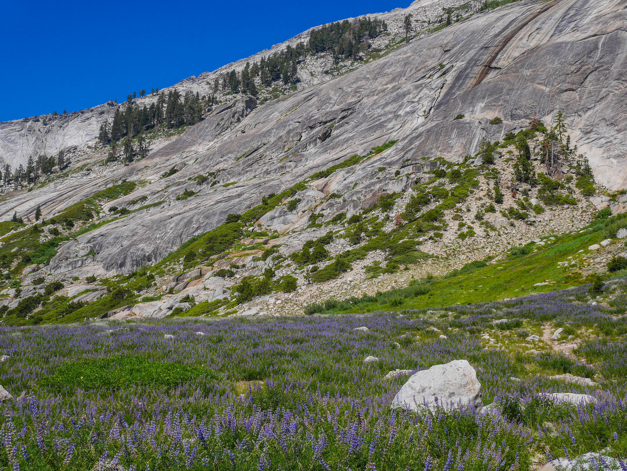
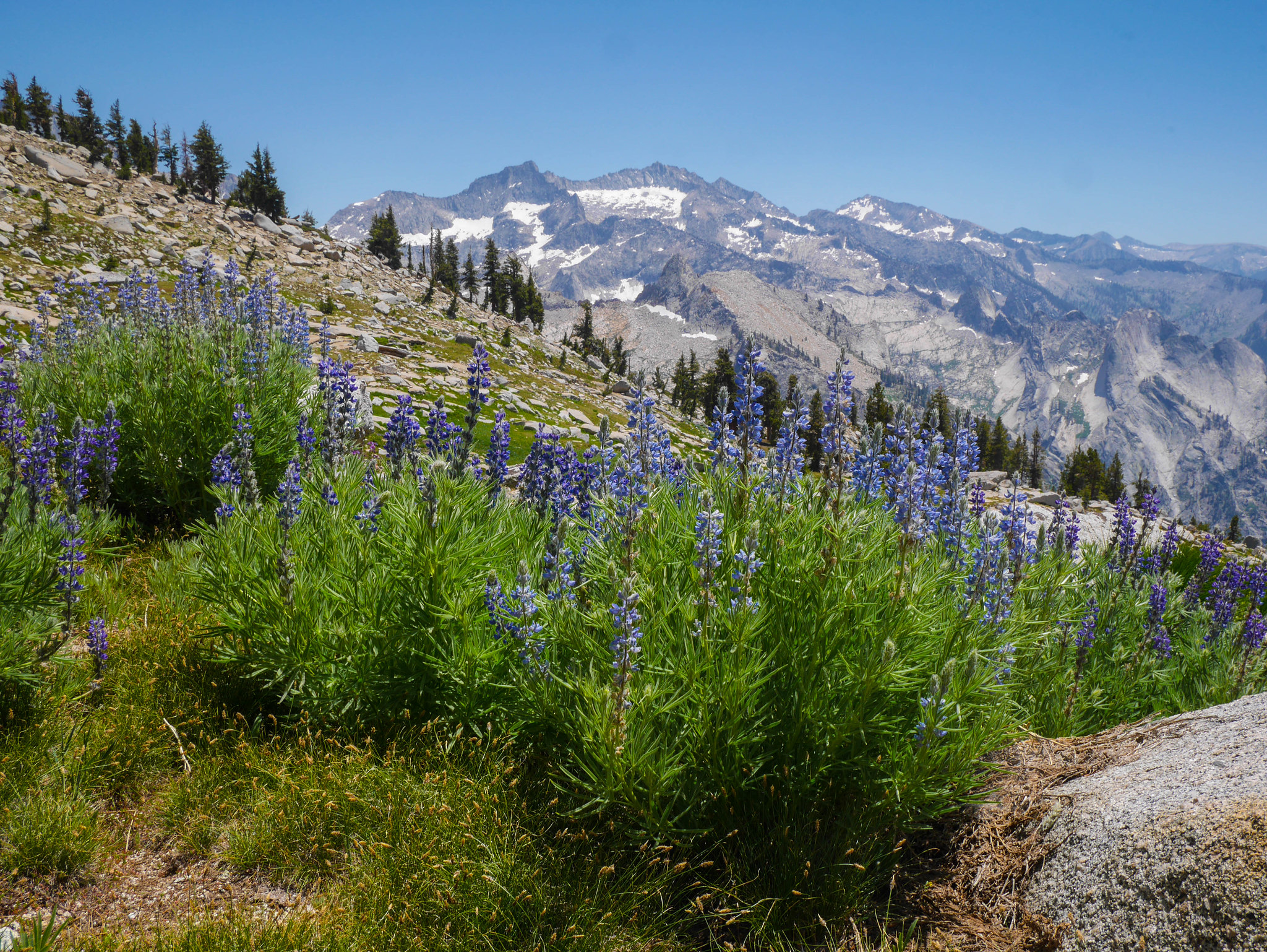
The lupine was still there, just as magnificent and just as everywhere.
Soon I was at the junction and had to start the climb. Just keep putting one foot in front of the other and you'll make it.
At least a climb this steep makes quick rewards that you can measure by how toy-like the trees get so quickly. I was again thinking of the fair, and the hour Miranda and I spent talking to an older German man running the model trains.
And then I was thinking about the Town of Crab, ville, in the autumn. And then suddenly I was at the spot where the trail crosses Lonely Lake's outlet, which was where I was to set off cross country. It's a new hiking hack. Just think thoughts about model trains and you'll forget what you're doing just long enough.
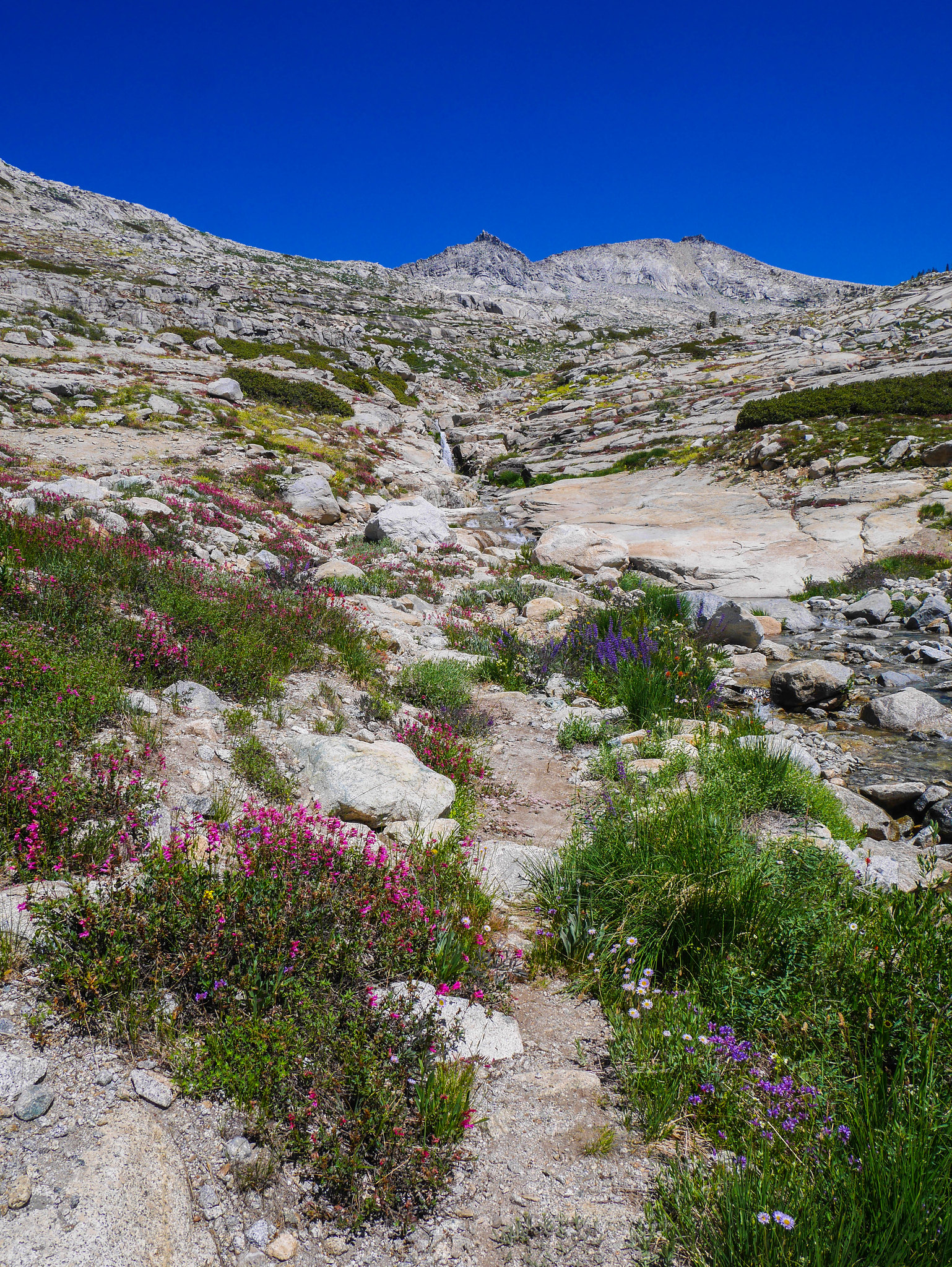
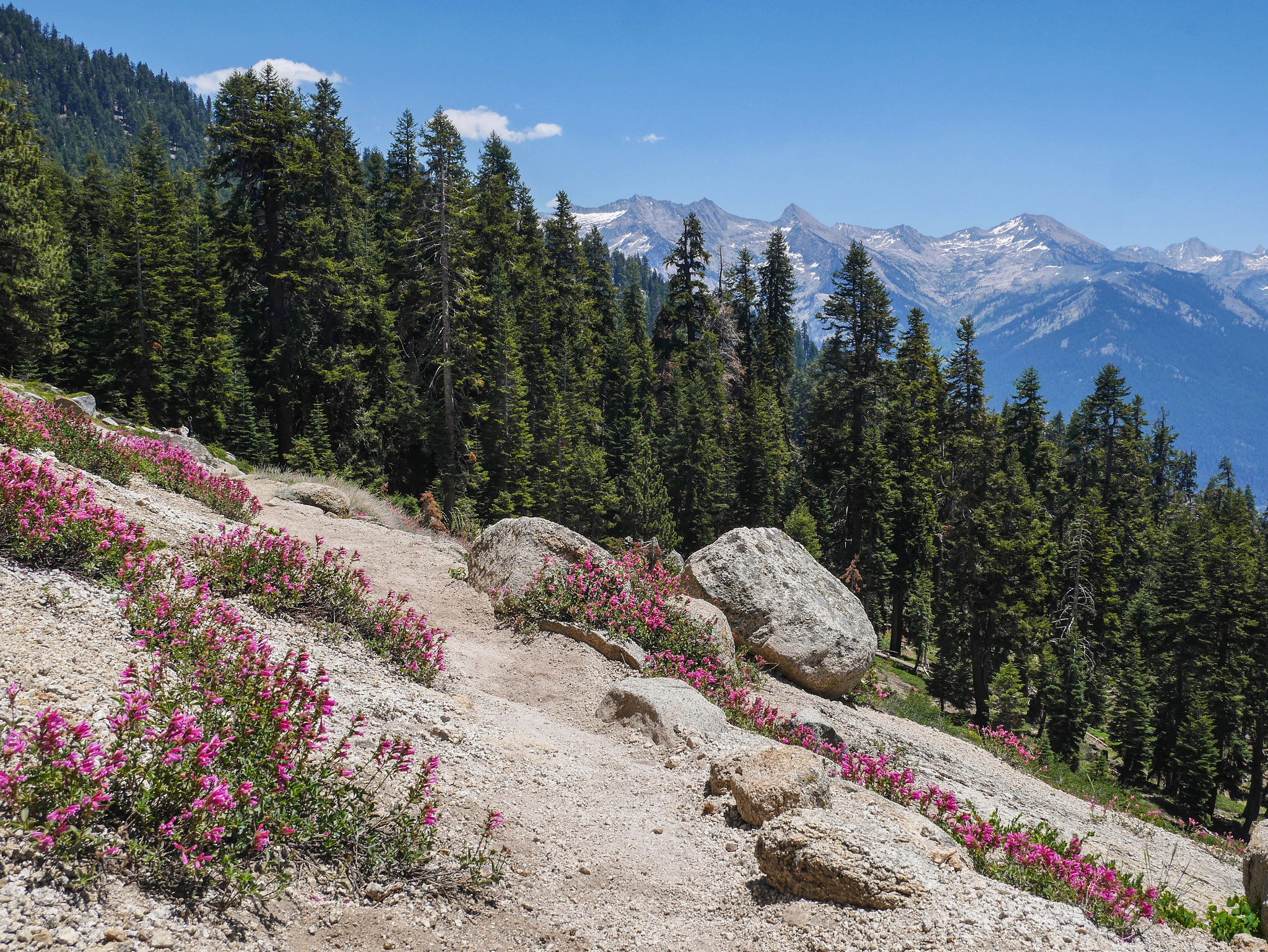
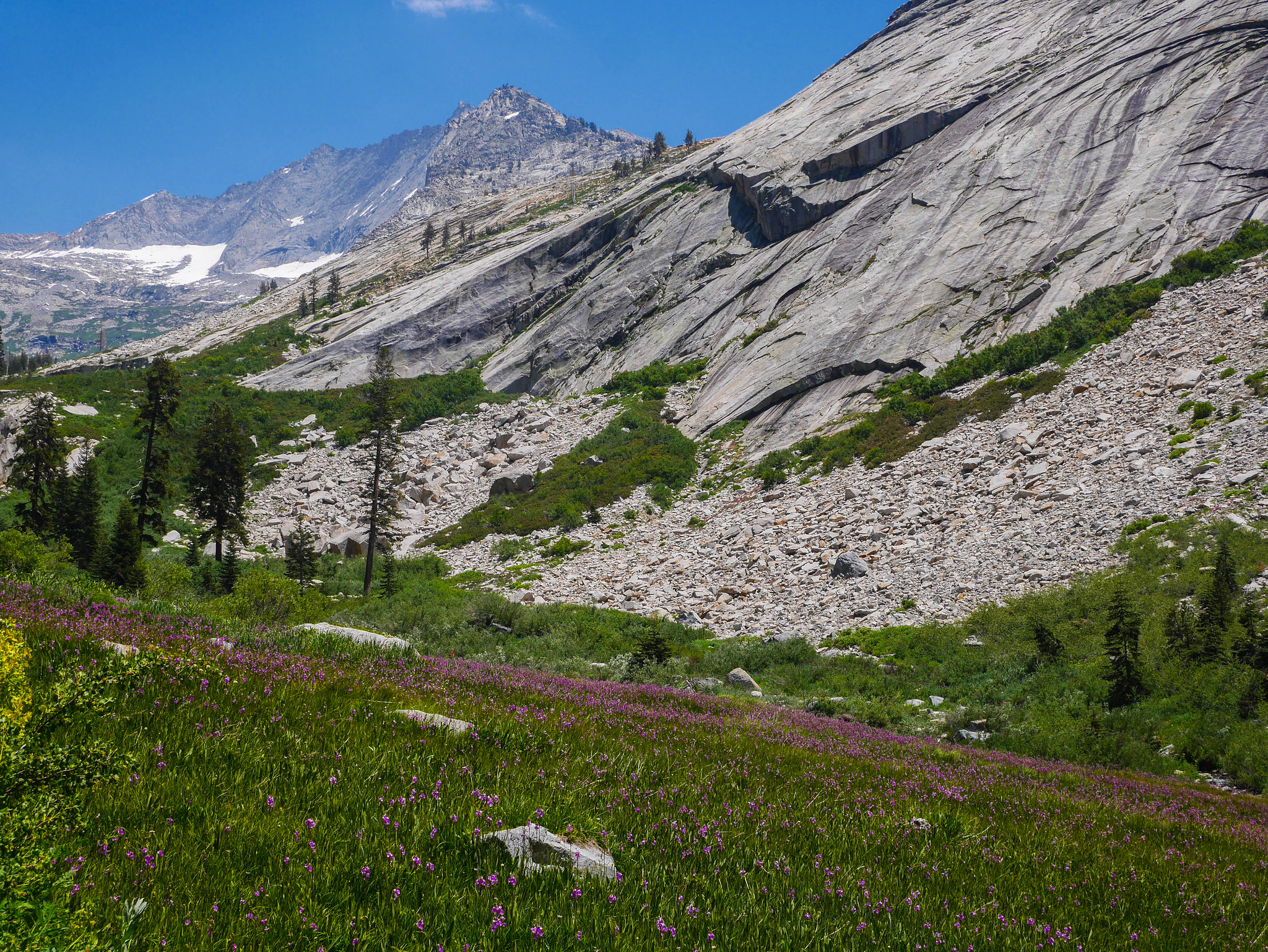
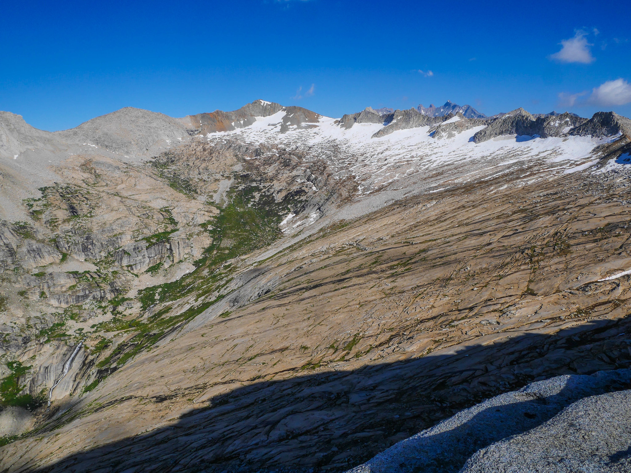
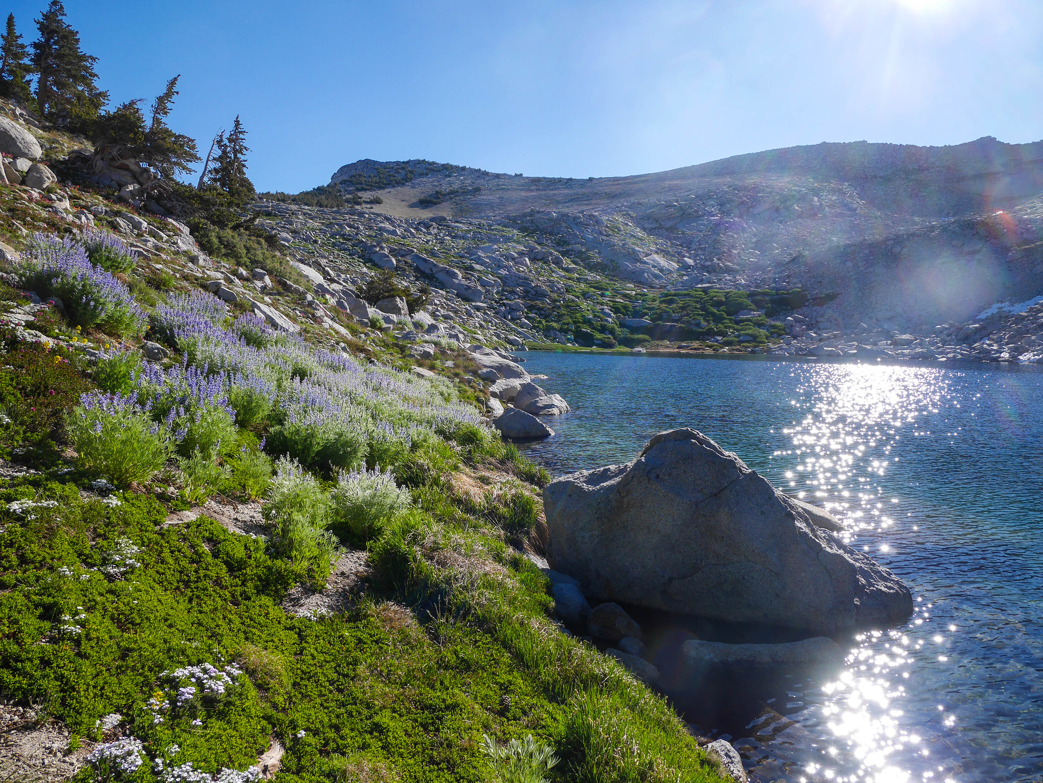
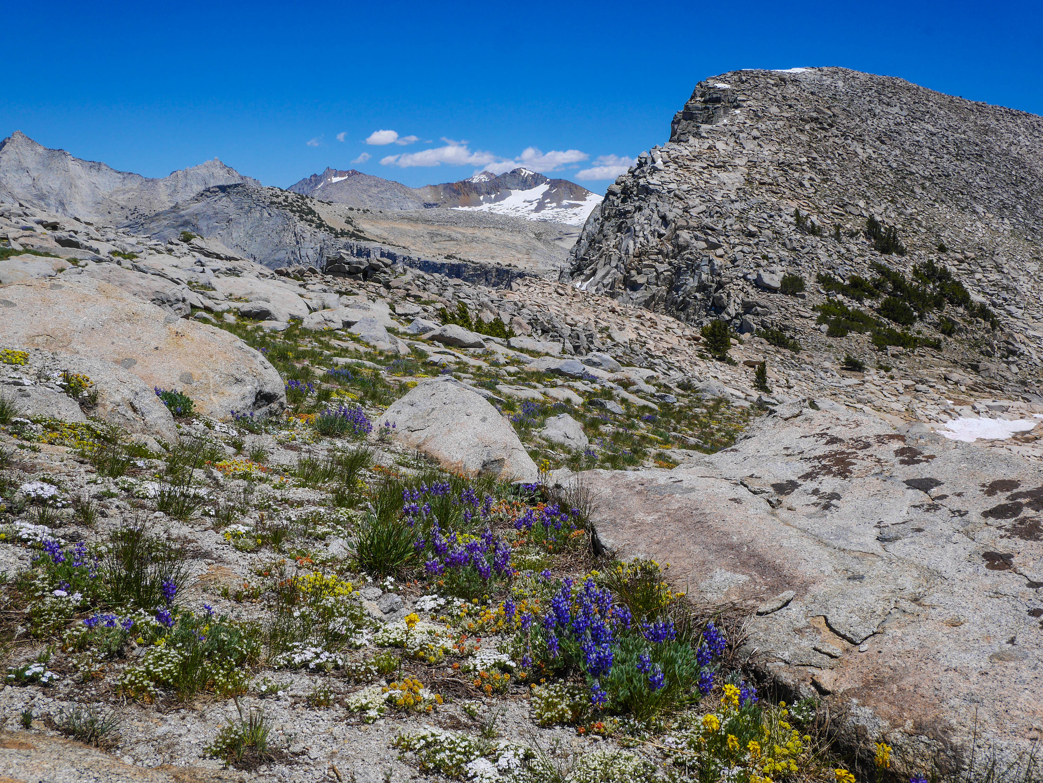
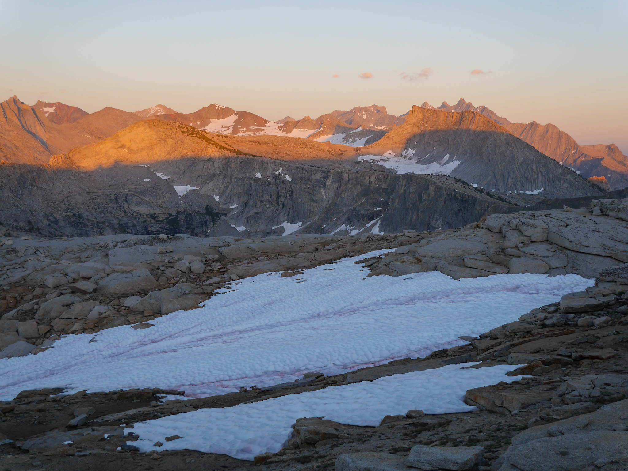
After an hour break or so I headed off trail up to Lonely Lake. I roughly followed the outlet stream on its east side, staying a few hundred feet up from the stream because the going looked a bit easier. As I climbed higher, I found more flower gardens and the views back across Valhalla got more and more spectacular.
I had a good view across the drainage to Pterodactyl Pass, tomorrow's destination, so I did a bit of preliminary mental planning as I ascended to Lonely Lake.
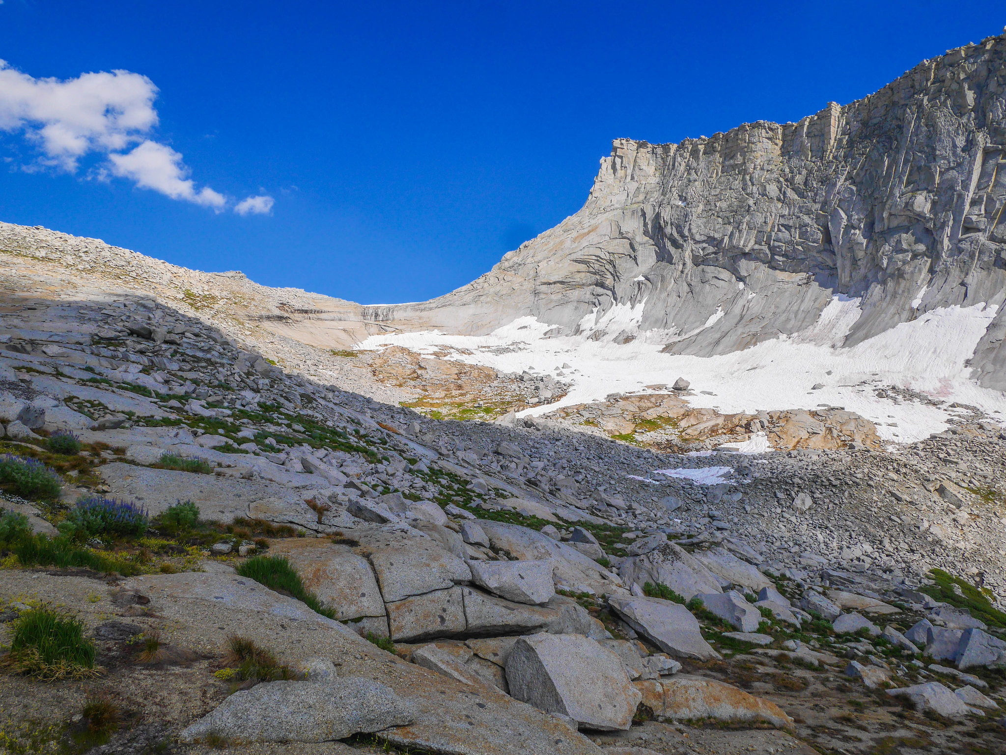
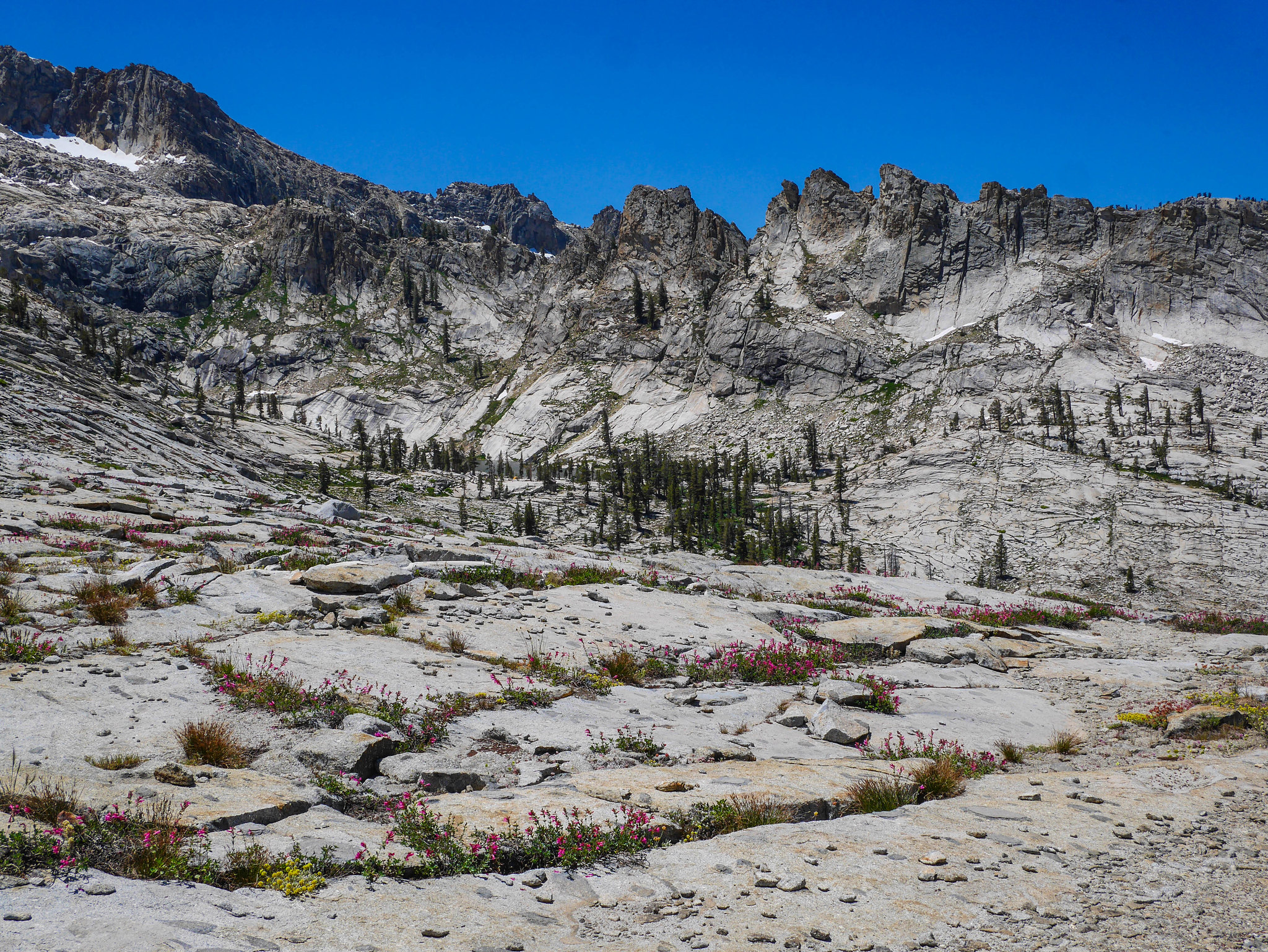
In the beginning, the terrain was mostly open granite slabs with only minor routefinding problems to solve. About halfway up I entered a steeper section, but nothing difficult. The terrain then flattened out again and I could see a lot of talus on my current side of Lonely Lake's outlet, so I crossed over to ascend more granite slabs. I zig-zagged up a final stretch of granite slabs, excited to be nearly there, only to encounter car-sized talus choking the last stretch to the lake.
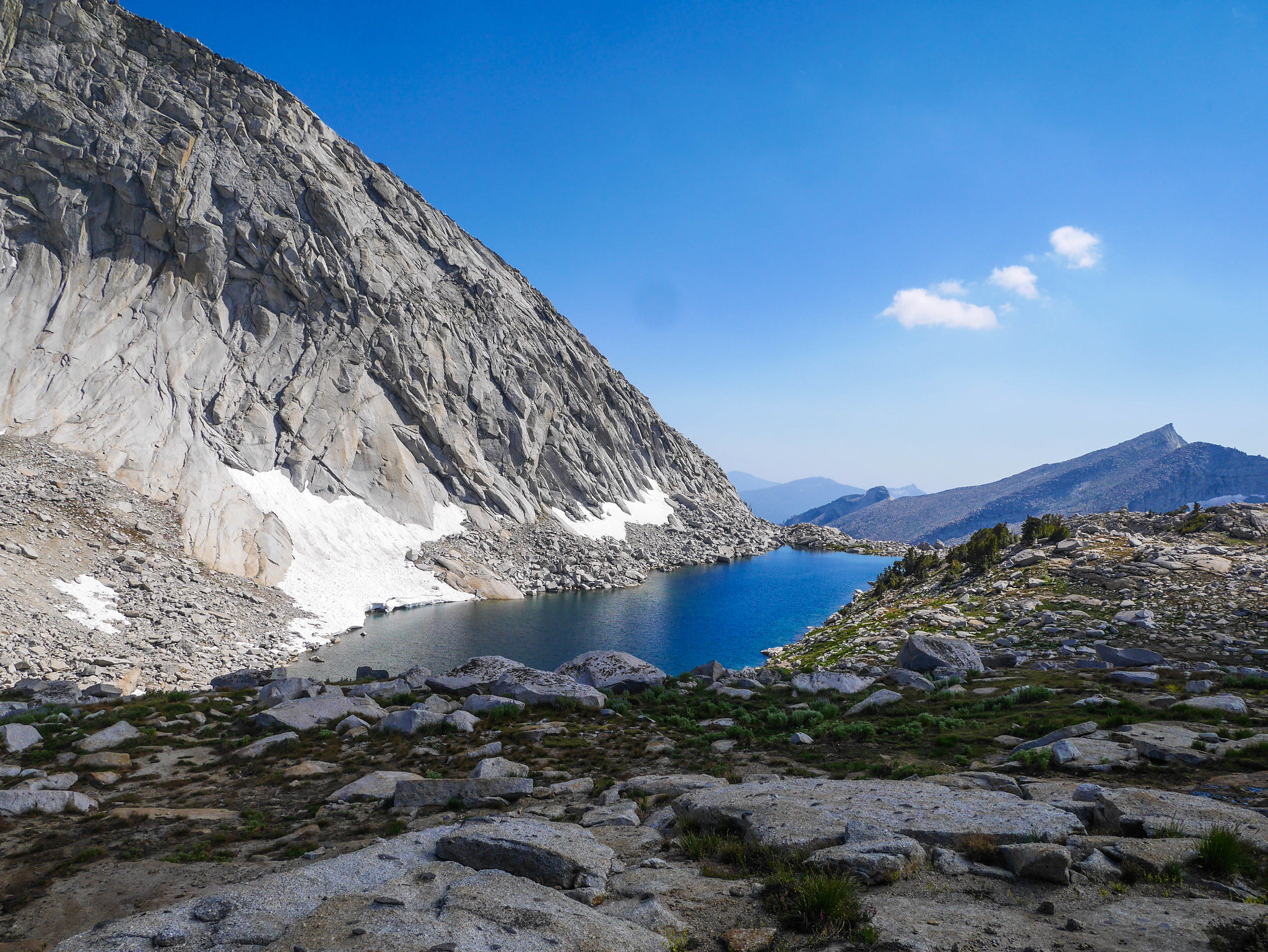
I got frustrated and decided to look for a talus-free route, so I backtracked a bit and climbed on a small hump ridge just north of the outlet stream to see if I could find an easier way. I ended up descending a short section of reasonably-sized talus across a trickle of a stream connecting some snowmelt ponds before I could get to the lake proper. I found what looked like a faint use trail and followed it to a lovely campsite overlooking the lake. I set up camp and took a short break, considering what to do: read or explore.
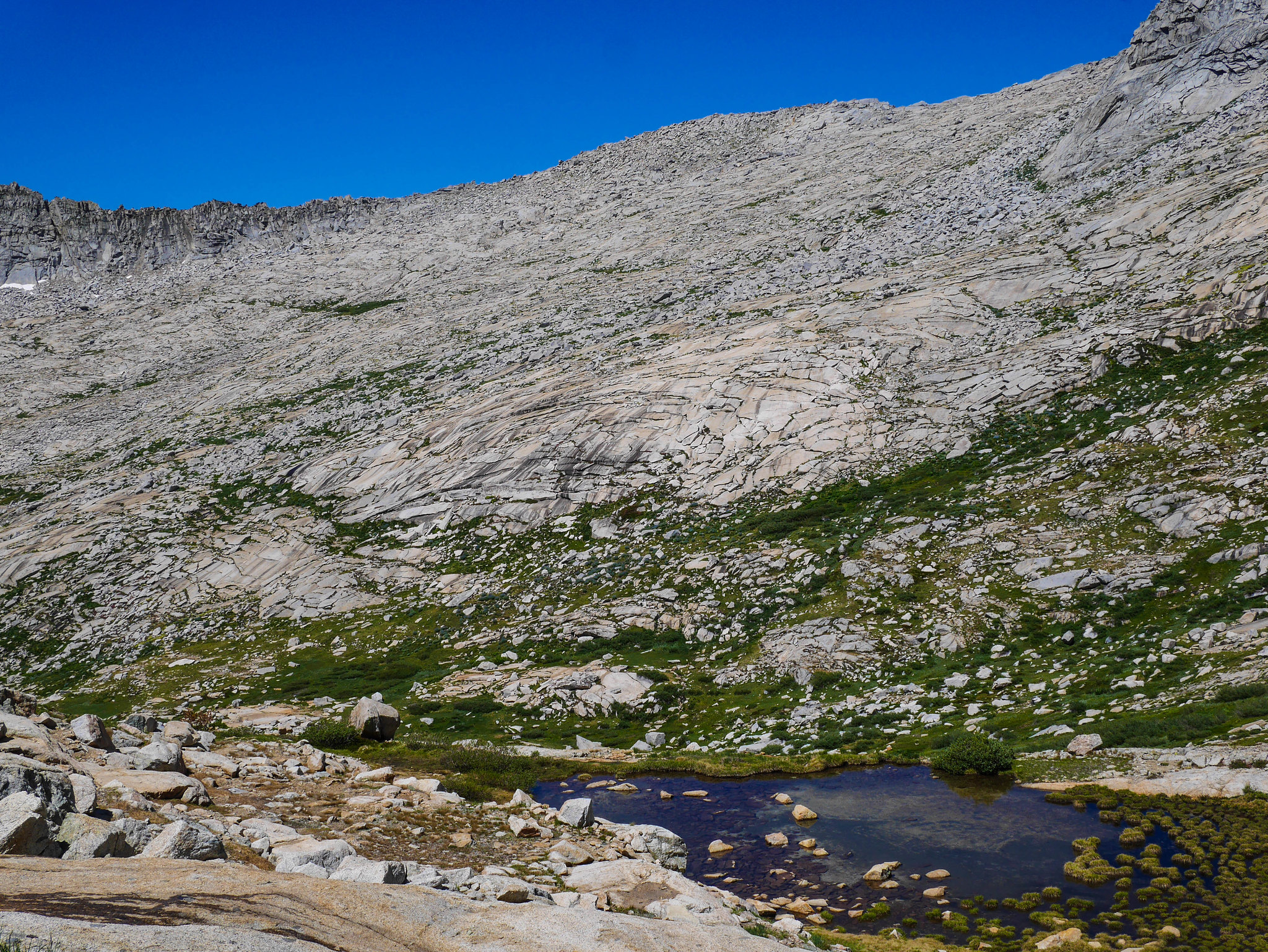
I decided that although I was a bit tired from the 2,800ft climb, I didn't know when I'd be back in this area next so I decided to see if I could make my way up to Horn Col. The terrain looked pretty easy for most of the way, but I could see a snow bridge and cornice on Horn Col, which was melting and making the steepish slabs just below it look pretty wet and slippery. As I headed up on a flat plateau and then granite slabs, I got some lovely views back down towards Lonely Lake and my campsite.
As I got closer, my concerns about the steepness of the wet slabs was confirmed. I edged closer to the wet area before deciding to turn back, seeing as I was on my own and was feeling a bit tired. I could have definitely made it go if I needed to for my route, but since I was just exploring pushing it seemed unnecessary.
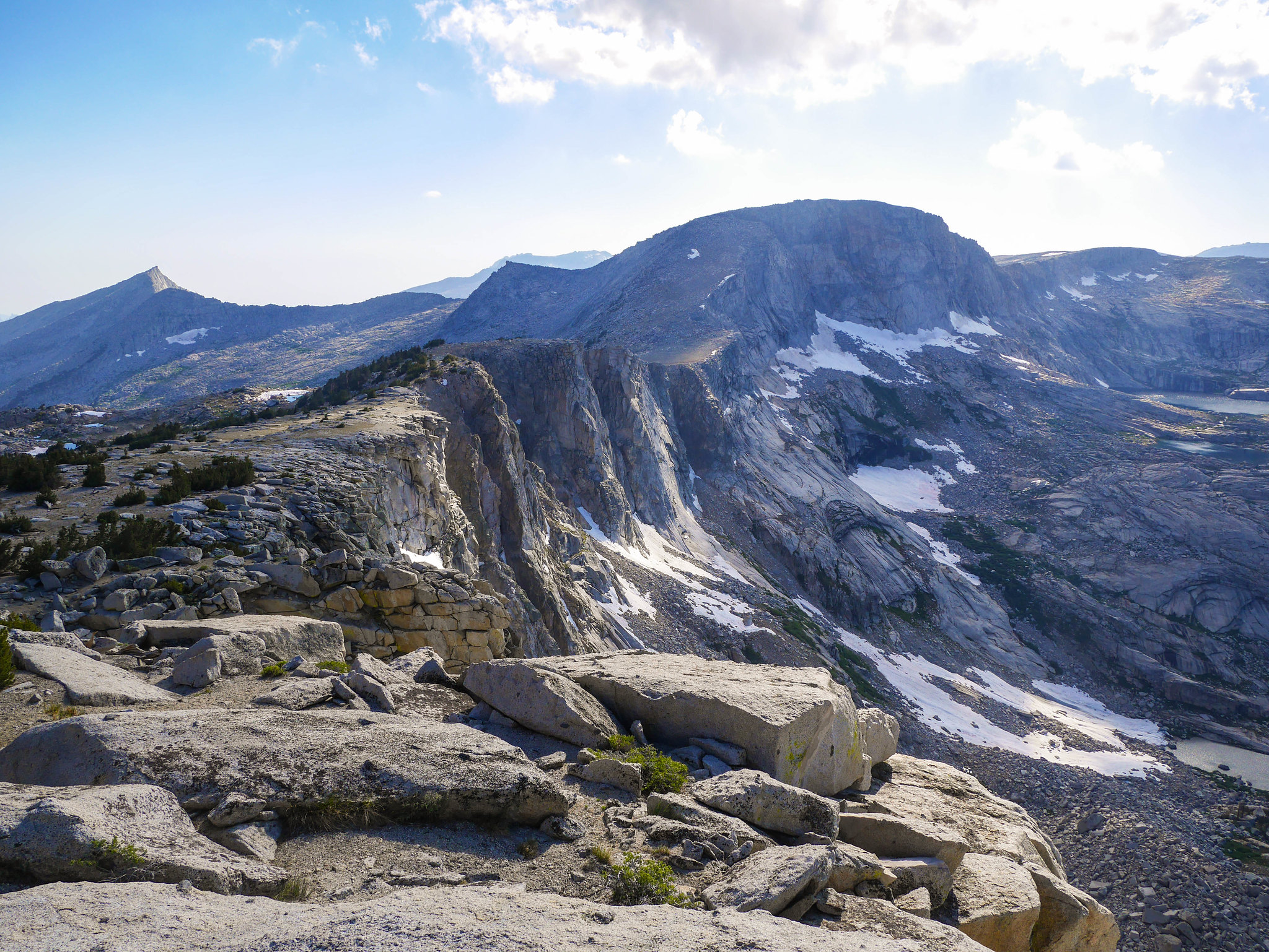
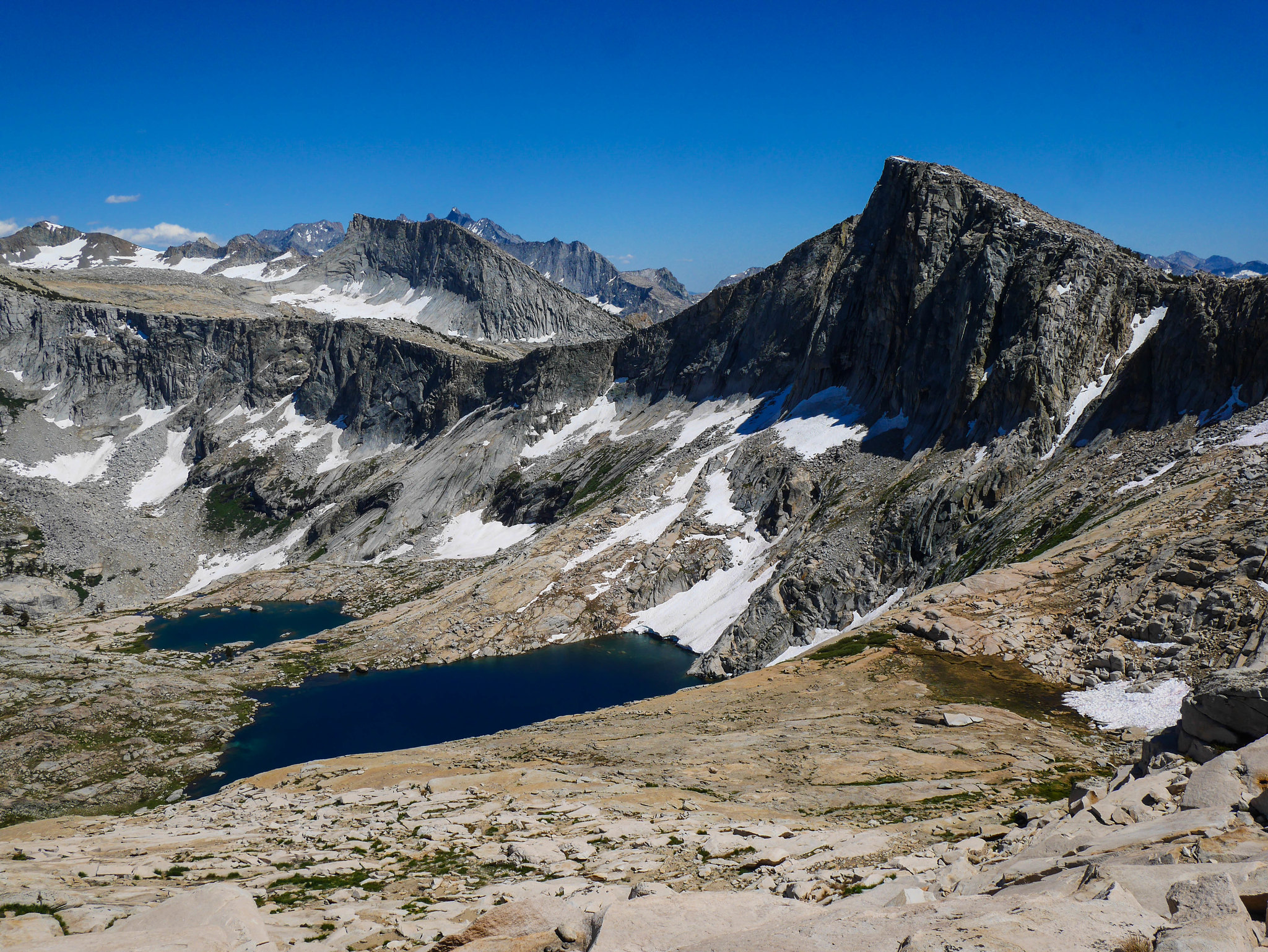
Instead, I headed straight up to the ridgeline north of Horn Col itself. It was views I was after, anyhow, and holy heck it was views I got.
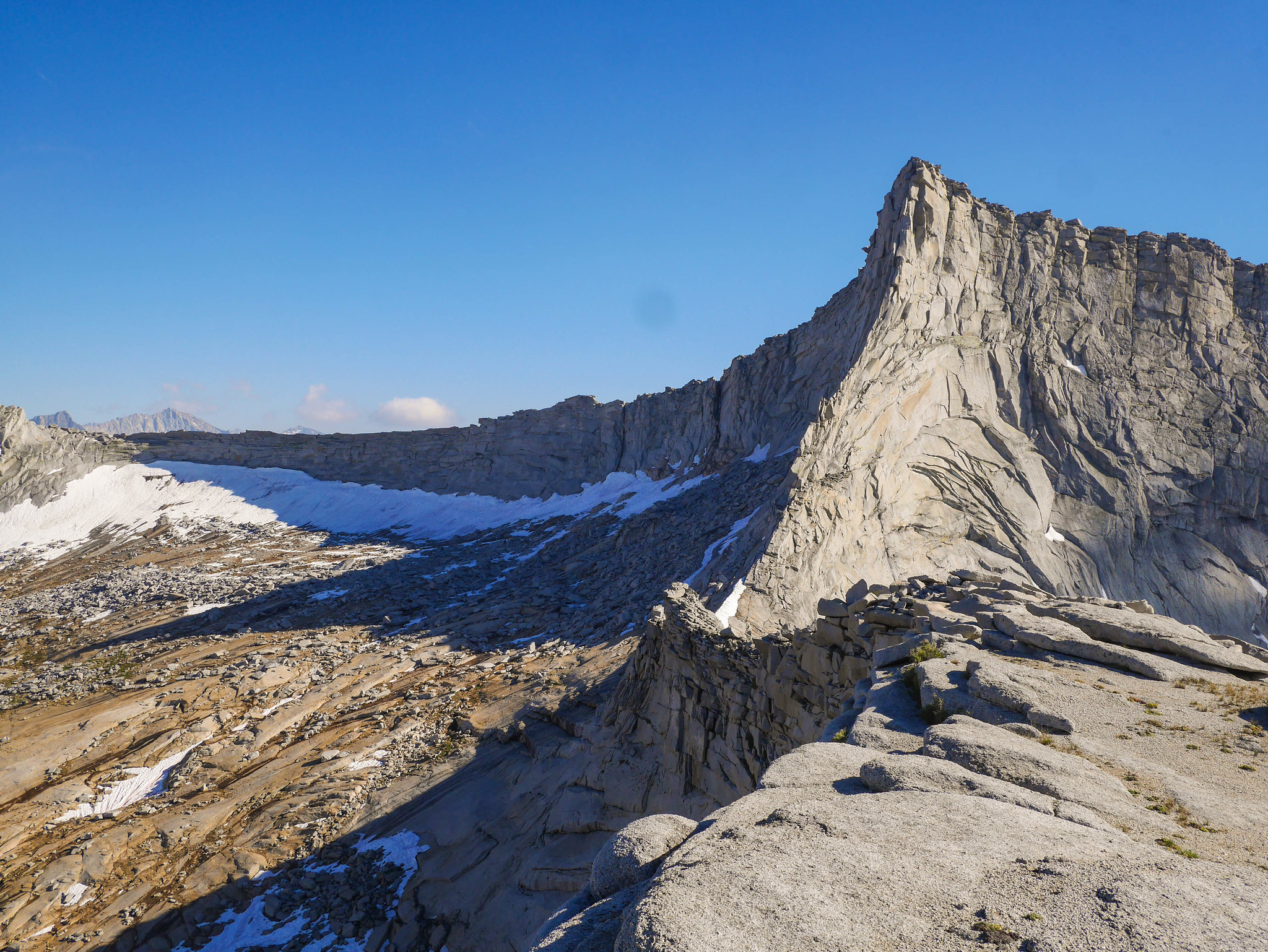
I explored up and down the ridgeline a bit and then decided to head over to the northern edge of the plateau so I could look down on Big Bird Lake.
After poking around a bit, I headed back down the sandy slope and then granite slabs to dinner and crashed.
Day 4
Lonely Lake to Lake 11,200 via Pterodactyl Pass
3mi, +1,300ft/-800ft off trail
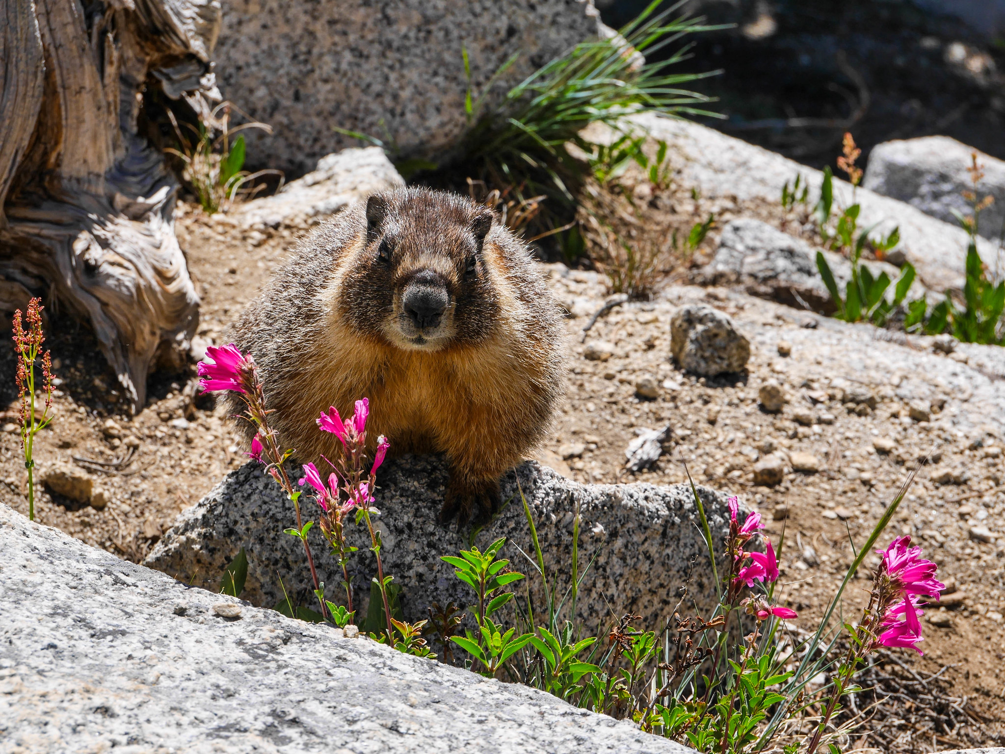
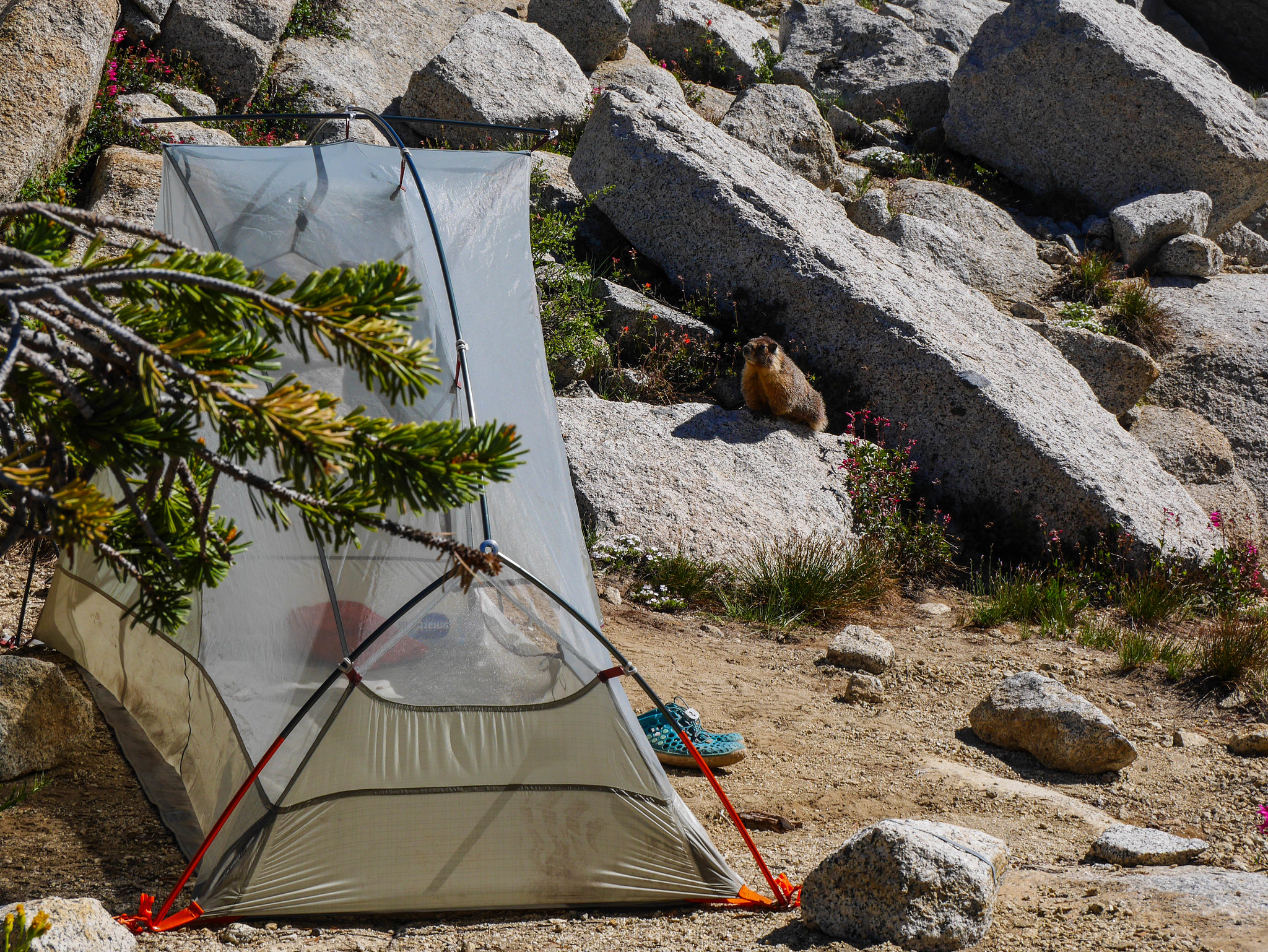
The sun warmed my tent around 7am and I woke to a sparkling Lonely Lake and had breakfast with a very unafraid marmot, who I had to keep a close eye on to prevent recreating previous disasters wherein a sternum strap was lost to the rodent gods with miles yet to hike.
I packed up camp and headed down from Lonely Lake. I chose to descend one of the gullies north of the lake and it was much easier than the route that I took to reach the lake initially. I needed to descend a few hundred feet to avoid some steeper slabs and talus below Pterodactyl Pass.
Aaaaaaaaand here we go again. Sing it with me now. All that glitters is gold.
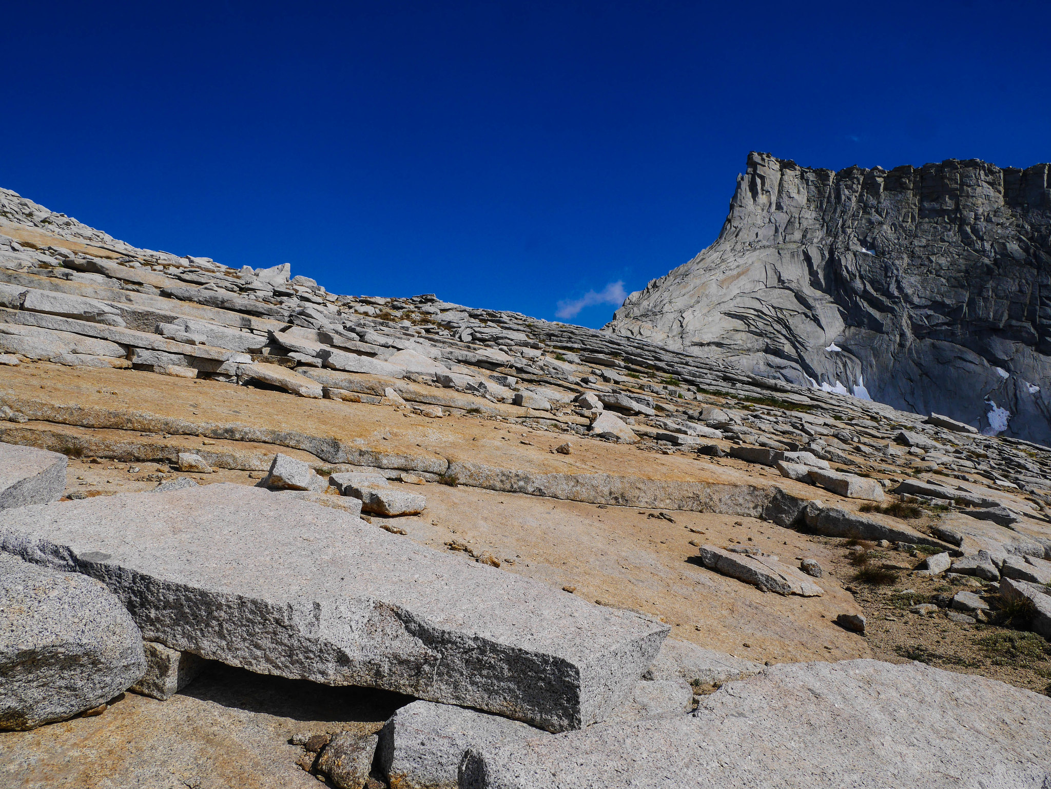
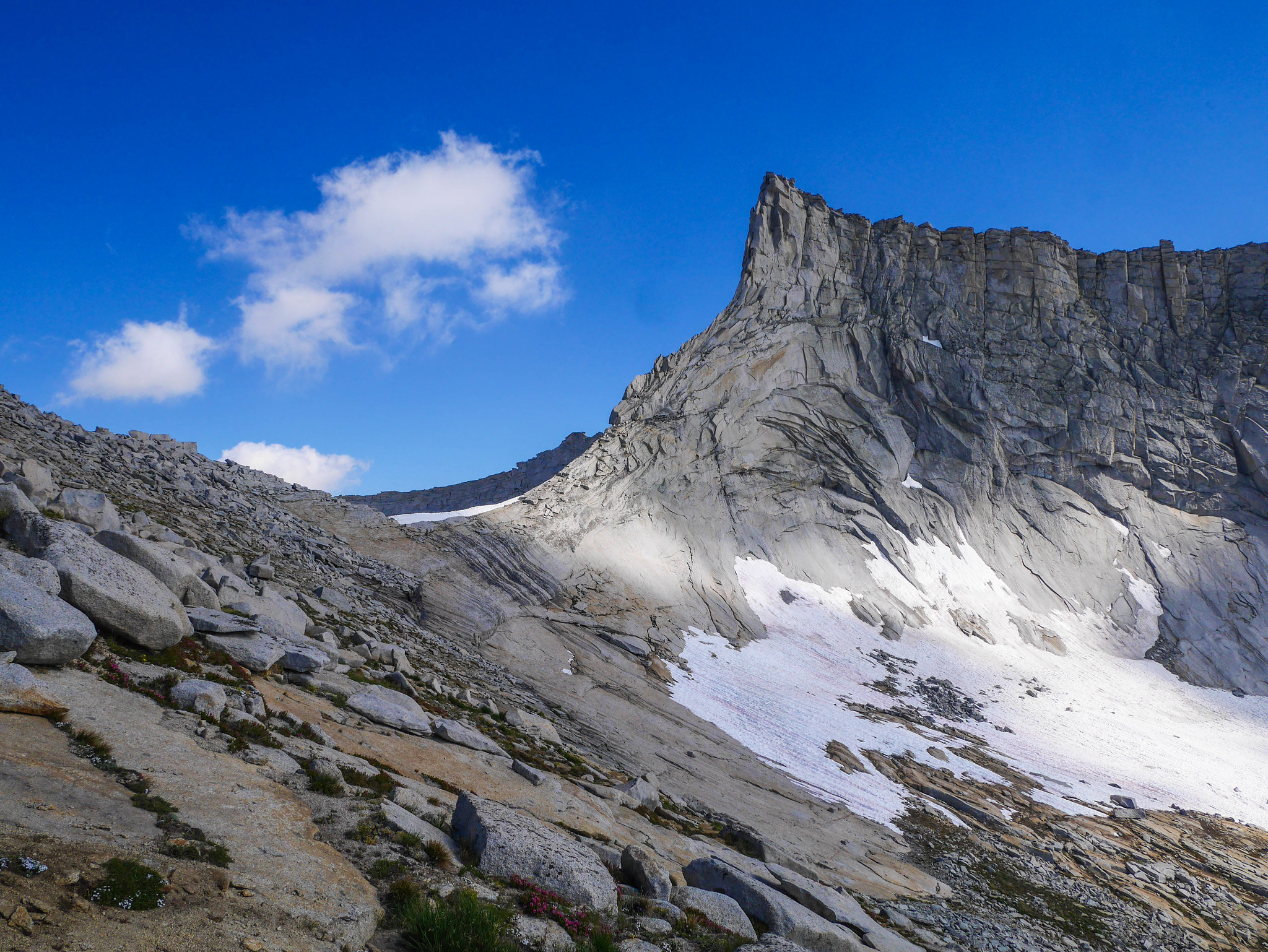
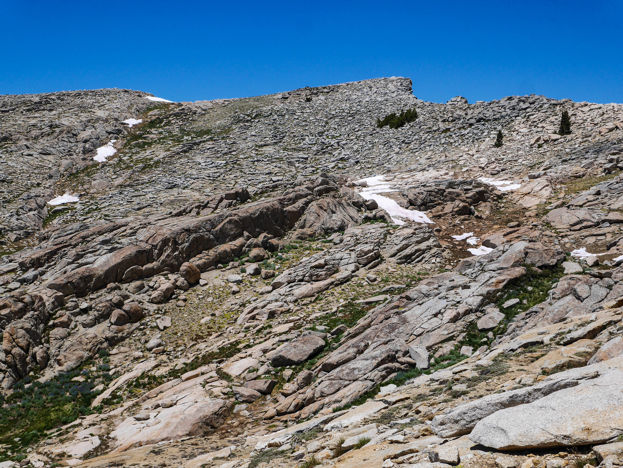
Ok so anyway, I had read reports that the ascent of Pterodactyl Pass is steep steep steep on slabs and I was a bit nervous before I started, but I chose to ascend through a series of grassy gullies and had no problems at all.

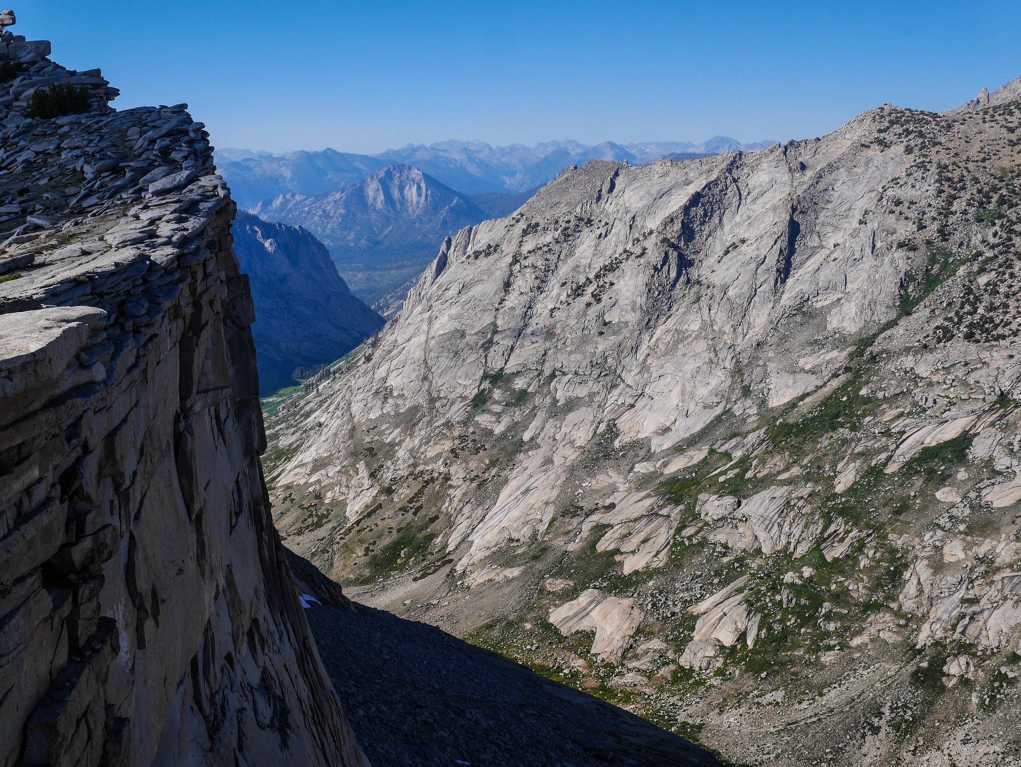
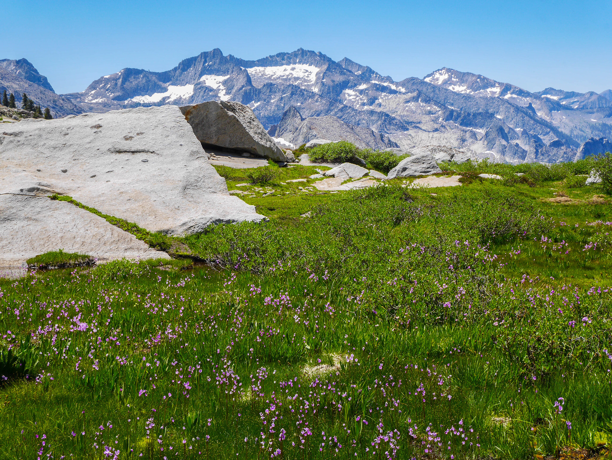
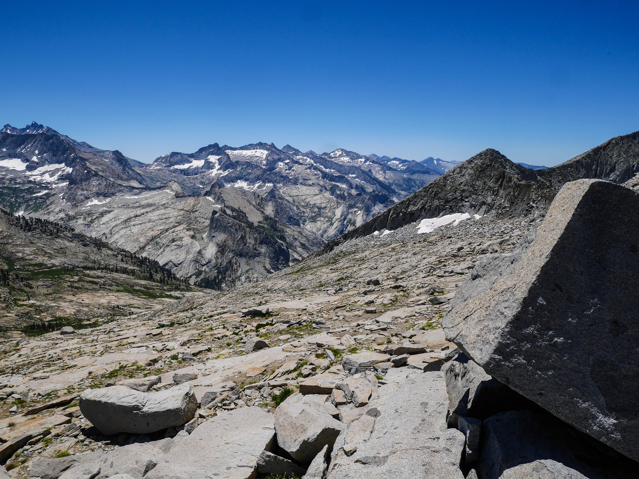
The top of the pass provided incredible views across the Great Western Divide and sat for a while eating a snack and lining up features with curly Q's on my topo map (this will be important later). I could see Precipice Lake's divot, Eagle Scout Peak, Lippincott Peak, Mt Stewart, and tons of other unnamed formations in Valhalla, the Hamilton drainage, and even down towards Mineral King.
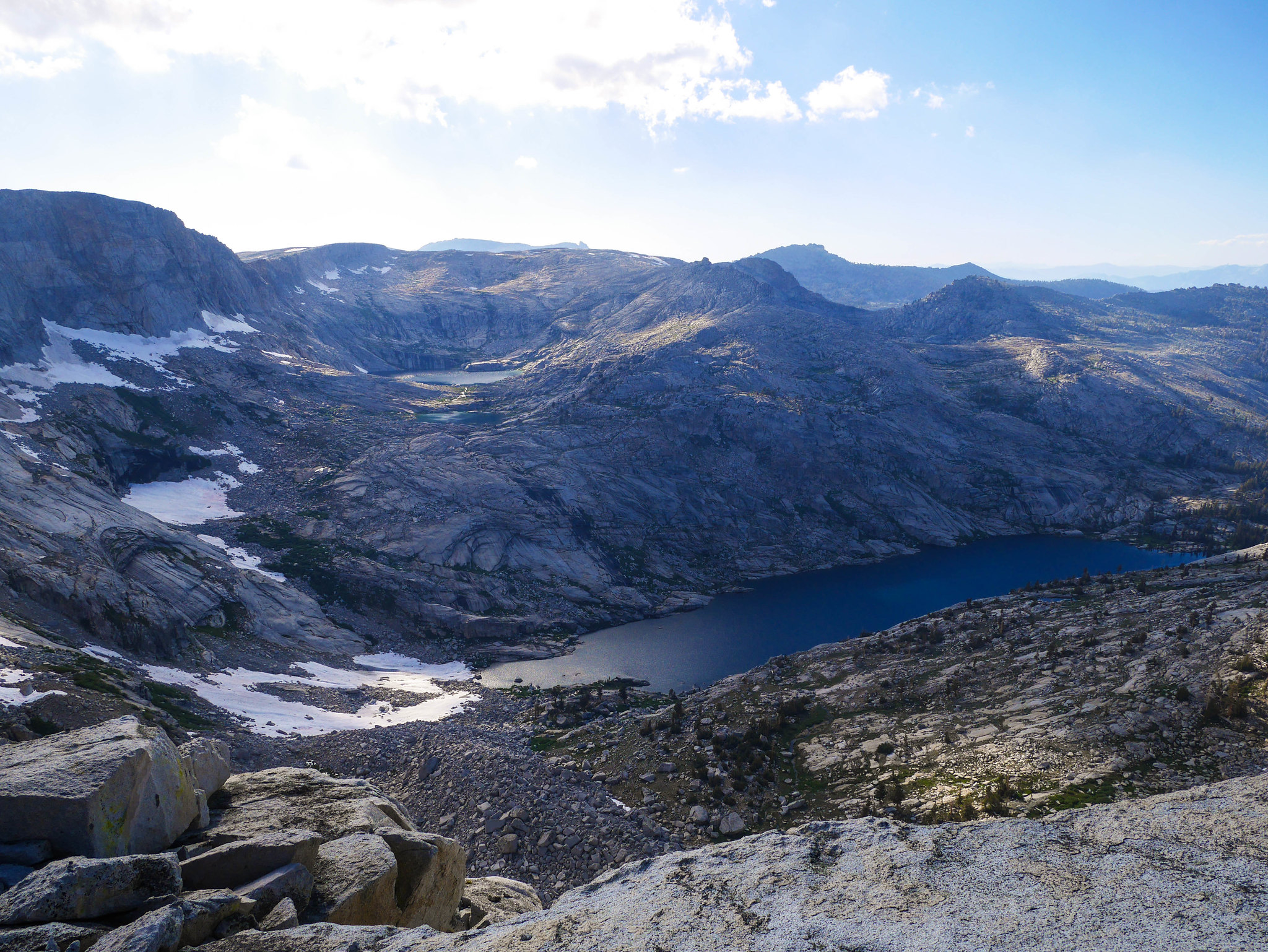
I hadn't talked to anyone in a while so I used a machine to talk to future humans. Wow ok this is what I sound like.[vimeo 278859368 w=640 h=360]Then it was time to head over to Lake 11,200, the uppermost in the chain of three lakes above Big Bird Lake. I was advised to stay high close to the ridgeline on my way over, and that worked just fine.
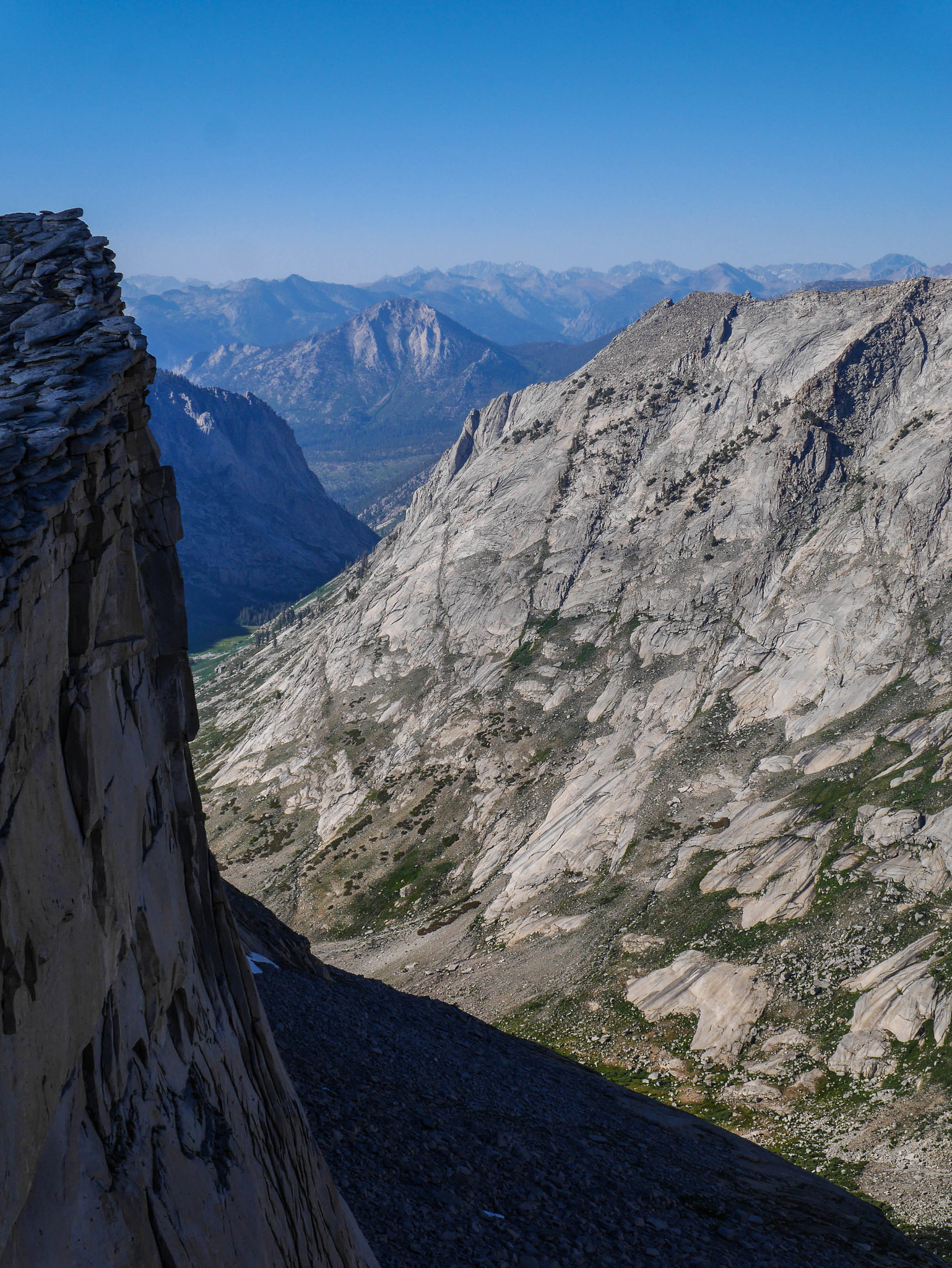
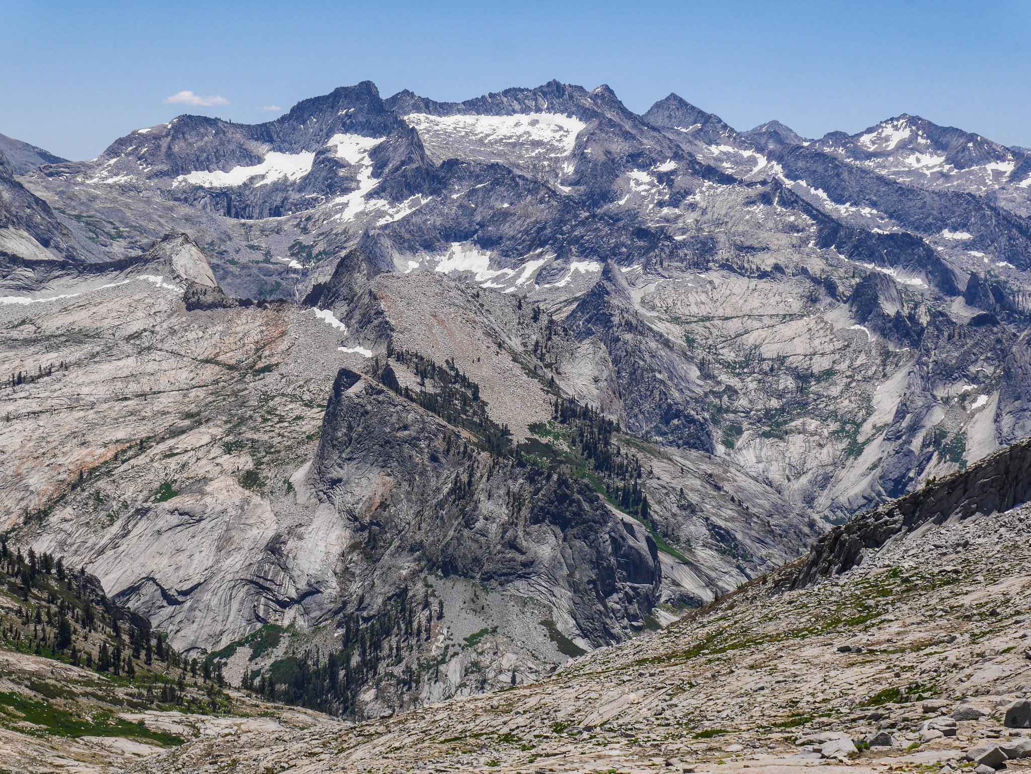
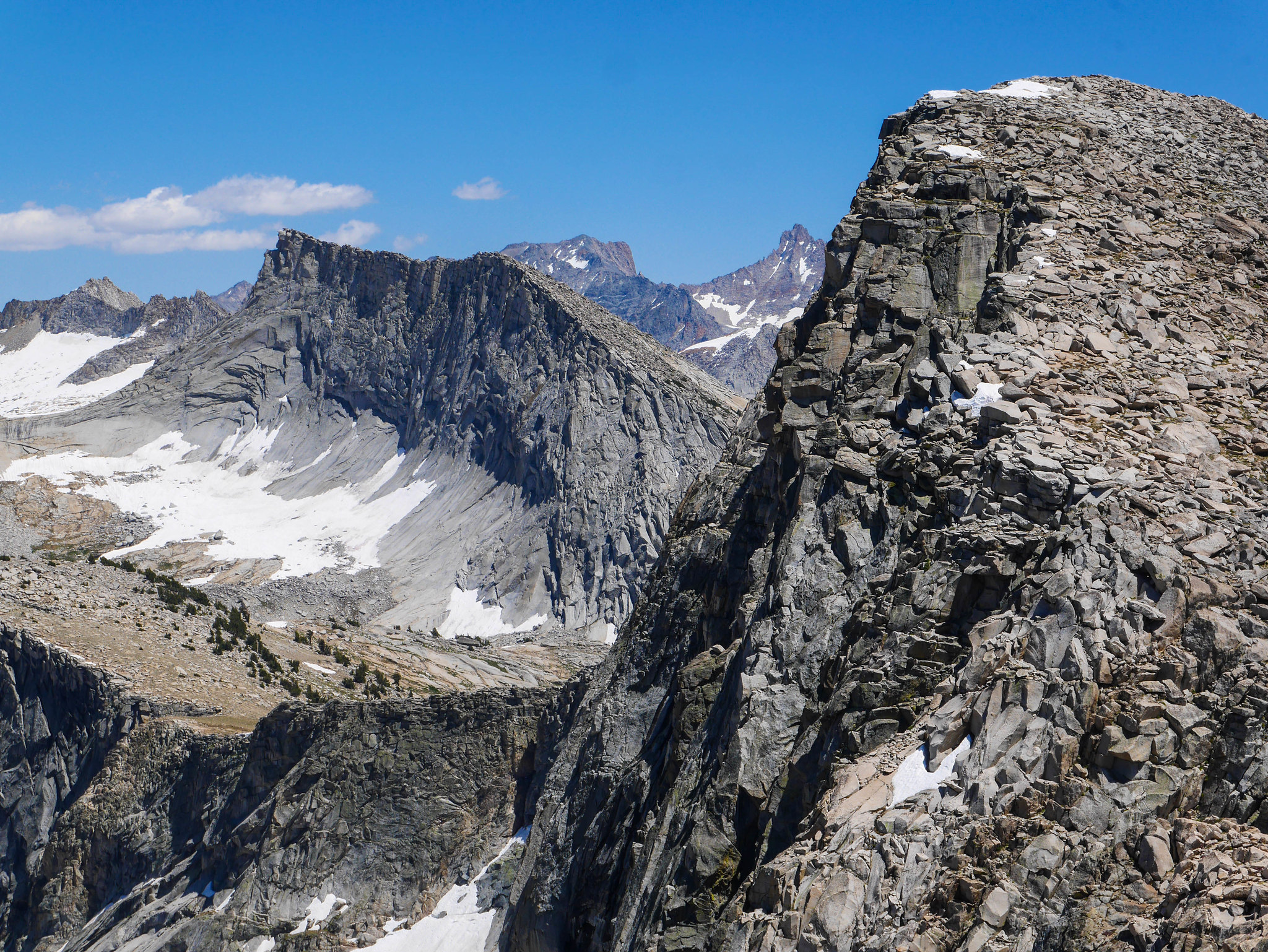
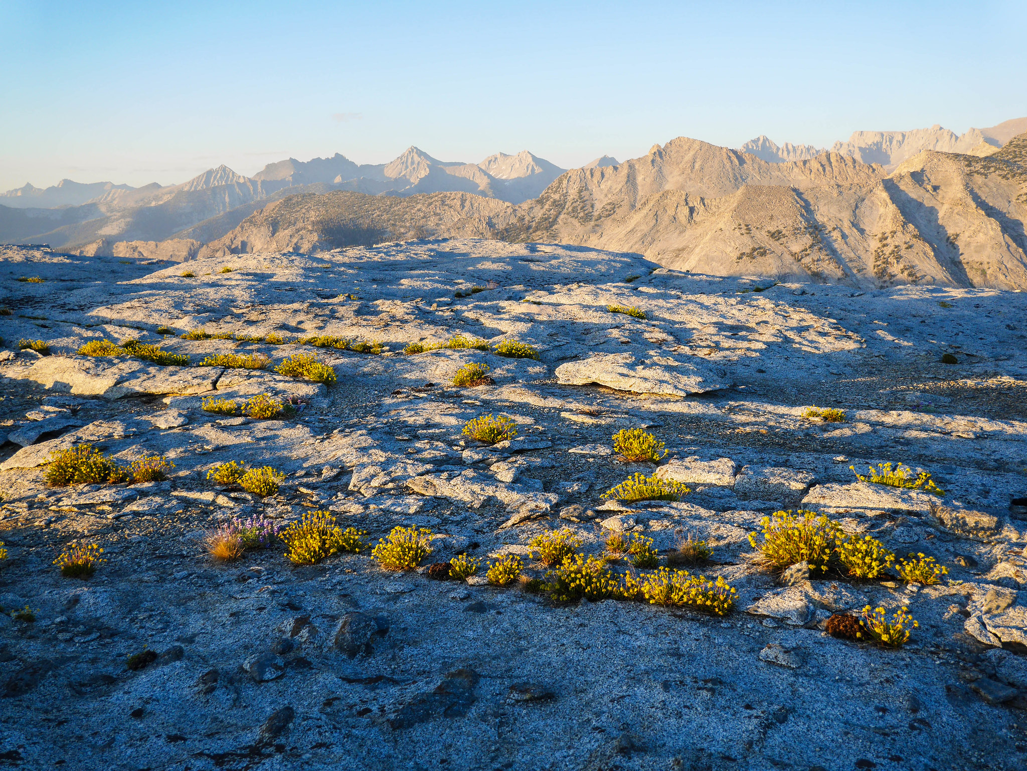
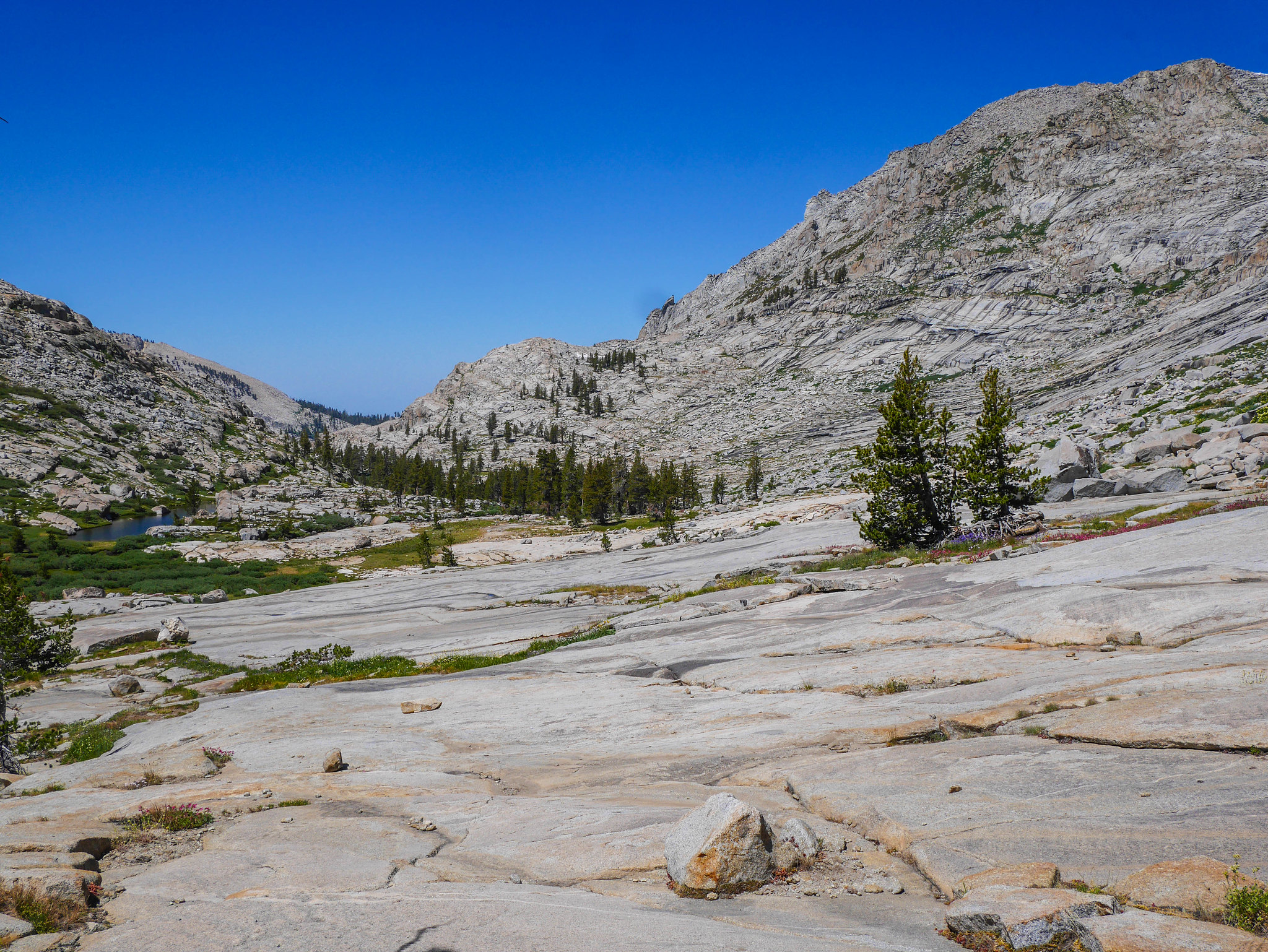
Looking back at Pterodactyl Pass gives a good idea of the jumbled nature of the Tablelands. It looks flat on the map, even on a 7.5" USGS quad, but it is definitely not flat. There are tons of 20 foot rock jumbles and mini-canyons everywhere that don't show up on a topo. Lots of little micro-routefinding problems to solve. Pretty fun if you don't have to get anywhere too quick, but a pain in the ass if you've got miles to cover.
On my way through this section I saw ANOTHER HUMAN! I waved and we met up and chatted.
"Hey! You heading over to Pterodactyl Pass?" -me
"Pterodactyl Pass?" -dude
"Yeah, you know, the pass you're heading towards. I just came from there"
"Oh, is that what it's called? I'm going to Elizabeth Pass."
"Oh cool yeah you can get there this way, you just have to go to Lonely Lake and then over Horn Col." [[thinking---it's 2pm right now that's far and you don't know what these things are called ok]]
"Yeah my map is not so good, it doesn't show any of these ups and downs, it's taken me a really long time to get here from Pear Lake. A former Outward Bound instructor there told me you can just follow along the ridgeline here to get to Elizabeth Pass."
"Do you have that Tom Harrison map?"
"No. It's a Nat Geo one." ((this map is 1:80,000 lmfao))
"Do you have a compass?"
"No."
"Let me tell you a bit about what I've learned from coming through here." [[my god man wow you are not prepared]]
I showed him on the GaiaGPS app (my first time using on this trip, pretty cool but also feels like cheating), describing how to avoid steepness on Pterodactyl Pass and how to get up to Lonely Lake and about the snow wall on Horn Col melting to wet the steep rock below it. I also told him he could just follow the Lonely Lake outlet stream down to the trail if he wanted to play it safer. I did what I could. I hope he made it.I continued on my way through fields of flowers on the shoulders of Big Bird Peak. What a weird name for a mountain, it looks more like a gumdrop or a marshmallow or just a big ol' lump.
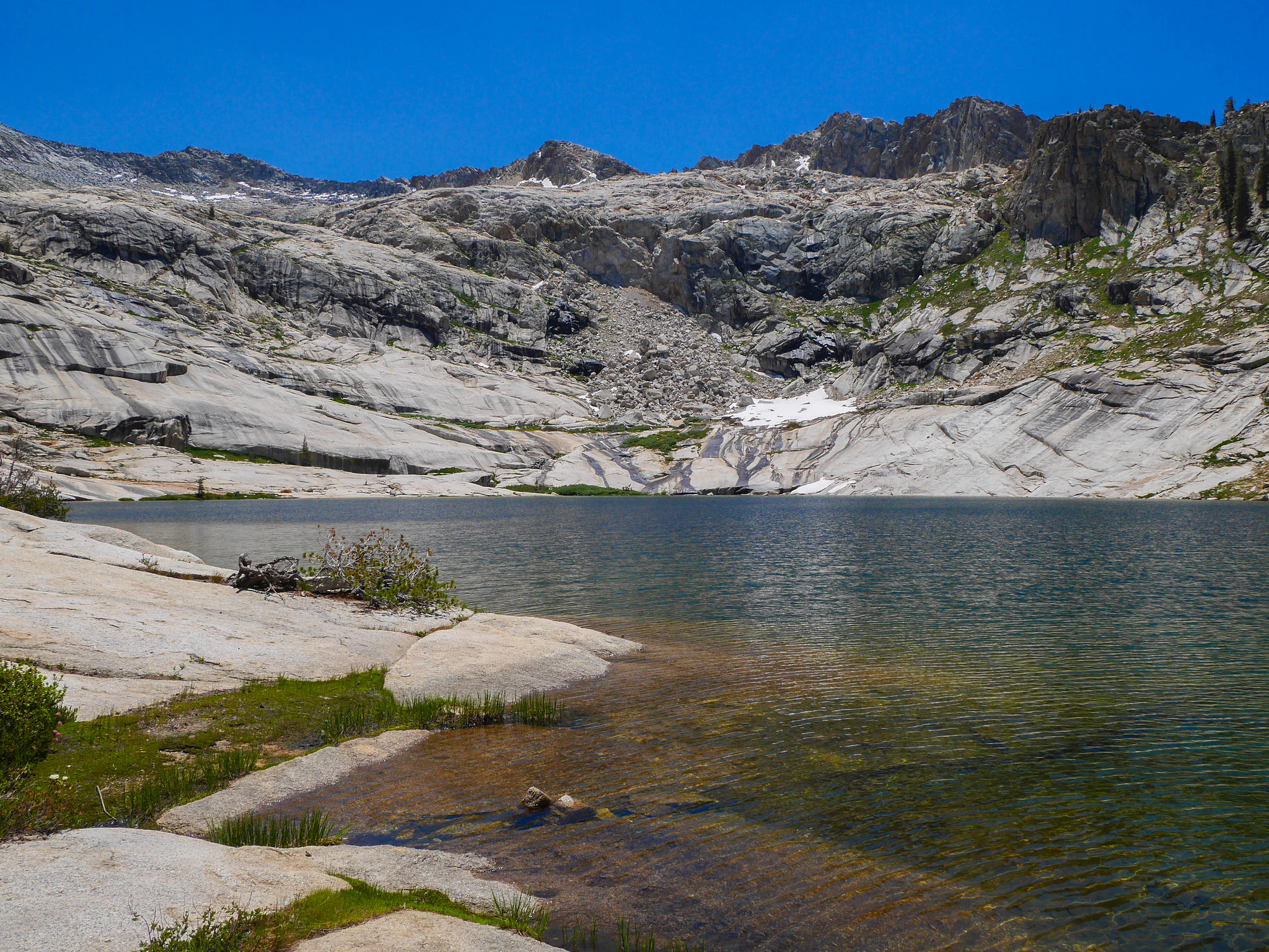
Oh hey that's Lake 11,200 over there! Cool, I'm almost there.
There's Big Bird again.
I mean really who could look at that lump of a mountain and come up with that name. It really looks nothing like a bird. These names. Pterodactyl? Pff. I didn't see any. And Moose Lake over there? Come on. But Big Bird, at least it's named after a thing that it could look like, but it doesn't look like a bir-----oooOOoOooooooOOOOooh!
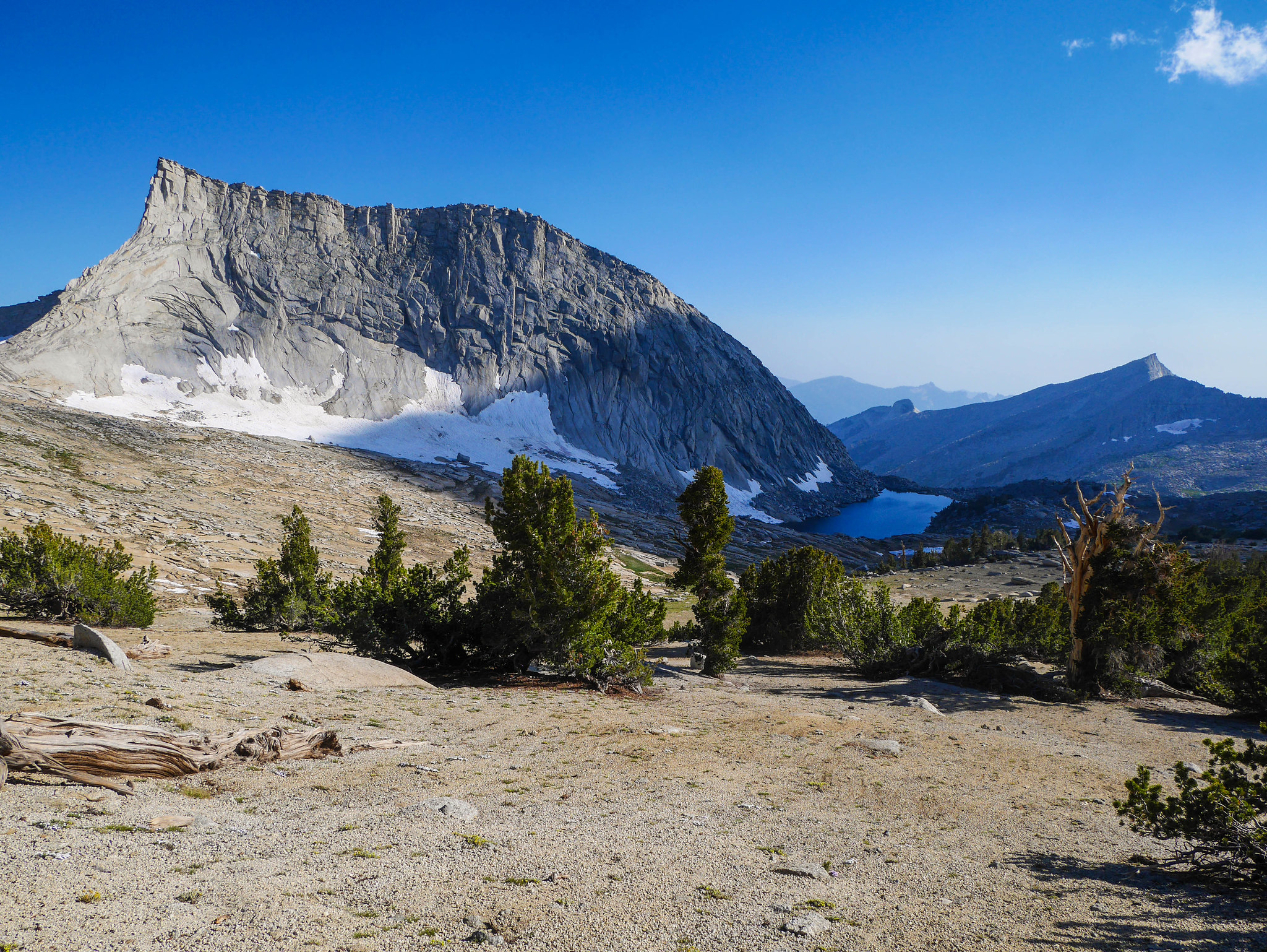
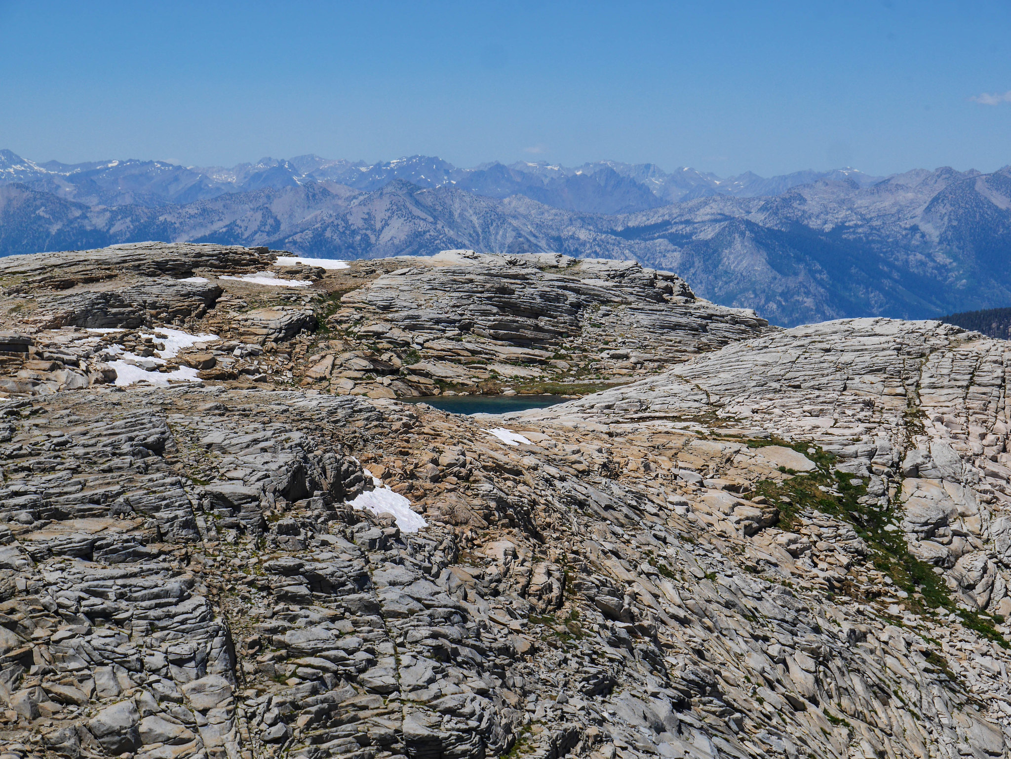
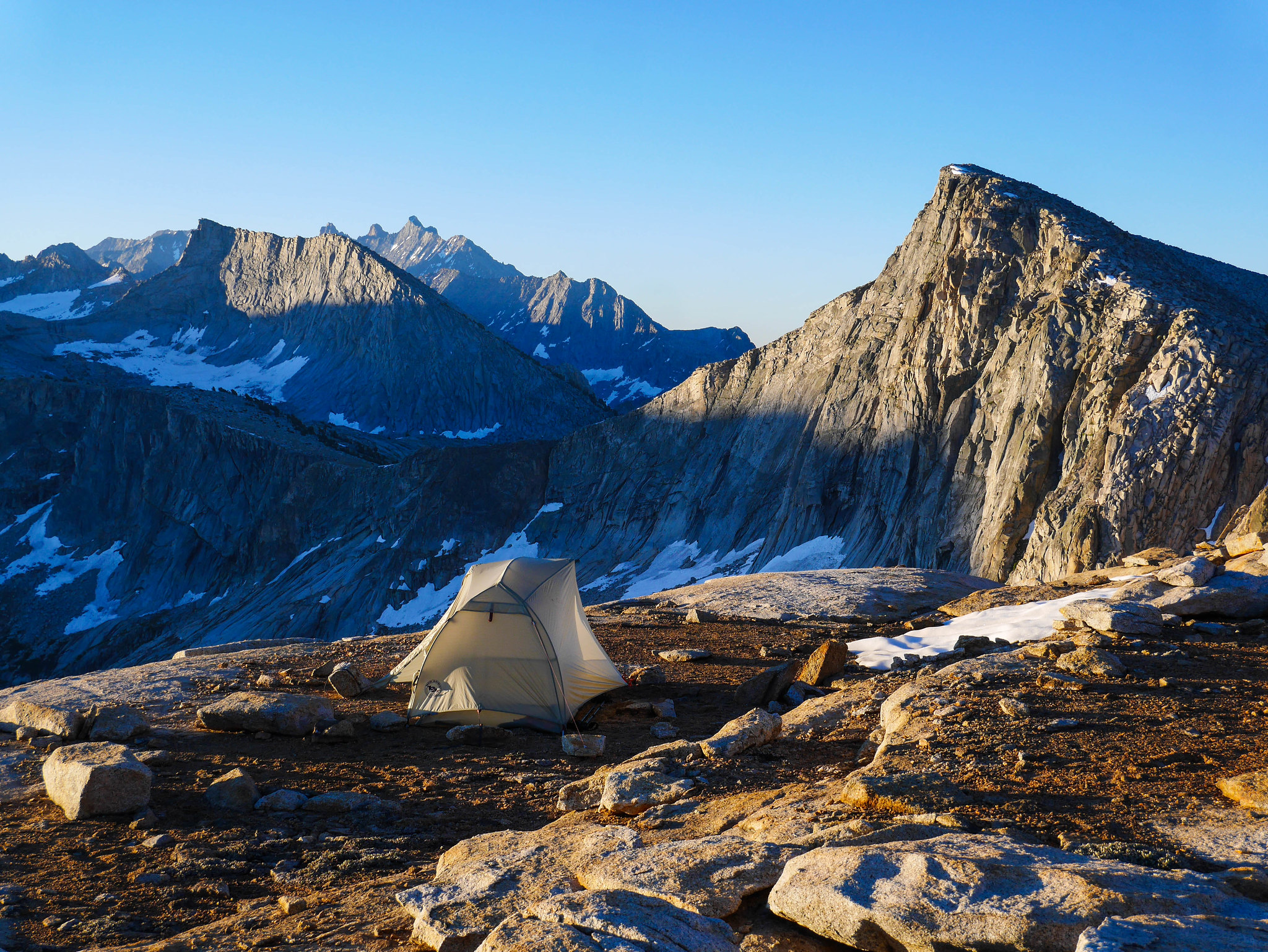
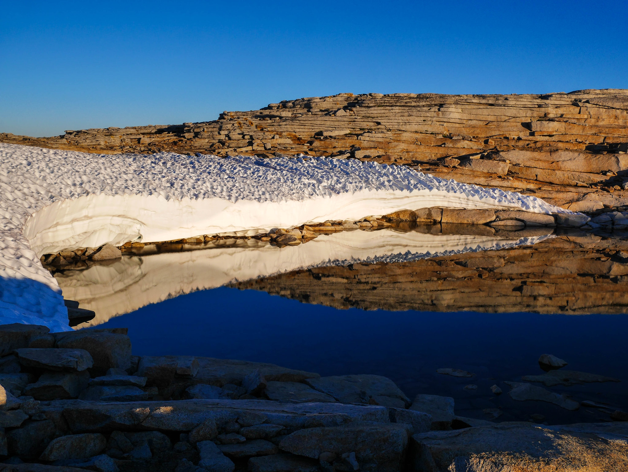
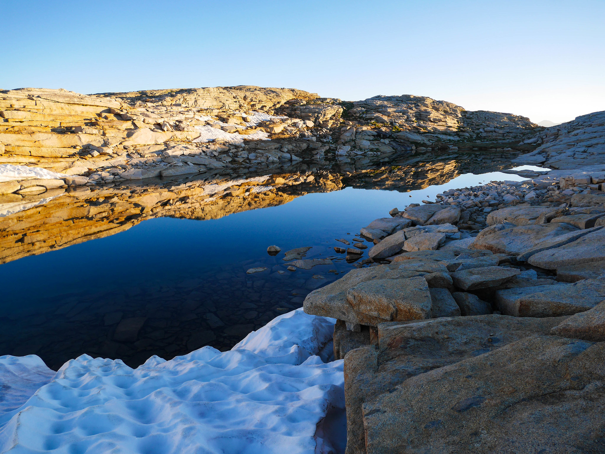
For years I never understood why it was called that just because I had never looked at it from the correct side. There's a life metaphor about perspective in here somewhere but I'm too lazy to find it for you.There was still a pretty big snowbank at Lake 11,200, but I was able to avoid it without much difficulty. I found an amazing perch for my tent for the night, set up camp, and went to pull out my Tom Harrison map to do some peak identifying. It.... wasn't there. Oh no, I left a trace on top of Pterodactyl Pass. Well, let's hope our good friend with no compass found it and made good use of it. If you did, and you are him, and you are reading this---hi wanna send it back to me? I still had a 1:23,000 CalTopo printout plus the GaiaGPS, so I wasn't worried, but I wouldn't be able to identify the far away peaks. Instead I read for like four hours.
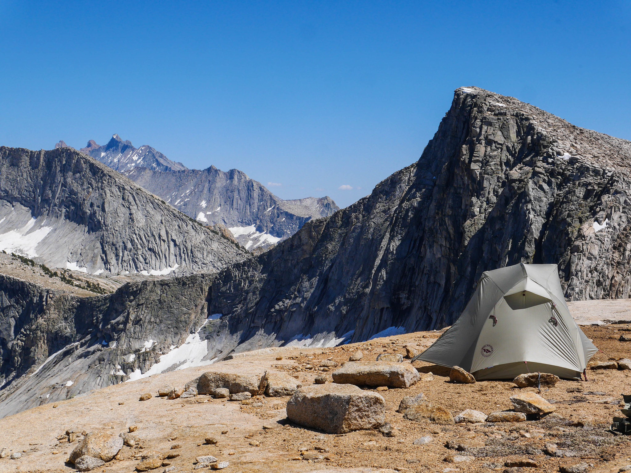
After dinner I roamed around to the various high points surrounding Lake 11,200 with my mouth agape just going oooooh and aaaaaah and oh my god. There was no way to capture it truly. It was too much for film. I tried again with an iPhone movie but it just ain't the same. Look at these photos and then stitch them all together in your mind's eye, paste them on every possible side inside of your skull so they surround your brain, and maybe, just maybe you'll get close to being there.
Day 5
Lake 11,200 to Wolverton via Tablelands and the Lakes Trail
5mi, +0ft/-1,800ft off trail, plus 6mi, +600ft/-2,800ft on trail
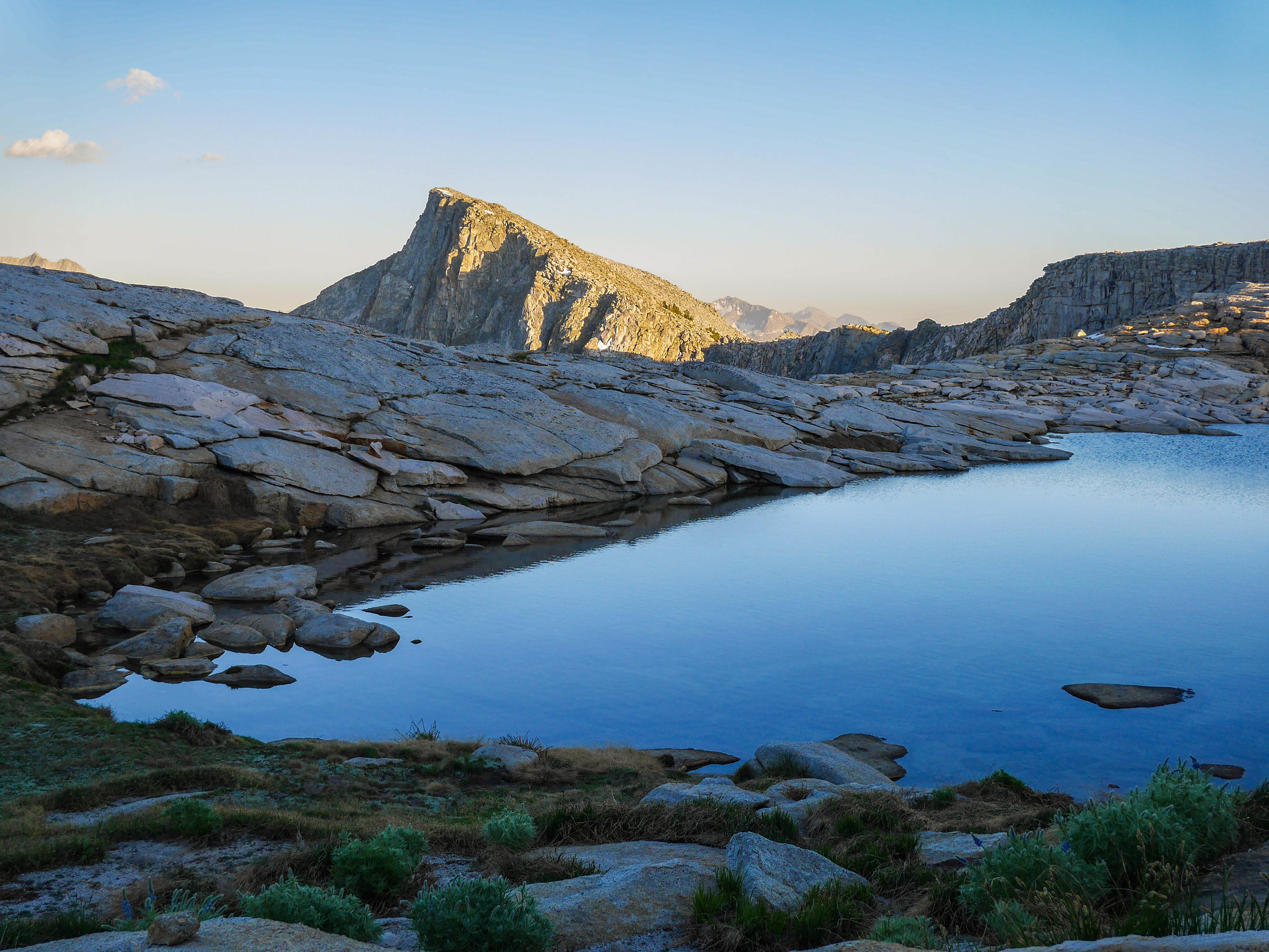
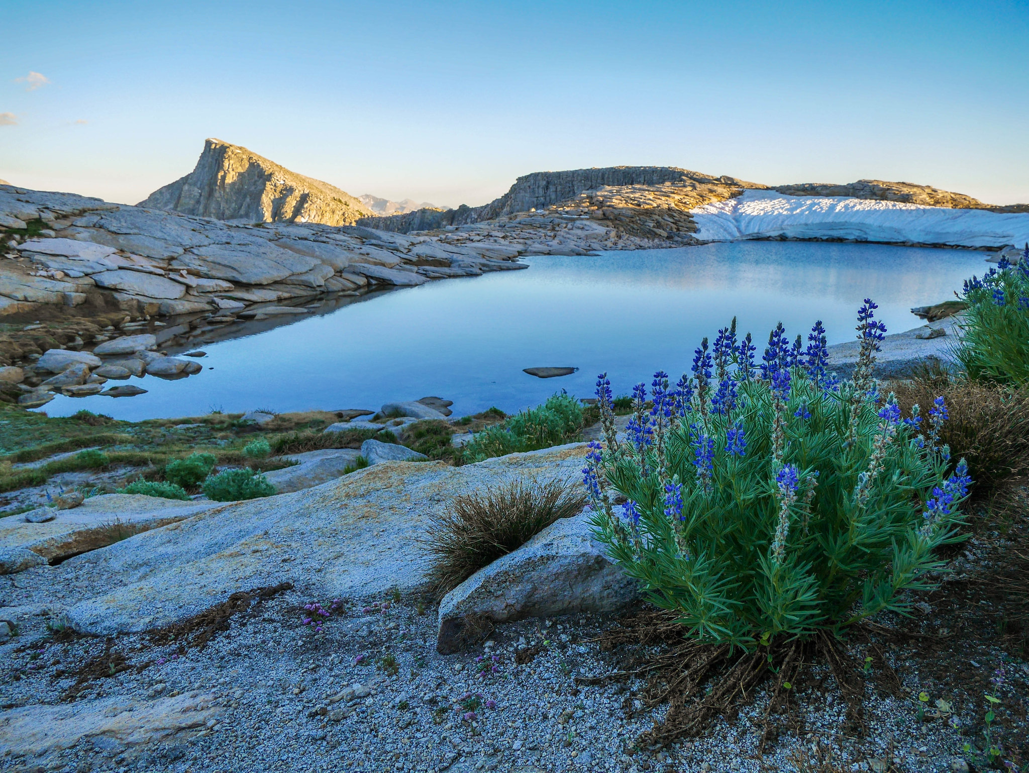
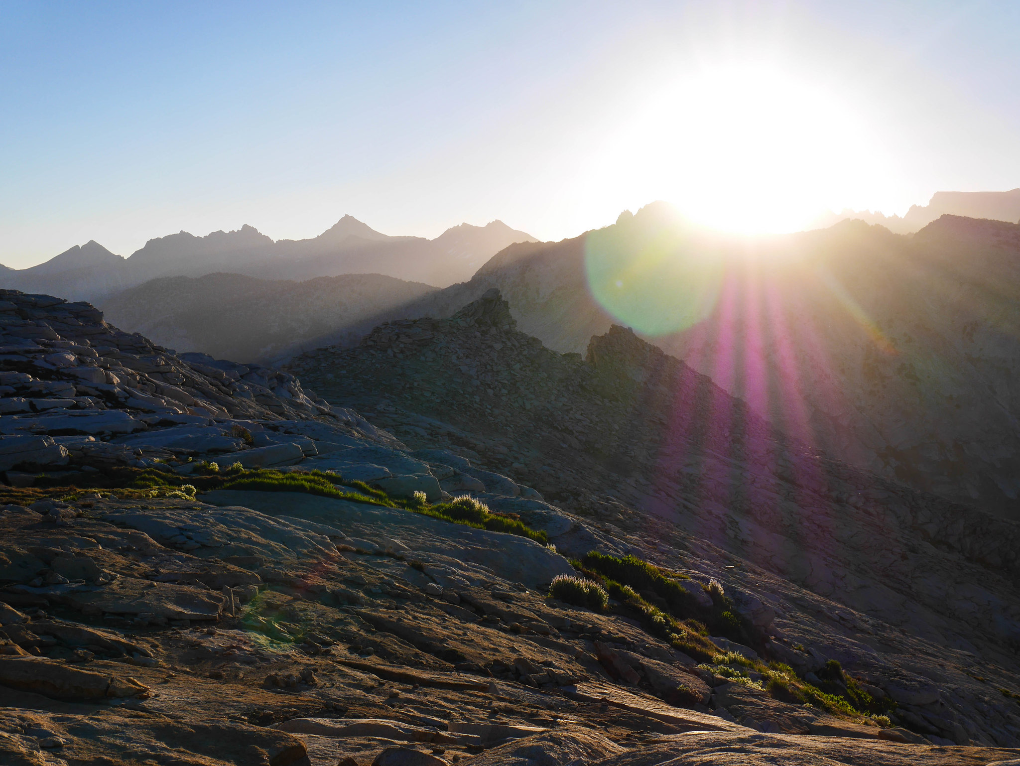
The sunrise did not disappoint, shining straight into my tent between breaks in the jagged Glacier Ridge.
I popped up and wandered around taking a few photos in the different light of morning before making breakfast and breaking camp.
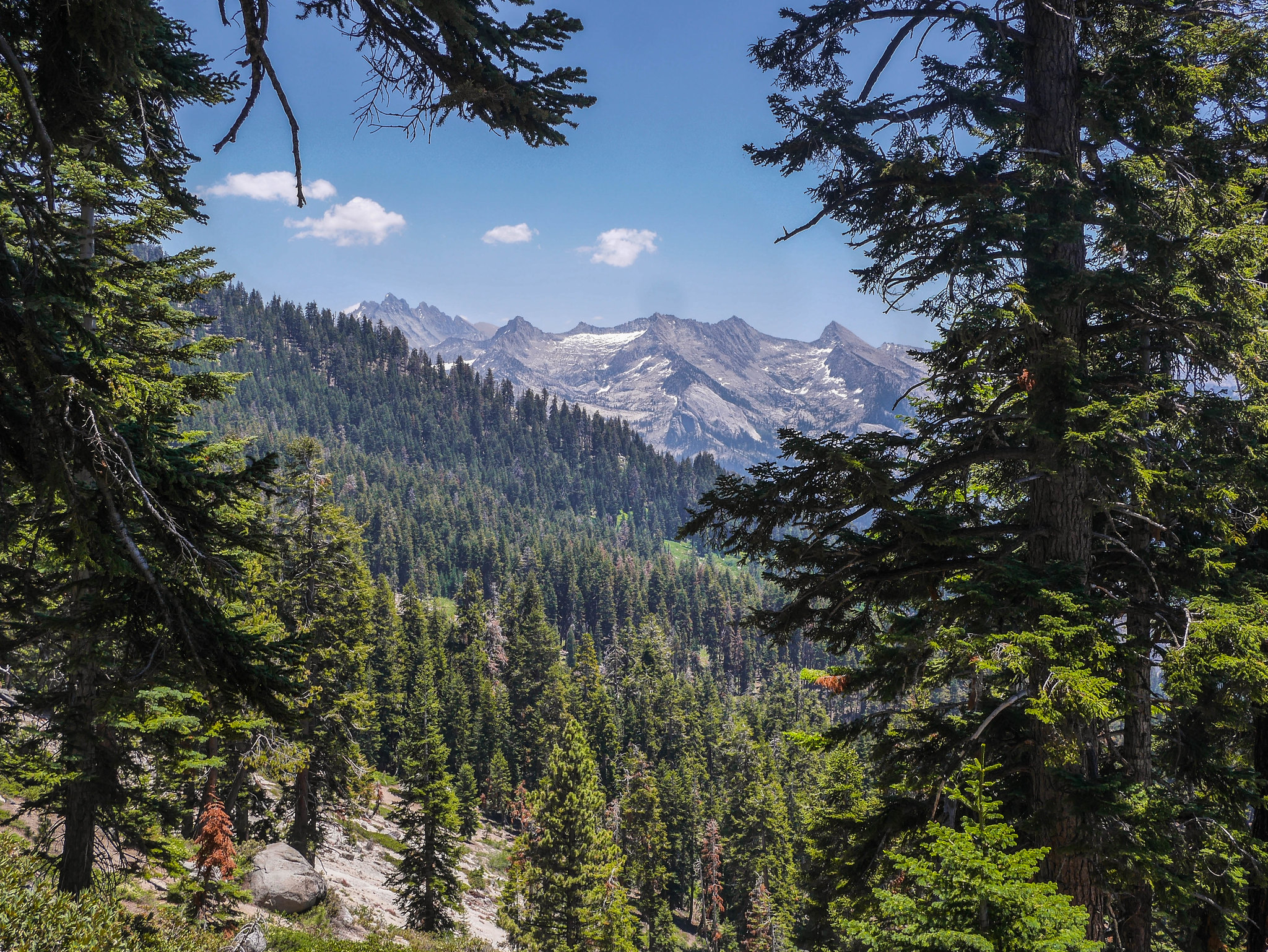
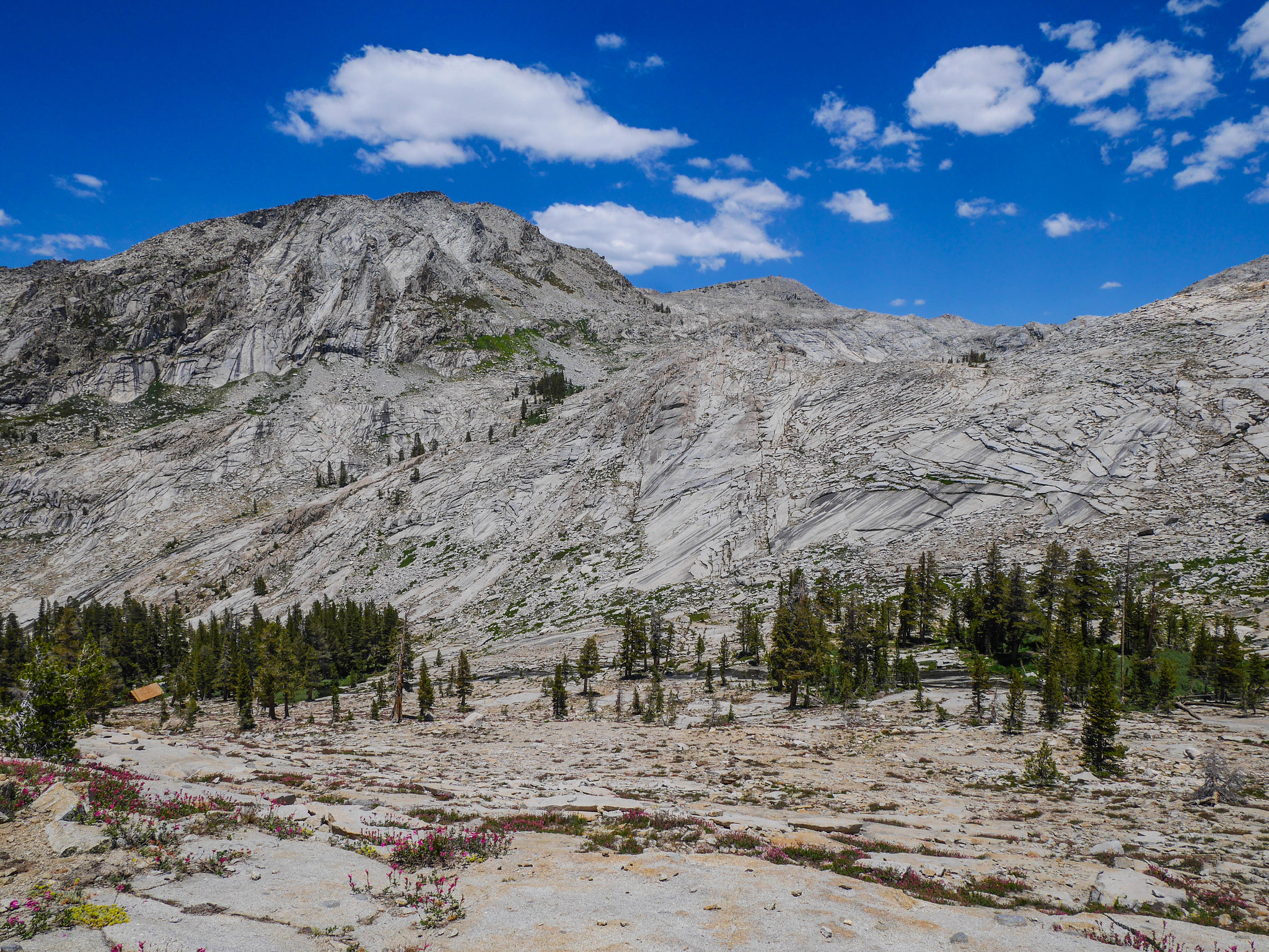
When planning this trip, I actually planned for 5 nights, thinking that maybe I'd go visit Moose Lake again for the last night or maybe I'd head down through Table Meadows and spend a night down in the valley somewhere. After seeing from Pterodactyl Pass the jumbled mess of terrain that I'd have to cover to get to Moose Lake, I knew I wasn't in the mood for that on this trip, so I headed across the Tablelands to make my way eventually to Pear Lake and the lakes trail.
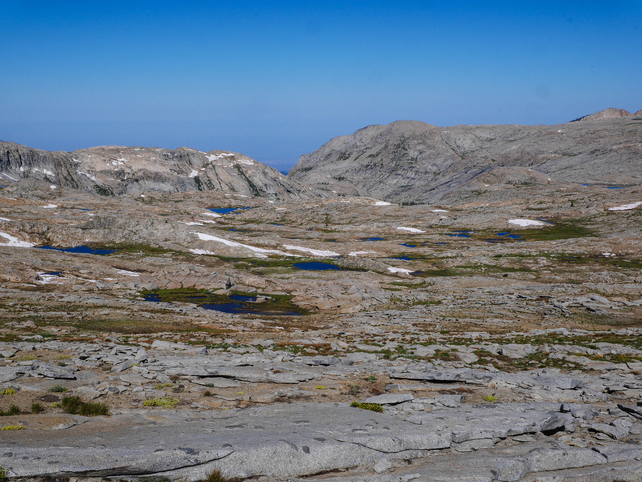
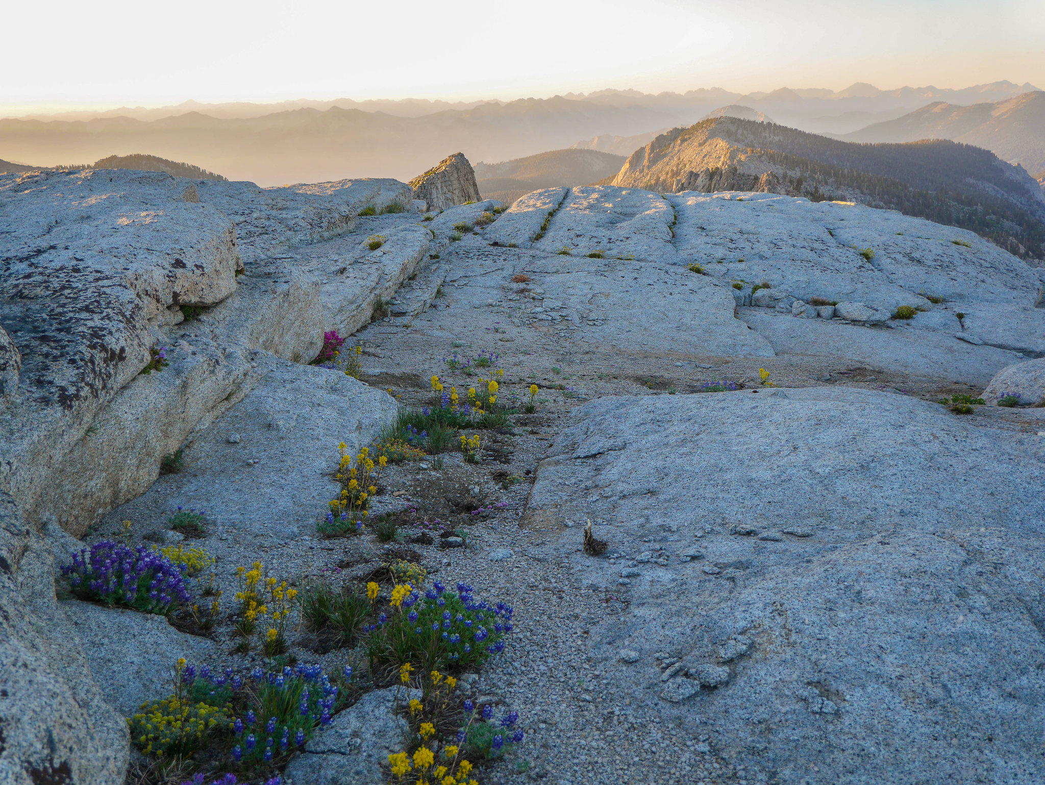
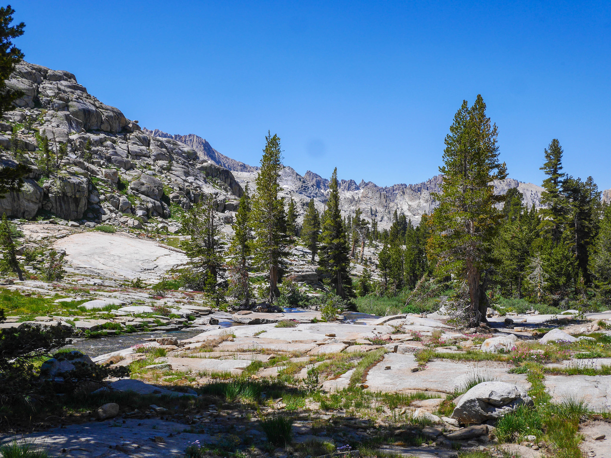
The key here is to stay very high and to the north for quite a while before descending down closer to the Marble Fork of the Kawaeh River. I mostly did this, but did still end up reaching the river a bit sooner than I'd have liked, so I did have to backtrack a time or two to avoid having to climb up unexpected 10 foot cliffs in drainages. Still, my adventures lead me through lush flower gardens.
aaaaaaand someBODY once told me noooooo not again T_T
I was happy to see this wide open swath of slabs, which I followed until it got jumbled again, about where I thought I should cross the Marble Fork to head over to the saddle to get to Pear Lake.
Just before ascending to the saddle, I had to navigate around this bog, which may or may not be there later in the summer.
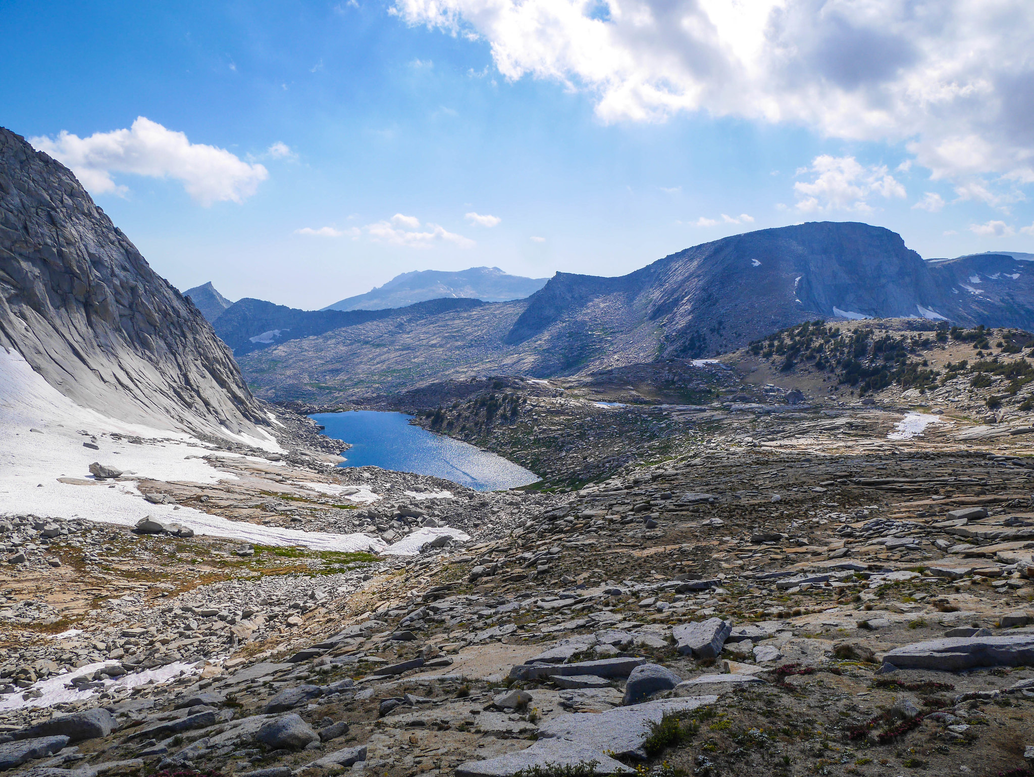
I took a swim in pleasantly-warm-compared-to-where-I'd-been Pear Lake, which is spectacularly beautiful, impossible to properly photograph, and usually crawling with people.

I was lucky to have it to myself for ten minutes before two groups of six and eight dayhikers arrived and cracked beers and hooted and hollered about how cold the water was. I packed up my stuff and booked it back down to Wolverton, passing twenty (!) seven (!!) more dayhikers between Pear and Emerald Lakes. I took the Watchtower trail. A dude was badly slacklining in the space between the mountain and the tower.

It took longer to get down that I remembered. Still, I was at my car by 3:30pm, a day early.


