TR: Alta, Moose, Kings-Kaweah Divide, Tableland 7/20-7/24
Posted: Mon Jul 29, 2019 12:14 am
I made a few changes to my original plan due to unfavorable weather and news that I wouldn’t be able to cross the stream in Deadman Canyon to get to the 2019 HST Meetup up at one of the Glacier Ridge lakes. So this trip ended up as a simple loop from Wolverton to Alta Meadows, Moose Lake, Lake 11,200 at the Kings-Kaweah Divide, Lake 10,559 in the Tableland and back to Wolverton.
From Wolverton, I shared the trail with many day hikers until the Alta split and was alone until densely populated Alta Meadows. Protip: If your group has only 1-2 tents and you are looking for privacy at Alta Meadows, head north up the hill and look for a site that is both flat and free of vegetation. It took me a while but I found an ideal site that was also close to the year-round stream for water access. The sky faded red as I turned in for the night. I woke up early in the morning to see that it was still red, snapped a photo, and dozed off again, trying to recover from the previous night’s 3.5 hours sleep.
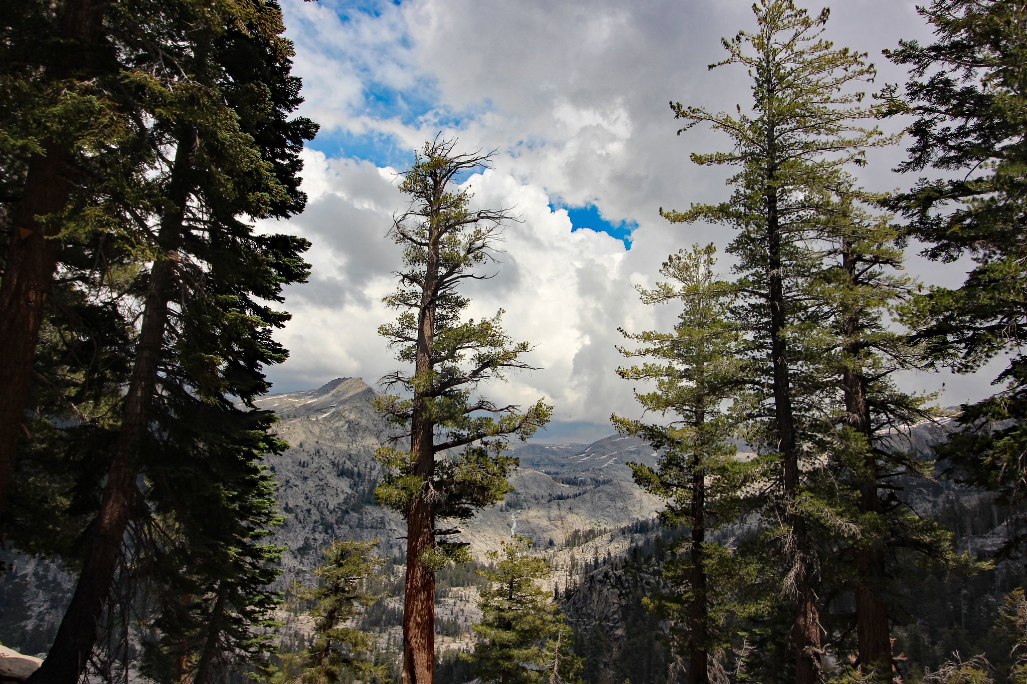
View of the Great Western Divide from Panther Gap

Privacy at Alta Meadows

Sunrise

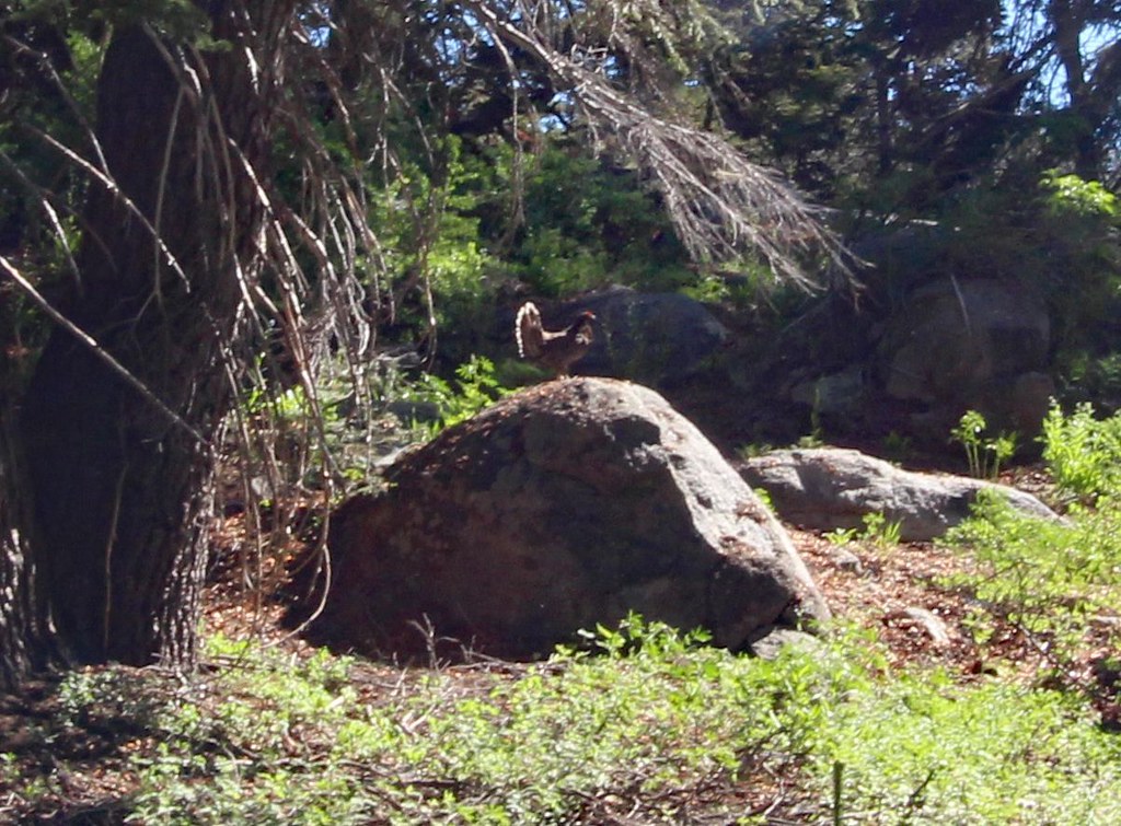
I admit that the hike from Alta Meadows to Moose Lake was much more difficult than I had expected. Obviously, this was due to my heavier than normal backpack to accommodate “winter” conditions: ice axe, microspikes, snow stakes, long snow gaiters, and extra mattress. I had also packed enough food for the originally planned longer route. The first half of today's hike involves going up through tree cover and shrubs on slope angles approaching ~30%. Without trails, I had to remind myself to conserve energy by zig-zagging instead of heading straight up towards my milestone destinations. I carefully walked around a mother grouse and her 2 young chicks with papa grouse perched on a rock watching guardedly and ready to defend. I also finally became a member of the found-a-mylar-balloon-in-the-High-Sierra, or at least pieces of one. I’m still undecided whether to be excited about this.
Papa Grouse
The second half to Moose Lake is above treeline and involves getting over a minor ridge. I tend to ascend higher than necessary, likely due to my reluctance to lose and have to regain elevation. At the top of the ridge, I feared my habit had gotten the best of me again as the other side of the ridge was just a steep cliff down. Surprisingly, I discovered a faint use trail going down. As expected, the trail didn’t last long but it got me down safely and I resumed the climb to Moose Lake. I arrived at the southern end of mainly frozen Moose Lake where getting water would be difficult. Because of the steep snow on the shoreline, I would have to go around the lake’s rocky perimeter to get to its outlet and flatter terrain. The question was, up and over or around back. I chose to go around the back, which was an arduous task as I had to backtrack a few times when the route became too precarious for comfort. The most difficult part of this trip was actually getting into and out of Moose Lake. Finally at the lake, I was able to relax.
On the ridge between Alta and Moose Lake

Southern side of Moose Lake

Moose Lake

Moose Lake

I was excited about getting up to Lake 11,200, flanked by a prominent avian on the Kings-Kaweah Divide. The lake wasn’t particularly far, but I was careful about crossing over snow-covered lakes or streams. Although rejected by traditional navigators using paper maps and compasses, I used my iPhone Gaia GPS app to make sure I was on solid land and make no excuses about it. My philosophy is any tool is fair game if it prevents me from becoming an ice cube. There were no cliff or tree obstructions so I assume the location was somewhat accurate. At a few locations, I heard water running below so had to navigate around or look for rocks to detour on. There was a single steepish section where I really didn’t need to, but took out my ice axe since I carried it all this way. I also had ice axe in hand as I walked across the final snowfield to Lake 11,200 just in case some strange force of nature pulled me towards the lake.
Moose Lake

Up and over to get out of Moose Lake

Mixed terrain to Lake 11,200

It never got steeper than this

Lake 11,200

Lake 11,200, Big Bird Peak peeking

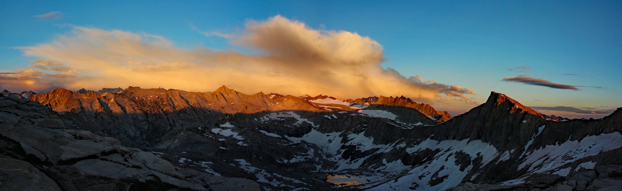
Big Bird Peak and the mountain ranges to the east are truly breathtaking sights from here. I'm so grateful for digital storage since I would have spent a fortune on film. There are many places to pitch a tent on this panoramic ridge but threat of thunderstorms forced me to reluctantly choose a lower unexposed site. Dark thick clouds hovered to the east and a bit to the north. I was only on the fringe of the storm, getting a light drizzle, but I could not predict its direction.
Big Bird Peak

Big Bird Peak, Kaweah Peaks, Glacier Ridge and more

Pot of gold on top of Lion Rock

One of many campsites on the ridge with excellent views, but not during a thunderstorm

Sunset
From Wolverton, I shared the trail with many day hikers until the Alta split and was alone until densely populated Alta Meadows. Protip: If your group has only 1-2 tents and you are looking for privacy at Alta Meadows, head north up the hill and look for a site that is both flat and free of vegetation. It took me a while but I found an ideal site that was also close to the year-round stream for water access. The sky faded red as I turned in for the night. I woke up early in the morning to see that it was still red, snapped a photo, and dozed off again, trying to recover from the previous night’s 3.5 hours sleep.
View of the Great Western Divide from Panther Gap
Privacy at Alta Meadows
Sunrise
I admit that the hike from Alta Meadows to Moose Lake was much more difficult than I had expected. Obviously, this was due to my heavier than normal backpack to accommodate “winter” conditions: ice axe, microspikes, snow stakes, long snow gaiters, and extra mattress. I had also packed enough food for the originally planned longer route. The first half of today's hike involves going up through tree cover and shrubs on slope angles approaching ~30%. Without trails, I had to remind myself to conserve energy by zig-zagging instead of heading straight up towards my milestone destinations. I carefully walked around a mother grouse and her 2 young chicks with papa grouse perched on a rock watching guardedly and ready to defend. I also finally became a member of the found-a-mylar-balloon-in-the-High-Sierra, or at least pieces of one. I’m still undecided whether to be excited about this.
Papa Grouse
The second half to Moose Lake is above treeline and involves getting over a minor ridge. I tend to ascend higher than necessary, likely due to my reluctance to lose and have to regain elevation. At the top of the ridge, I feared my habit had gotten the best of me again as the other side of the ridge was just a steep cliff down. Surprisingly, I discovered a faint use trail going down. As expected, the trail didn’t last long but it got me down safely and I resumed the climb to Moose Lake. I arrived at the southern end of mainly frozen Moose Lake where getting water would be difficult. Because of the steep snow on the shoreline, I would have to go around the lake’s rocky perimeter to get to its outlet and flatter terrain. The question was, up and over or around back. I chose to go around the back, which was an arduous task as I had to backtrack a few times when the route became too precarious for comfort. The most difficult part of this trip was actually getting into and out of Moose Lake. Finally at the lake, I was able to relax.
On the ridge between Alta and Moose Lake
Southern side of Moose Lake
Moose Lake
Moose Lake
I was excited about getting up to Lake 11,200, flanked by a prominent avian on the Kings-Kaweah Divide. The lake wasn’t particularly far, but I was careful about crossing over snow-covered lakes or streams. Although rejected by traditional navigators using paper maps and compasses, I used my iPhone Gaia GPS app to make sure I was on solid land and make no excuses about it. My philosophy is any tool is fair game if it prevents me from becoming an ice cube. There were no cliff or tree obstructions so I assume the location was somewhat accurate. At a few locations, I heard water running below so had to navigate around or look for rocks to detour on. There was a single steepish section where I really didn’t need to, but took out my ice axe since I carried it all this way. I also had ice axe in hand as I walked across the final snowfield to Lake 11,200 just in case some strange force of nature pulled me towards the lake.
Moose Lake
Up and over to get out of Moose Lake
Mixed terrain to Lake 11,200
It never got steeper than this
Lake 11,200
Lake 11,200, Big Bird Peak peeking
Big Bird Peak and the mountain ranges to the east are truly breathtaking sights from here. I'm so grateful for digital storage since I would have spent a fortune on film. There are many places to pitch a tent on this panoramic ridge but threat of thunderstorms forced me to reluctantly choose a lower unexposed site. Dark thick clouds hovered to the east and a bit to the north. I was only on the fringe of the storm, getting a light drizzle, but I could not predict its direction.
Big Bird Peak
Big Bird Peak, Kaweah Peaks, Glacier Ridge and more
Pot of gold on top of Lion Rock
One of many campsites on the ridge with excellent views, but not during a thunderstorm
Sunset