
Starting (and ending) TH: Maxson (Courtright Reservoir)
Lakes visited: Fleming, Rae, Lower Indian, Davis, Dale, Disappointment, Hell for Sure, Horseshoe, Blackrock, Big & Little Shot, and Devil’s Punchbowl.
Fishing: none (apologies to those who find this to be blasphemy)
Photos taken: way too many
I was inspired to do this trip by reading trip reports by sekihiker, kpeter, Wandering Daisy, and others. I modeled the general direction of my circuit (minus his peak-bagging) from Bill’s old TR (thank you !). Lacking the skills and stamina of those who’ve been doing this stuff for many years, I skipped some lakes (Diamond-X, Arctic, Upper Indian, Turf), but still had a nice adventure.
And now, on to my (possibly too-long) report.
Day 1:
After an overnight stay in Clovis, I had a nice, nearly traffic-free drive to the trailhead. Some pre-hike indecision (gear to leave in the car; food to leave in a bear box) got me on trail around 10:00.
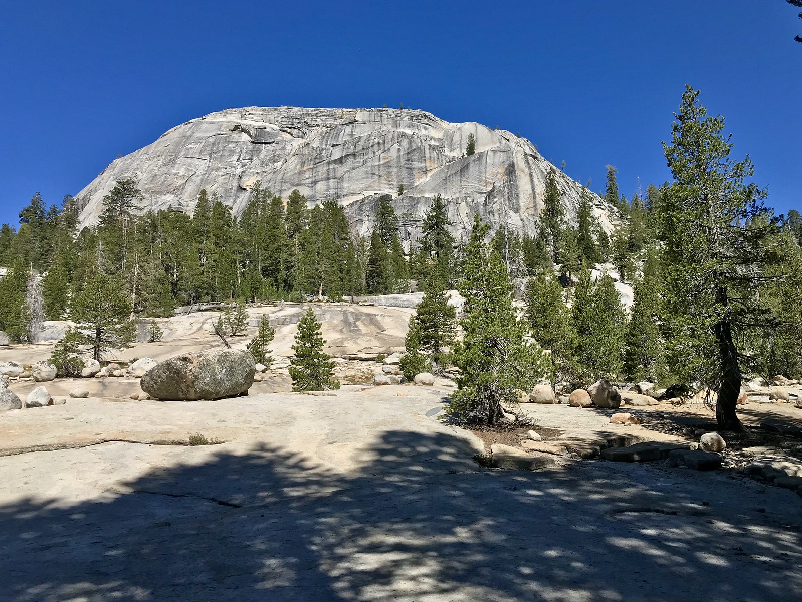 Maxson Dome
I figured this to be just a day to get “from point A to point B”, but I tried to focus on the positives: song birds (around Maxson Meadow), a relative lack of skeeters, a few nice tree specimens, and a pleasant stop at Post Corral Creek. Here, I met four hikers (about to turn south onto the Meadow Brook trail) and one horse packer, who mentioned counting about 70 people in the Basin over the weekend of the 4th. I filtered water, then continued another 2 miles (with some elevation gain) and made a dry camp.
Day 2:
The extra effort (to camp beyond PC Creek) paid off, as there was still a bit of a climb this morning. Finally leveling out somewhat and coming upon a wet forested area just before Fleming Lake, I ran into the worst mosquitoes for this part of the trip. Fleming Lake was pleasant enough, but didn’t merit a long visit. Rae Lake I found to be much more appealing. I found a shady place to rest (bug-free, thanks to the many dragonflies at Rae). I took some photos, but ended up with none that properly reflect the appeal of this lake.
Moving on to Lower Indian Lake, I walked up the west shore, and took some photos:
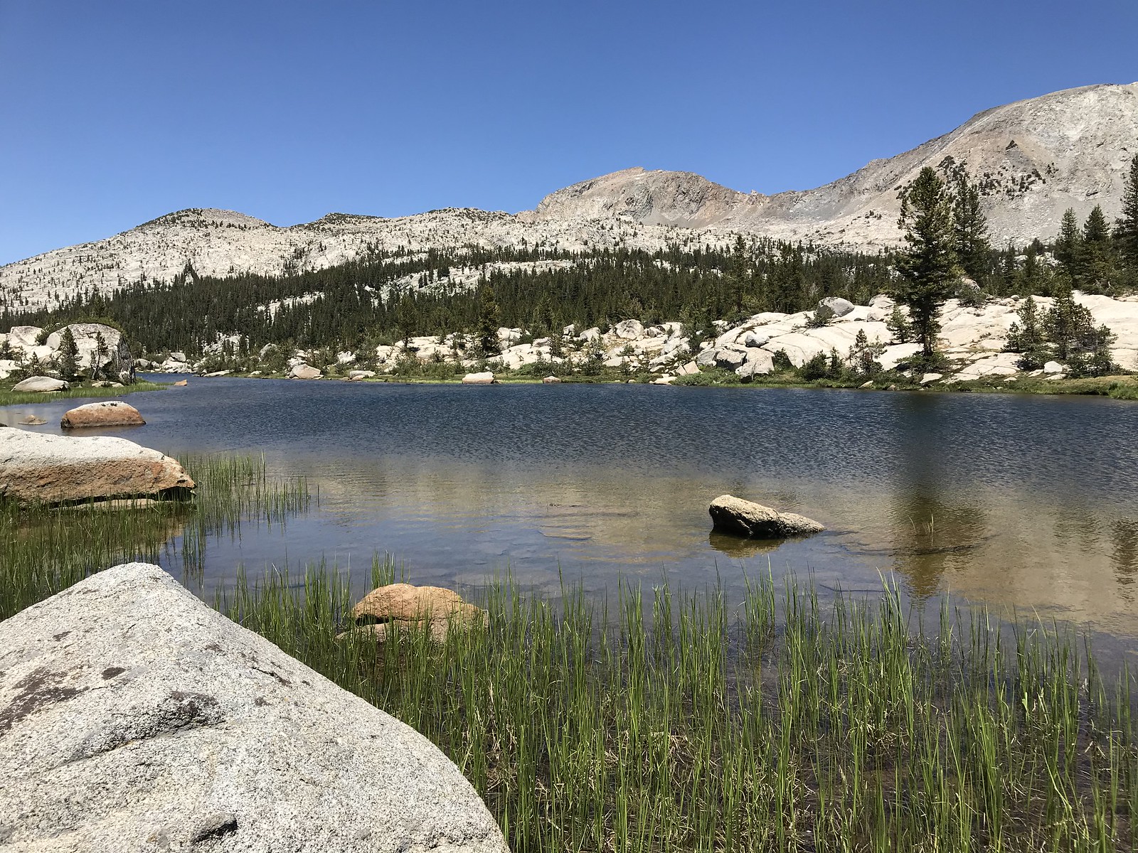 Lower Indian Lake
Still on trail so far, I got to the north end. Here, I crossed the inlet and headed toward Davis Lake, climbing about 450 feet. I’ll mention now that one reason for this particular trip was to gain more experience in cross-country/off-trail trail travel, so here my education began. Ascending the low ridge, I got myself into some difficult terrain (tedious to maneuver, but not dangerous) between two streams, but eventually got it sorted out. My chosen route seemed seldom used, as evidenced by my almost stumbling into a resting doe (surprising both of us); she went bounding away, followed in a moment by her faun. Continuing, I arrived at Davis, found a nice tent site, then rinsed off a bit in the lake before dinner and turning in.
Day 3:
I’d made an unwise decision the previous night; being clear and dry, I left the rain fly off my tent. Subsequently, the night turned quite cold. I woke around 3:00 with dampness on the outside of my sleeping bag (from dew, or maybe condensation from my own body vapor). My backpack - left exposed outside the tent - still had frost on it at 7:30. I got my gear dried out, packed up and started toward Dale Lake.
Reaching the south end of Davis, I saw my tentative route started out through lots of dense brush, so I mapped out a “plan B”. Some micro-navigation issues occupied my attention, but I got to Dale Lake in good shape.
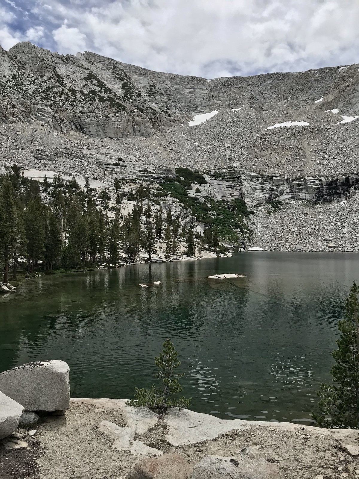
 looking back (south to north) at Dale Lake
After looking about a bit, and a short rest, I proceeded on toward Disappointment Lake. This segment took about an hour and a half. It was fairly easy travel, but my trip log has several entries of “found trail” and “lost trail”. The first part has no mapped trail, but I often found bits of a “use” trail; the “mapped trail” segment that followed seems to be unmaintained, as suggested by its frequent disappearance. Arriving at Disappointment Lake, I stashed my bear can, set up my tent, and tossed most of my gear (less some essentials) inside.
With lightened pack, I did my planned side trip to Hell for Sure Lake (2.5 miles round-trip, +/- 415’ elevation gain & loss); other than my being a bit winded from the altitude, it was a nice trip with great views. The trail passes several smaller ponds ponds further down, before climbing up to the lake. I took a nice break on the northwest shore, admiring this beautiful lake and Mt Hutton, which has a classic-looking cornice along one of its ridges. Looking up (to my North) at Red Mountain, I noted the general location of HfS Pass and decided to save it for a future trip.
 just arrived at Hell for Sure Lake
 Hell for Sure Lake (Mt Hutton in background)
Returning to camp, I washed off a bit and filtered water, then happened upon a young man who had just finished his walk (14 miles) from Maxson TH. He was the only person I’d encountered since reaching Post Corral Creek about 52 hours earlier.
 Disappointment Lake - 8:00 pm on Day 3
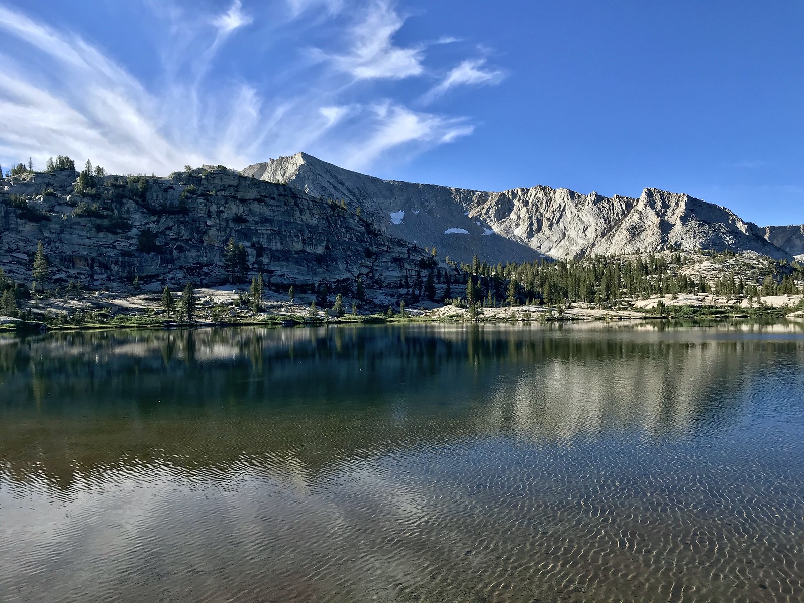 Disappointment Lake - 8:00 AM on Day 4
Day 4:
I got started toward Horseshoe Lake around 9:00. I modified my original plan to generally conform to kpeter’s suggested route (minus an ascent to the very top of pt 10552’, which I skirted around on its west slope). A bit further along, I found the outlet stream from Horseshoe (interspersed with some small ponds); keeping this in view proved to be a convenient “hand rail” in my route-finding. After one rest break (and lots of photo stops), I reached Horseshoe Lake.
 Horseshoe Lake
 Horseshoe Lake
The first photo shows the northeast shore; note the peninsula mentioned by Wandering Daisy in her report, including the “cliff barrier" (visible if you zoom in). After enjoying the views, I retraced my steps part way, then crossed over the Horseshoe outlet stream, now heading roughly southwest. Somewhere in this section the terrain transitioned to mostly large expanses of bedrock granite and exfoliated areas, where even the broken-off sheets of granite made an even, stable walking surface.
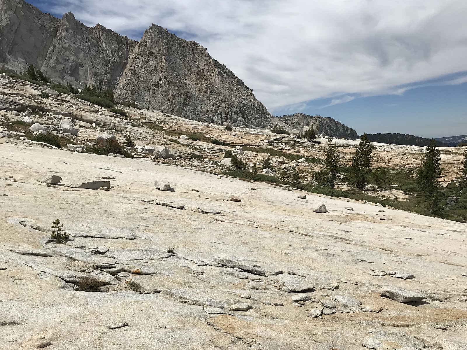 easy travel between Horseshoe and Blackrock Lakes
In short, it made for an easy stroll with some magnificent scenery. Around the point where I gained a view of Blackrock, I turned a bit and found I also had a view back to Disappointment Lake.
Minutes later, I arrived at the northeast side of Blackrock Lake. Looking up at the ridge to the southeast, I spotted an Osprey; I hoped it would drop down and fish the lake (perhaps letting me get some video ?), but instead it continued circling higher on thermals, apparently gaining altitude to head elsewhere. Along with my other photos, I captured these two images showing different moods of the lake:
 Blackrock Lake
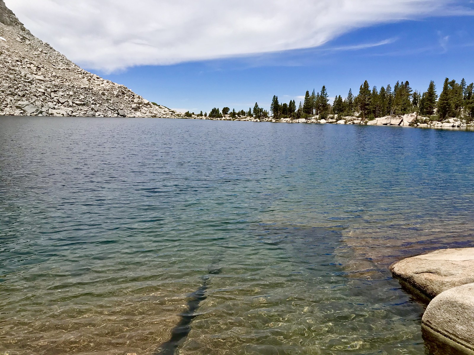 Blackrock Lake
After a relaxed lunch break, I rounded the north end of the lake and continued roughly west (and mostly downhill) toward Big Shot Lake. In about 45 minutes, I reached Big Shot Lake. Though it looked like a nice-enough lake, it was quite buggy (and weather had gone a bit gloomy), so I didn’t feel compelled to stay long, stopping mainly for photos.
 Big Shot Lake
Moving on to Little Shot, it looked in some respects much like Big Shot (exact same ridge as a backdrop to the south, but with a bit of an “infinity pool” effect (and lots of trees) towards its outlet.
 Little Shot Lake
About 20 minutes after reaching Little Shot, I was already at the southeast shore of Devil’s Punchbowl (yeah, these lakes are closely spaced). I stopped a bit to relax on some rocks and cool off in the water, then continued on northward. I scouted around (without success) on my way for a tent site, finally settling on a spot above the north tip of the lake; somewhat near the trail junction.
 Devil’s Punchbowl - view from east shore toward the southwest
 Devil’s Punchbowl - view along east shore
Going down to filter water, I found this nice sand beach:
 beach at Devil’s Punchbowl
and ran into only the second person I would encounter while in the basin. He mentioned seeing four hikers (“my” four hikers seen at PC Creek on day 1) and noted they were the only people he had seen on HIS trip. I did a quick walk around part of the west shore, returned to camp for dinner, then turned in.
 Devil’s Punchbowl - view from northwest shore
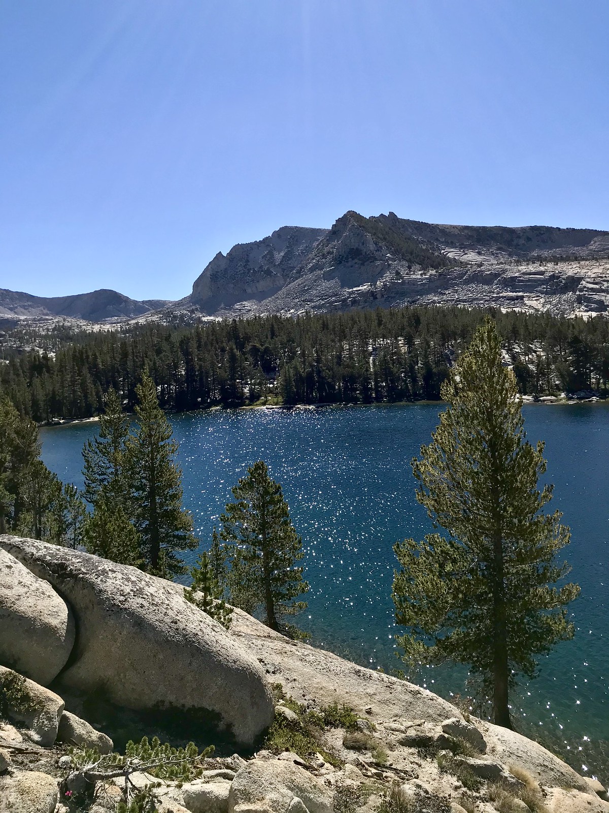 a final look at Devil’s Punchbowl from my exit trail on Day 5
Day 5:
“Heading for the exit” day.
I retraced my step from the previous evening’s exploration of the trail to the west, now crossing the outlet and climbing a bit, then descending again to (first) a forested section, then encountering the first of several meadows for which Meadow Brook is undoubtedly named. I liked these meadows; the time of morning was too late to spot deer, but I did encounter a large number of Clark’s Nutcrackers making their distinctive call. Moving on, I found some of these forested section on this trail somewhat oppressive (and quite buggy), but I did pass by a few impressive Red Firs, Jeffrey Pines and (a bit later) some large and old Junipers, as I made my way to the N. Fork Kings and beyond. On the segment along the Kings, a bit after Fleming Creek joined the river, I found a nice (and probably well-known) “water-slide” stretch - with these nice swimming holes:
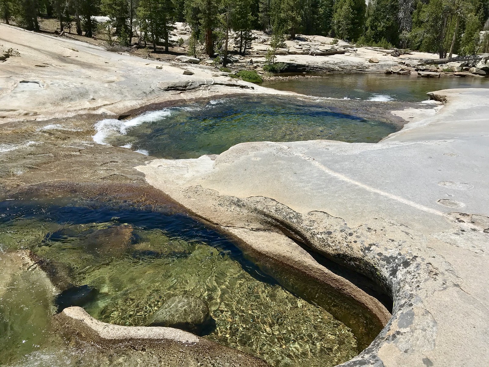 nice swimming holes along the N Fork Kings River
If I’d had any sense, I would have camped upon reaching the Post Corral Creek trail junction a bit after 3:00. Hoping to make just a few more miles, I pressed on. I hadn’t noticed (in my “positive thinking” mode of Day 1 ) what a dense and overgrown section of Lodgepole forest this was; difficult to find even marginal campsites. So, on to Hobler Lake! Arriving exhausted, after a 14 mile day, I found a nice-enough tent site, dense mosquitoes, and a (mentally) more-dense group of jerks who stumbled around shouting, while waving flashlights in all directions until 10:00 or so.
Day 6:
I did the last 4 miles to my trailhead in under 2 hours; did a quick cleanup in the parking lot, and was driving back across Courtright Dam by 10:00. Curiously, the best wildflower displays of my trip - long, dense swaths of giant lupine, leopard lilies, and various other varieties could be seen along the roadside, off and on until I got to Shaver Lake.
Now that I've done the trip, here are some things I might have done differently:
1. Before the trip, I should have asked more questions about the "simple" things, and not just what I thought could be the difficulties. I really should have asked about camping opportunities (or lack thereof) heading west from P.C. Creek, and used this input to form a better plan.
2. Though the "continuous loop" idea is attractive, I agree more now with the folks here who promote the "base camp" concept; I might have had an easier time accomplishing my goals if (once "in" the Basin) I had simply camped at Disappointment and Devil's Punchbowl, dispensing with the (more or less) continuous circuit.
3. I'm glad I saw the "northern" lakes; Lower Indian, Davis (which is actually quite nice, I just couldn't get a great photo), and Dale. But if I was taking people with me, I'd likely skip them; exactly what W.D. told me, by the way.
Things I felt good about:
I think I got some good practice navigating off-trail (and “re-planning my plan” on the fly, when necessary. I had also hoped to do this trip with some solitude - especially since this aspect of multi-day wilderness travel is sort of a mental barrier for me. I think that seeing only two people (in my three days or so) felt a bit liberating; it was good practice in being able to relax and just enjoy being at my destinations - rather than always quickly moving on to my next destination, just for the sake of movement.
Anyway, thanks to all who provided info (and inspiration), on my “questions on Red Mountain Basin” thread, as well as in their numerous (past) reports !


