TR: Sequoia July 19 - 24, 2020

If you've been searching for the best source of information and stimulating discussion related to Spring/Summer/Fall backpacking, hiking and camping in the Sierra Nevada...look no further!
Post Reply
User avatar
mort
Topix Regular
Posts: 160
Joined: Mon Sep 16, 2013 2:47 pm
Experience: Level 4 Explorer

TR: Sequoia July 19 - 24, 2020

Post by mort »

Over July 19 - 24, 2020, my brother and I went camping in the Tablelands. The photos are his. The trip was inspired by the report by TehipiteTom from 2013 - Thanks!
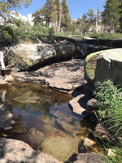
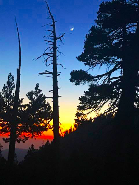
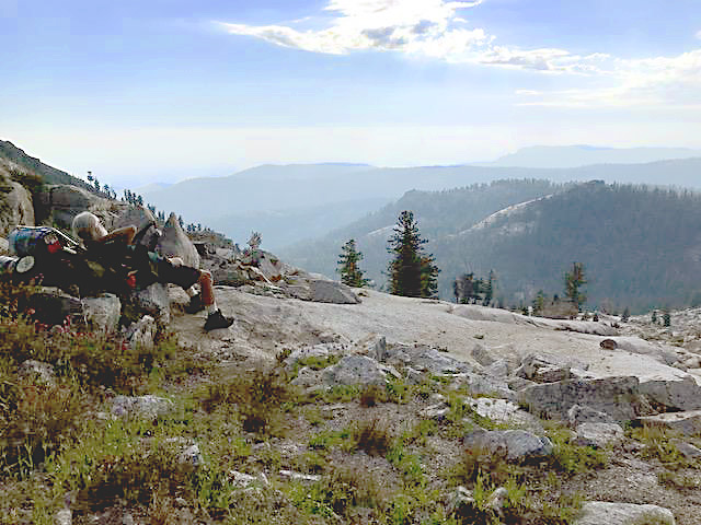
It was a warm and cloudless day as we started out from Lodgepole. At Silliman creek we met a couple finishing their lunch on the way to Little Lakes. We followed Silliman Creek up, the trail is OK for a couple miles, until we found a nice lunch spot.Image
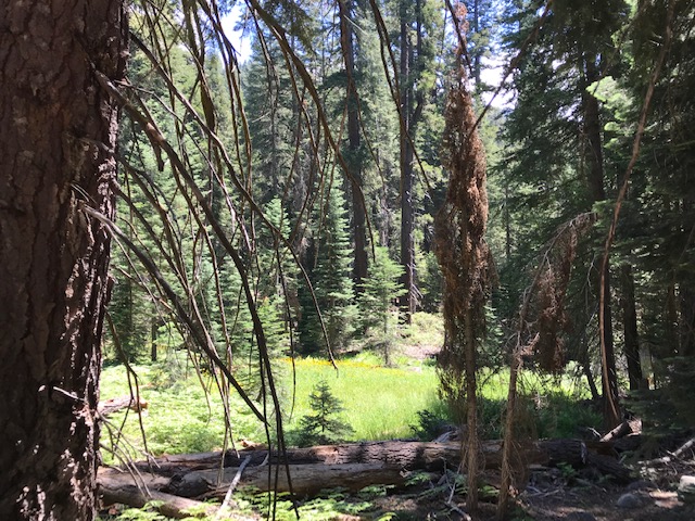
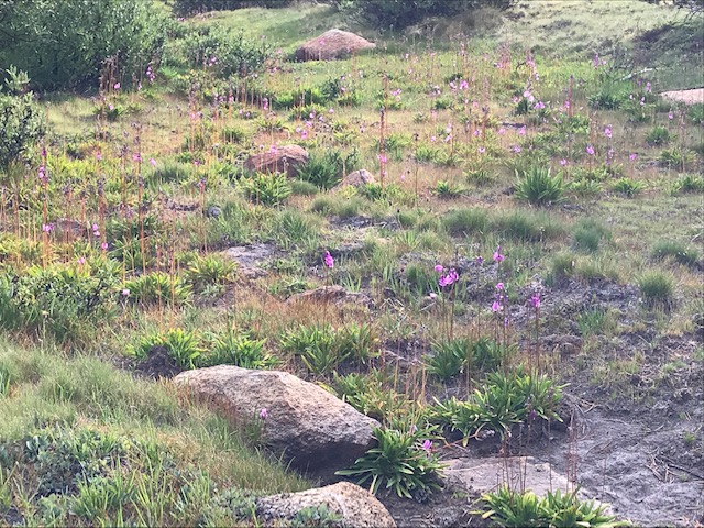
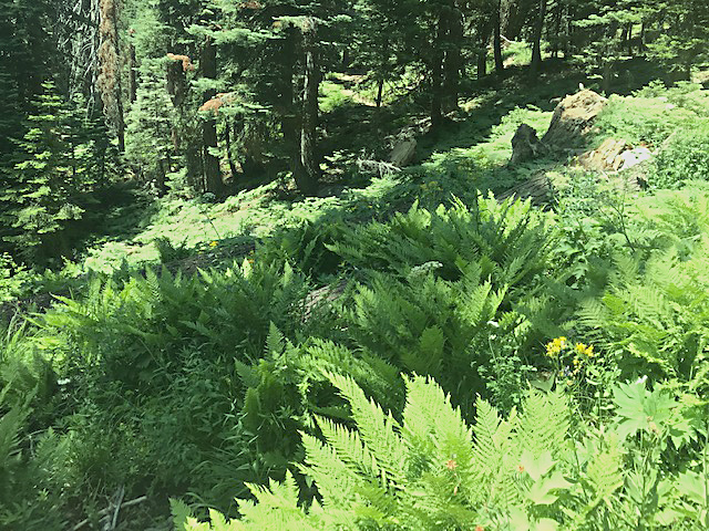
Silliman Meadow is just off the trail.
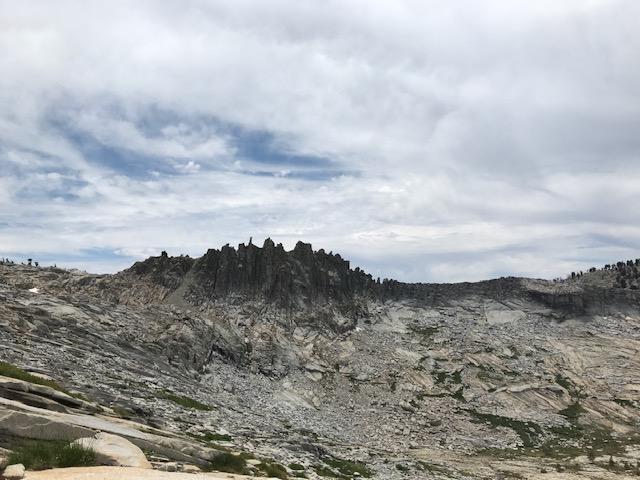
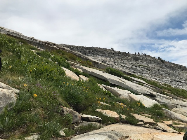
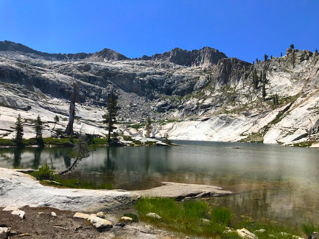
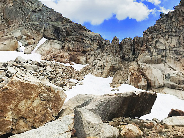
Soon we were on the "slabs" below Silliman Lake. The trail has pretty much disappeared, but you know where the lake is. The slabs are very steep and put quite a strain on our leg muscles. We had a few sprinkles on the slabs, but it didn't last long enough for me to get my pack cover on.
Image
The next morning Ranger Austin L. came to our camp. He had written out our permit on the phone a week earlier, and had wanted to see Mt.Silliman this week.
Image
We started up the rocky slope to the higher Silliman Lake, and then on to the low place on the ridge, just south of the last clump of trees.
Image
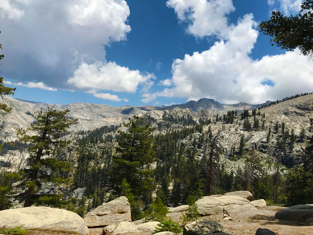
On the ridge you can look over to the east, the ridge is nearly knife edged in places with a few narrow chutes down to the broad talus slope and then steep slabs.
Image
Looking west on Google earth shows 4 distinct chutes coming from the talus up to the crest of the ridge. But from the top only 3 are apparent.
I looked down the most northerly, and it looked too steep for us. My brother looked at the next one and told me it smelled of pee. We checked out the 3rd chute and it seemed OK.
There is a steep scree ramp about 15 feet long from the flat on the ridge down to a large block in the center of the top of the chute. The whole chute is about 8 feet wide at the top and narrows down a bit before it gets to the talus. Below the scree and initial block there is a shaft, with many hand and foot holds, about 10 vertical feet. Below that is 30 or so feet of steep rough climbing down through small loose talus.
Image
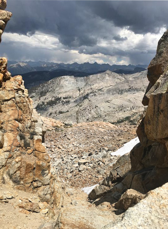
You can see it's already raining over Deadman canyon.
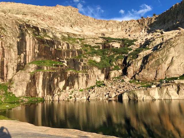
We dropped down, loosing a few rocks on the way, but made it down to the lower snow field. We had agreed to have lunch at the small green grassy swale at the foot of the talus. There was a pond and we rinsed off and let our knees stop vibrating. TehipiteTom suggested "Crescent Col" as a name for that pass, I'd just add a better name might be motherf***ing Crescent Col.
Image
We were aiming for Crescent Lake, just about due east, but terrain kept us moving further north. After just a few minutes on slabs it started to hail. Small hard bbs of hail that really stung. We got our pack covers and ponchos on and the storm really got going. Still on steep slabs we were amazed at how sticky our boots were on the wet granite. The storm and trying to descend safely and easily were distractions that shoved us further north. By the time the storm had let up and the sun was peeking through the clouds we were just above the ponds north of Crescent Lake.
Image
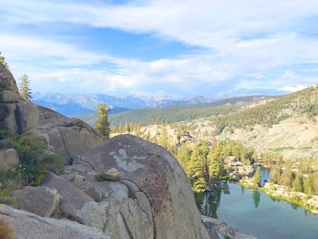
We camped at the outlet end of the lowest pond.
Last edited by mort on Thu Mar 04, 2021 1:53 pm, edited 3 times in total.
User avatar
mort
Topix Regular
Posts: 160
Joined: Mon Sep 16, 2013 2:47 pm
Experience: Level 4 Explorer

TR: Sequoia July 19 - 24, 2020

Post by mort »

We contoured around along the east face of the mound between the ponds and the Crescent Lake basin. Then dropped down to (South Fork) Sugarloaf Creek where the creek out of Crescent Lake joins it. Then we followed Sugarloaf creek canyon up, mostly south-east a few benches until the crest of the ridge.
Image
Here we could see the spectacular head wall of box canyon. And a fairly short drop, contour and climb about due south, and we were atop the Kings Kaweah Divide.
Image
We had lunch and planned our descent. The view was tremendous, Alta, Pear Lake, The Watchtower, Visalia. And to the east all the way to the crest of the Sierra Nevada. But a bit east of the Pear Lake, there was a large irregular lake. We weren't high enough to see Moose Lake. It seems that even though the Tableland was drying out the area called Table Meadow was one large lake.
Image
We contoured down, moving east until we could drop down to the Marble Fork. We camped just below 10,000 ft.
Image
We hadn't seen anybody since Ranger Austin on Monday, but we did see a tent about a half mile further down the creek. The next morning the tent campers hiked by our camp, we waved. That day we moved camp down the creek to a particularly lovely swimming hole and nearby flowing stream for drinking water. Here we took a rest day.
Image
The weather was perfect, the geology amazing, bird song, wild flowers, bushes and trees. That's why I go.
Image
We packed up and contoured around to the Pear Lake outlet. We met a couple starting up for Big Bird Lake. Then climbed slabs again, to the lake.
Image
We met the Pear Lake ranger, Wilson. Then followed the trail to Wolverton. Between us we'd taken the Watchtower route up or down about a dozen times. And since we had a date in Lindsay, we decided to try the Hump Trail, perhaps to save time. If you had never taken the Watchtower, you'd say the Hump has some wonderful vistas.
Image
The Lakes trail is a fine trail with lots of wildflowers and even a nice ferny meadow to help cool off on a hot day.
Image
Mosquitoes were seen, but not a problem.
-mort
Last edited by mort on Thu Mar 04, 2021 1:56 pm, edited 1 time in total.
xcountry rider
Topix Acquainted
Posts: 29
Joined: Sat Jul 23, 2016 4:58 pm
Experience: Level 3 Backpacker

Re: TR: Sequoia July 19 - 24, 2020

Post by xcountry rider »

Thank you for the report and pictures. I really enjoyed the read. My wife and I had a trip planned for Tablelands in July but had to cancel due to busy work schedules. Hoping to get there one of these years.
Post Reply

Who is online

Users browsing this forum: Google Adsense [Bot], yosemitejim and 165 guests