TR: Diamond Peak, 5/29-5/30/2015

Topics related to peak bagging, rock climbing and bouldering in the foothills and high country of the Sierra Nevada. Be sure to also check out the Information Booth forum category to learn from / see if you can contribute to a profile for High Sierra 13'ers, 14'ers and cross country passes.
Post Reply
User avatar
MN2CAPisco
Topix Acquainted
Posts: 39
Joined: Tue Mar 18, 2014 10:36 pm
Experience: Level 4 Explorer

TR: Diamond Peak, 5/29-5/30/2015

Post by MN2CAPisco »

I had a chance this weekend to alleviate my withdrawal symptoms and get back to the Sierra after inclement weather and other circumstances had stifled my intentions the previous several weekends. I had two goals for the weekend, the first being to leave from a trailhead that I had not yet experienced, and the second was to stand on a summit, both of which were nicely accomplished through our trip on the Baxter Pass trail up to Diamond Peak via the Class 2 southeast slopes.

The trail was rough as advertised, lots of elevation gain through brambly, slightly overrun trail in an area apparently still recovering from a fire. At first sight of Oak Creek I was nervous that there would be no water at all, however thankfully it was running pretty well higher up though the stream crossings were no problem at all.

Image
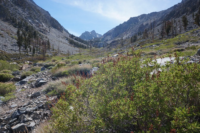
The open meadows and burnt old forest allowed for great views at our objective for the following day.

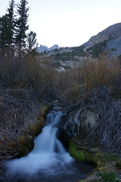
We made our way up to Summit Meadow to camp for the night, unaware that with a bit more climbing we would have found some great campsites near where we'd break from the trail to enter the Black Mountain/Diamond Peak bowl that we'd take up to the summit next day. In any case, the stream near our site was superb.
Image

We woke at sunrise the next day to set out on our quest for the summit. We were pleased to find great weather on the way up, and only encountered minimal snow along the creekbed coming down from the cirque, making for a straightforward climb along slabs and ledges.

Image
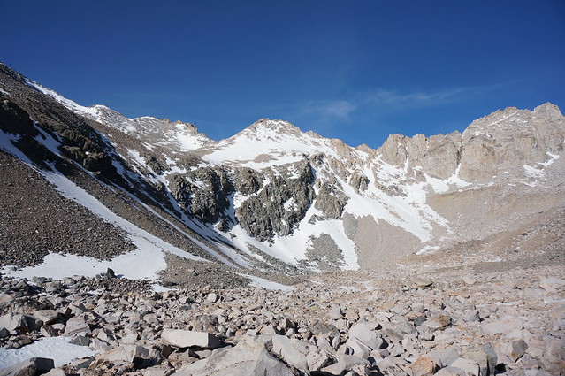
The view up the cirque to a sub-peak on the Black Mountain/Diamond Peak ridge

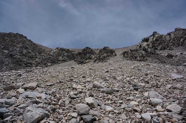
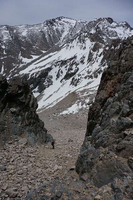
The arduous slog started after the bowl climbing up through a chute to the base of Diamond Peak, alternating from rock-hopping on talus to slip-sliding up scree. We followed beta to choose one of the three chutes, and we ended up taking the right-side one trying to hug the rock wall when possible to keep from sliding down the slope with anything unstable. The way down we erroneously chose the leftmost from this picture, which was also a pain but nothing more than Class 2.
Image
Image
Rae lakes were all thawed and no visible snow was seen in the valley, though there is certainly some snow left over on north-facing slopes, including Glen Pass.

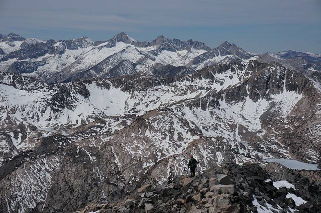
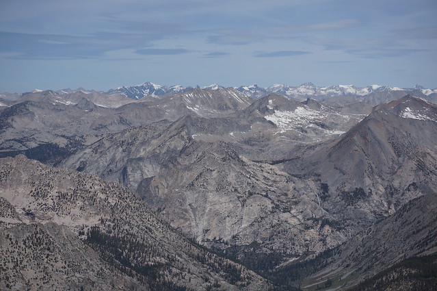
The summit was fantastic, so much so that we spent a good 45 minutes enjoying the fine views and trying to name off peaks for future, more-ambitious trips.
Image
Image

The descent was as painful as we imagined, but we managed to trudge through the talus and scree down to our camp and back to the car, a full 7000' feet below. My knees weren't happy with me by the end, but my head was once again clear and my hands steady with my mountain withdrawal subsided, at least for now.
User avatar
ExploreABitMore
Topix Regular
Posts: 168
Joined: Thu Jan 11, 2007 2:38 pm
Experience: Level 4 Explorer
Location: Ridgecrest, CA
Contact:

Re: TR: Diamond Peak, 5/29-5/30/2015

Post by ExploreABitMore »

Looks like a nice trip, thanks for sharing. Thinking of heading up that way myself soon ( If my back stops acting up :/ ), so these photos were helpful. Diamond sure looks like a slog, but sounds like the views should be well worth it.
Sierra Nevada, Mojave Desert, Night Sky Photography: http://www.evanthomasphoto.com/
User avatar
rams
Topix Acquainted
Posts: 75
Joined: Fri Jul 14, 2006 10:11 am
Experience: N/A

Re: TR: Diamond Peak, 5/29-5/30/2015

Post by rams »

Nice pics. The view of the hiker looking out towards Mt. Brewer looks like a motivational poster.
User avatar
MN2CAPisco
Topix Acquainted
Posts: 39
Joined: Tue Mar 18, 2014 10:36 pm
Experience: Level 4 Explorer

Re: TR: Diamond Peak, 5/29-5/30/2015

Post by MN2CAPisco »

Finally got around to working on pictures this weekend and thought I'd put up some 360's here for anyone interested...might give a bit of an idea what the conditions are, though as it was two weekends ago it's likely that a lot of snow has cleared up since then considering how low it was to start with.

https://www.360cities.net/image/diamond ... california
https://www.360cities.net/image/rae-lak ... california
https://www.360cities.net/image/black-m ... california
https://www.360cities.net/image/sundown ... california
User avatar
maverick
Forums Moderator
Forums Moderator
Posts: 11834
Joined: Thu Apr 06, 2006 5:54 pm
Experience: Level 4 Explorer

Re: TR: Diamond Peak, 5/29-5/30/2015

Post by maverick »

Thanks for including the 360's. :thumbsup:
Professional Sierra Landscape Photographer

I don't give out specific route information, my belief is that it takes away from the whole adventure spirit of a trip, if you need every inch planned out, you'll have to get that from someone else.

Have a safer backcountry experience by using the HST ReConn Form 2.0, named after Larry Conn, a HST member: http://reconn.org
Post Reply

Who is online

Users browsing this forum: No registered users and 17 guests