GENERAL OVERVIEW: Scimitar Pass crosses the Palisades, and provides direct access between Elinor Lake (east side) and Lake 11,672’ (west side). From the west side of Scimitar Pass, it is easy to connect with Cirque Pass and Potluck Pass.
CLASS/DIFFICULTY: Class 2-3
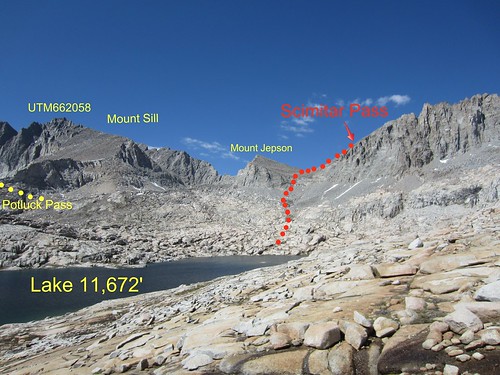
LOCATION: Scimitar Pass is located on the northern shoulder of the Palisade Crest, south of Mount Jepson. HST Map
ELEVATION: 13,250 feet
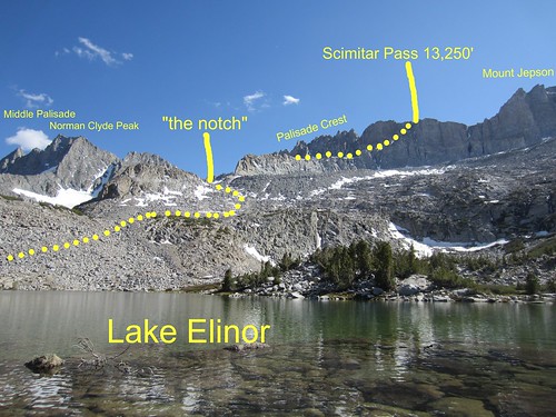
ROUTE DESCRIPTION (east to west): From Big Pine Creek trailhead, follow the Big Pine Creek South Fork trail to Willow Lake. From Willow Lake, follow a use trail -- or go cross-country -- to Elinor Lake. Be careful with navigation here. Upstream from Willow Lake, it may be unclear which canyon leads to Elinor. If you turn too soon, you will find yourself ascending the canyon south of Elinor. If you turn too late, you will ascend Mount Gayley. Check your map before leaving Willow Lake.
At Elinor Lake you will find several good campsites along the northern shore. Camping here is sensible if you plan to climb Scimitar Pass in the morning.
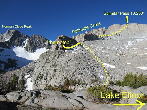
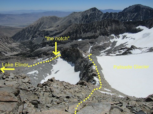
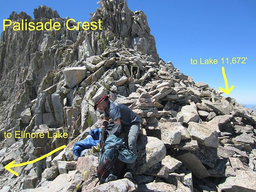
From Elinor Lake, visually locate the ridge descending east from the Palisade Crest. Along this ridge, visually locate “the notch” (indicated in photos), which is uphill and southwest of Elinor Lake. Climb easy class 2 scree and some boulders to arrive at the notch.
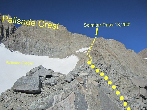
From the notch, descend about 30 vertical feet on the south side, and then contour southwest and uphill to avoid the steepest part of the ridge. Climb steep class 2 scree for about 500 vertical feet and then regain the ridgeline. Follow the ridgeline -- less steeply now -- to Scimitar Pass. The final 1000 vertical feet to the summit is one giant staircase of class 2 rock. It’s not technically difficult, but it is exhausting.
Note in the photos that Scimitar Pass is not the lowest point on the ridge. More accurately, Scimitar Pass is the northern shoulder of the Palisade Crest.
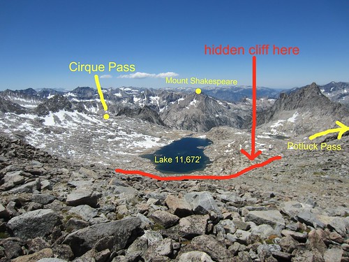
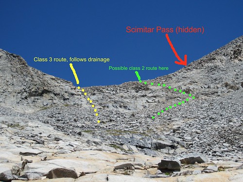
From Scimitar Pass, descend on solid class 2+ boulders to the basin below Mount Jepson. This part isn’t difficult, per se, but you will need to use your hands. Once you arrive in the basin, continue downhill along the drainage to arrive at a system of cliffs above Lake 11672’. In this author's opinion, descending these cliffs is the most difficult part of crossing Scimitar Pass. The intuitive route is to follow the drainage into a rocky slot, and then down-climb on class 3 rock along a seasonal waterfall. An easier class 2 route may exist, however, by skirting to the south end of the cliffs and descending via steep scree. From the bottom of the cliff, walk along grassy slopes to arrive at the northeast shore of Lake 11672.