Foerster Ridge
Posted: Mon Jan 14, 2019 9:41 pm
GENERAL OVERVIEW: Leads between the Lyell Fork of the Merced River and Foerster Creek by way of the hanging valley between Mt Ansel Adams and Foerster Peak
CLASS/DIFFICULTY: Class 2
LOCATION: Yosemite National Park HST Map
ELEVATION: 11250 feet
USGS TOPO MAP (7.5'): Mt Lyell, CA
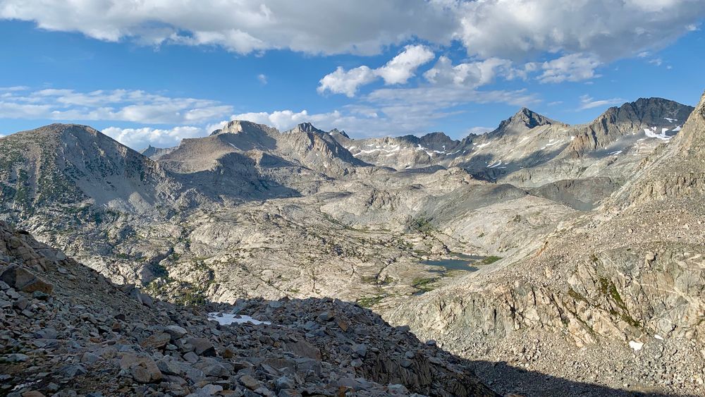
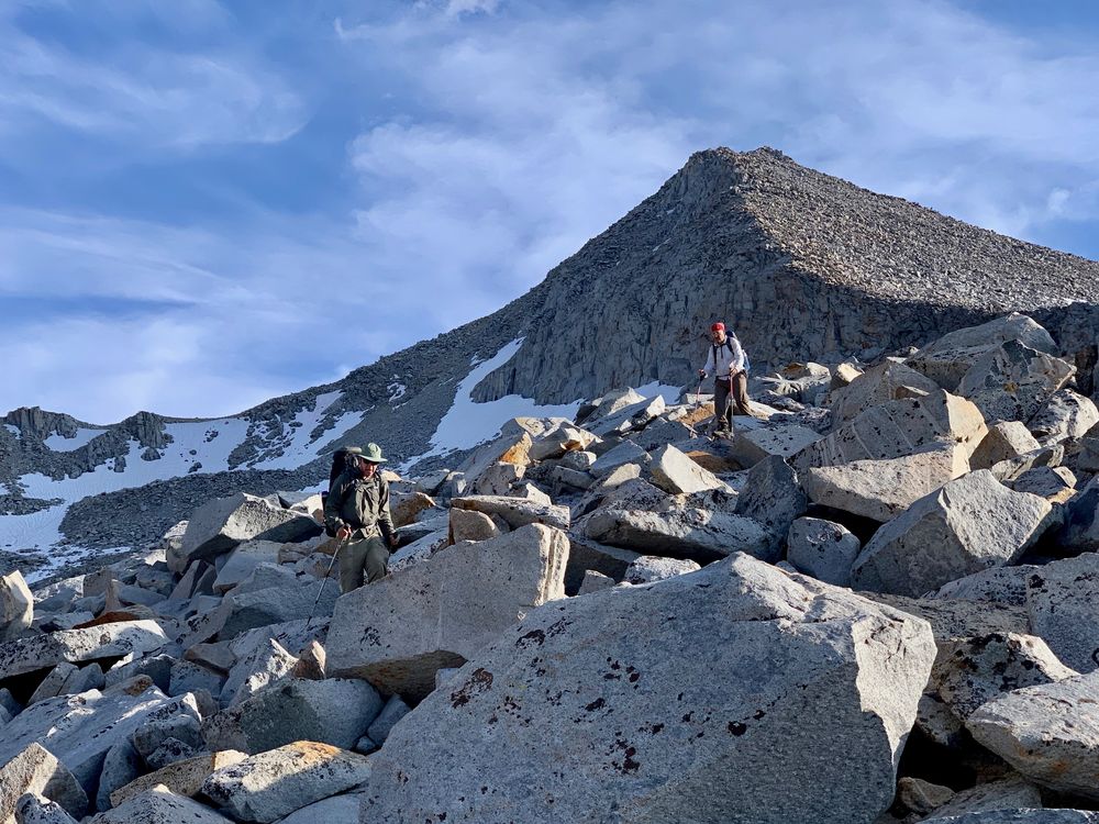
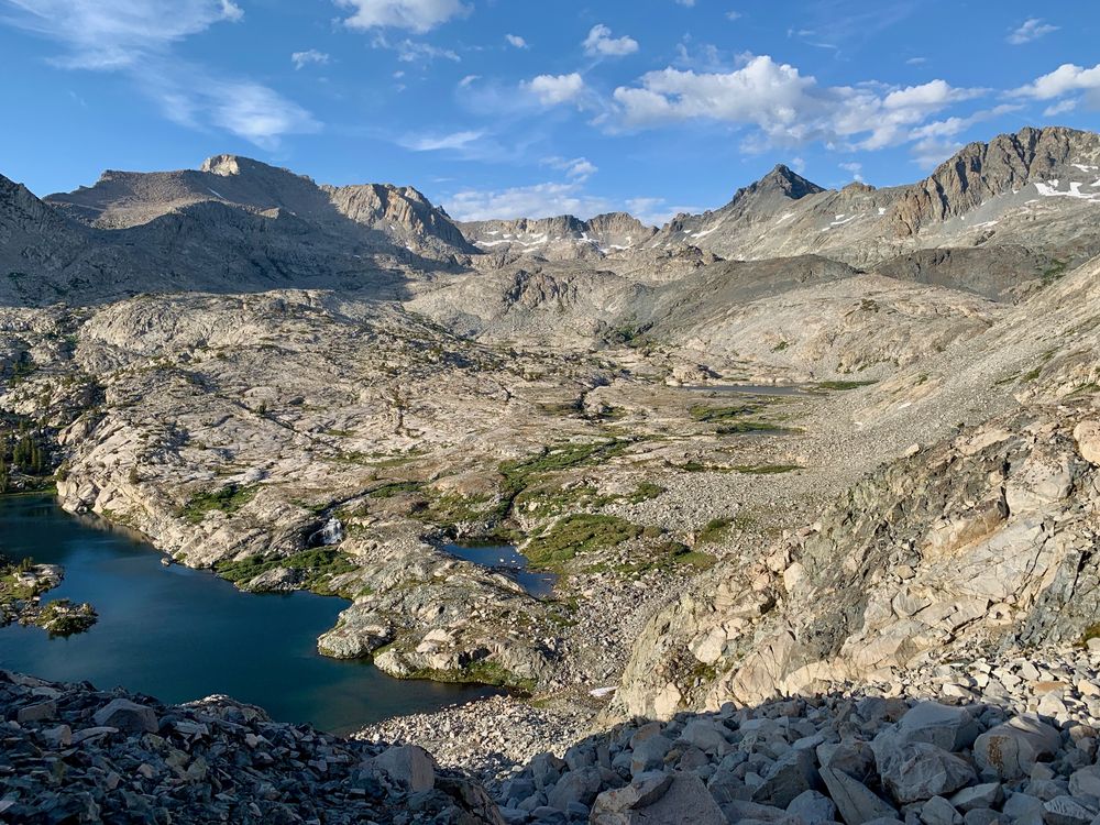
ROUTE DESCRIPTION: I crossed from east to west in mid-July 2018 -- winter 2017-18 had lower than average snowfall. There are two stages to this route: 1) climbing to the hanging valley beneath Mt Ansel Adams; and 2) climbing the north ridge of Foerster Peak. Coming from the east, getting to the valley is straightforward cross country hiking if a bit steep in places. From one of the pool lakes on the Lyell Fork I hiked up a talus slope to a steep meadow shown in the first photo below. From there I followed along the base of the large slabs on more talus and gravel until reaching the outlet gulley. From that point up to the small lake in the valley itself the route required navigating the large boulders among which the stream flowed. It was disconcerting to me not to be able to see the route to the ridge until I was almost in the valley -- until that point it sure looked like cliffs were the order of the day. From the valley, however, the crossing is easily identified and it involves only Class 2 scrambling -- free hands very helpful in spots. In the third photo below, I scrambled up the boulder field on the left side, directly in line with Foerster Peak. Then I traversed across slabs below the ridge and picked my spot to go over. The other side is quite easy and really doesn't warrant commentary. Hope this helps.
Dennis
CLASS/DIFFICULTY: Class 2
LOCATION: Yosemite National Park HST Map
ELEVATION: 11250 feet
USGS TOPO MAP (7.5'): Mt Lyell, CA
ROUTE DESCRIPTION: I crossed from east to west in mid-July 2018 -- winter 2017-18 had lower than average snowfall. There are two stages to this route: 1) climbing to the hanging valley beneath Mt Ansel Adams; and 2) climbing the north ridge of Foerster Peak. Coming from the east, getting to the valley is straightforward cross country hiking if a bit steep in places. From one of the pool lakes on the Lyell Fork I hiked up a talus slope to a steep meadow shown in the first photo below. From there I followed along the base of the large slabs on more talus and gravel until reaching the outlet gulley. From that point up to the small lake in the valley itself the route required navigating the large boulders among which the stream flowed. It was disconcerting to me not to be able to see the route to the ridge until I was almost in the valley -- until that point it sure looked like cliffs were the order of the day. From the valley, however, the crossing is easily identified and it involves only Class 2 scrambling -- free hands very helpful in spots. In the third photo below, I scrambled up the boulder field on the left side, directly in line with Foerster Peak. Then I traversed across slabs below the ridge and picked my spot to go over. The other side is quite easy and really doesn't warrant commentary. Hope this helps.
Dennis