Overview: This pass provides a route between the upper reaches of the valley of the North Fork of the San Joaquin River and the eastern side of the Ritter Range (including, Rodgers and Davis Lakes and 1,000 Island Lake).
Class/Difficulty: 2
Location: Clinch Pass sits on the ridgeline of the Ritter range South and a bit West of Rodgers Lakes. See the HST Map for the location:
Elevation: ~11,500 ft.
USGS Topo Map: Mt. Ritter 7.5 minute
HST Map: HST Map
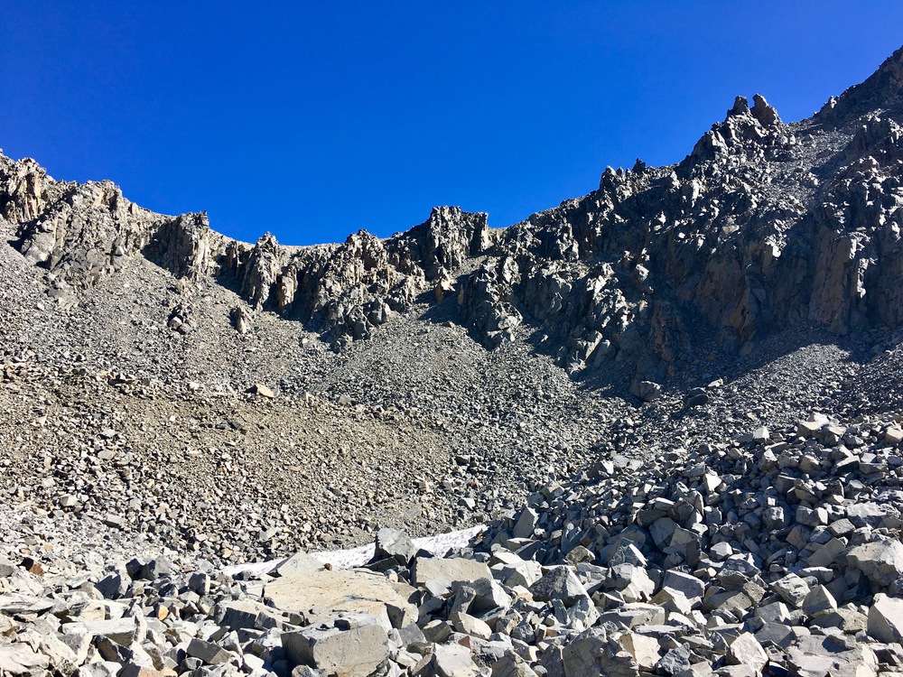
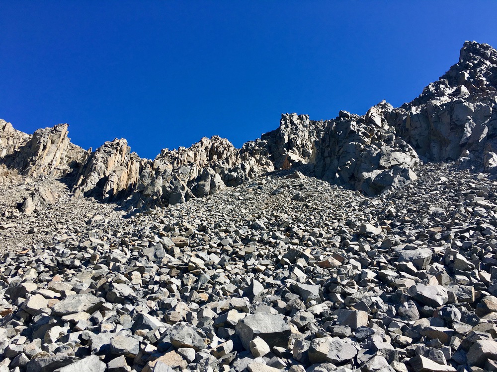
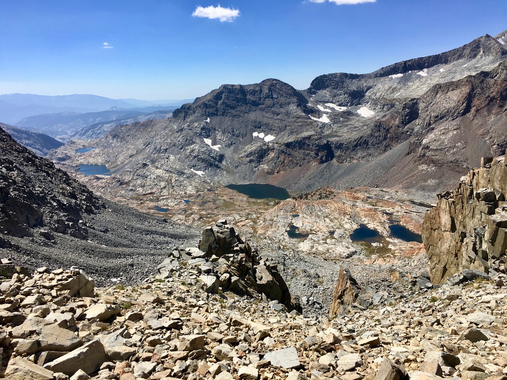
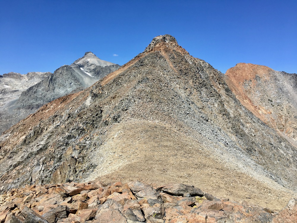
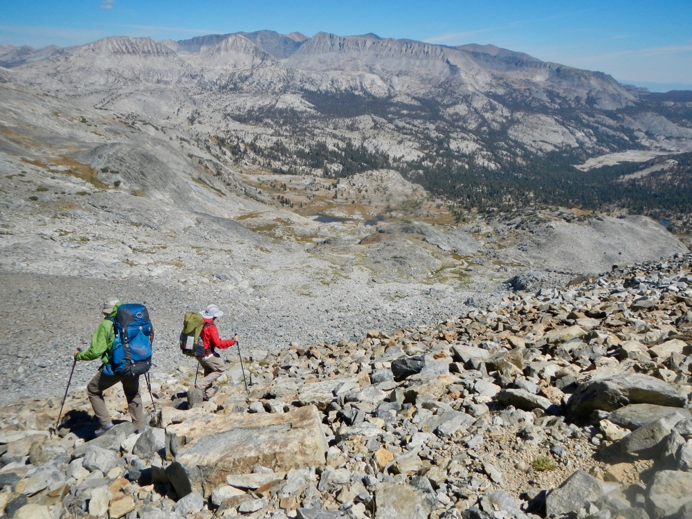
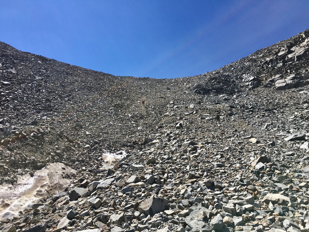
Route Description: I have only traversed this ridge from the Rodgers/Davis Lakes side, and it is a fairly straightforward climb to the ridgeline with patches of talus, scree and gravel, but nothing out of the ordinary. However, the descent into the North Fork basin is similar in many respects to Rogue’s description of the descent of nearby Rodgers Pass. Much of the footing is very loose, and one must be particularly cautious about not triggering large rockslides. My second traverse of this ridge came with exceedingly high winds at the ridgeline and consequently, I failed to descend the less-steep chute to the southeast (see photos). However, one can make one’s way down at least three of the available chutes, but as the photos will show, the slightly higher southeastern option is preferable, because it is somewhat less steep. The reward for patience in descending this route is the almost completely undisturbed upper reaches of the North Fork drainage. One sees minimal signs of human presence and the lakes, meadows and peaks are magical in every direction. Happy trails! Cameron
Clinch Pass
-
cgundersen

- Topix Fanatic
- Posts: 1338
- Joined: Sun Jul 16, 2006 1:07 pm
- Experience: N/A
Clinch Pass
You do not have the required permissions to view the files attached to this post.
Last edited by cgundersen on Tue Jul 18, 2023 3:20 pm, edited 4 times in total.
-
Harlen

- Topix Addict
- Posts: 2097
- Joined: Sat Mar 11, 2017 9:13 am
- Experience: Level 4 Explorer
- Location: Santa Cruz Mountains
Re: Clinch Pass
Very nice Cameron. I greatly admire brevity in a Trip Report, (something I have yet to achieve) but I wanted to know a bit more about the crazy route you guys followed once down the tricky Clinch Pass. But I see now that this is a Cross Country Passes report. Please do drone on like me, in a subsequent TR, and tell what all you guys saw and did. Did you make a great circular trip of it? Cheers, Ian and Lizzie.
Properly trained, a man can be dog’s best friend.
-
jimmyjamhikes

- Topix Regular
- Posts: 116
- Joined: Wed Jun 01, 2016 9:00 am
- Experience: Level 4 Explorer
- Location: San Diego, CA
- Contact:
Re: Clinch Pass
I have a full trip report on this pass, approaching from the more difficult western side in September 2018:
https://jimmyjamhikingclub.com/2018/09/07/clinch-pass/
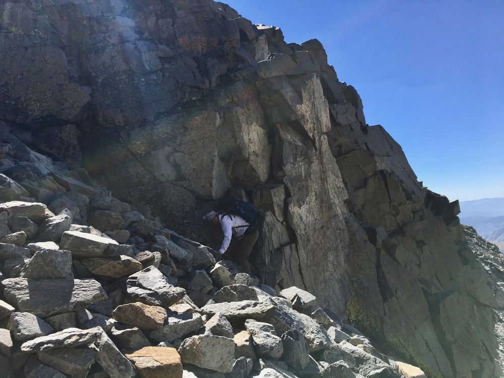
I completely agree with Cameron, that the best route is the one just to the south of the large central abutment. I made the mistake of heading up the middle of the talus field, but it was so unstable that I set off a rockslide with each step, taking half my pinky tip in one of them! Once I worked my way over to the right wall, it was easier to ascend, though the wall is pretty crumbly, too.
Clinch Pass from the west. Aim for just right of center.
Extremely unstable here. Head for the low wall on the center right and stick to that all the way to the top.
That's more like it!
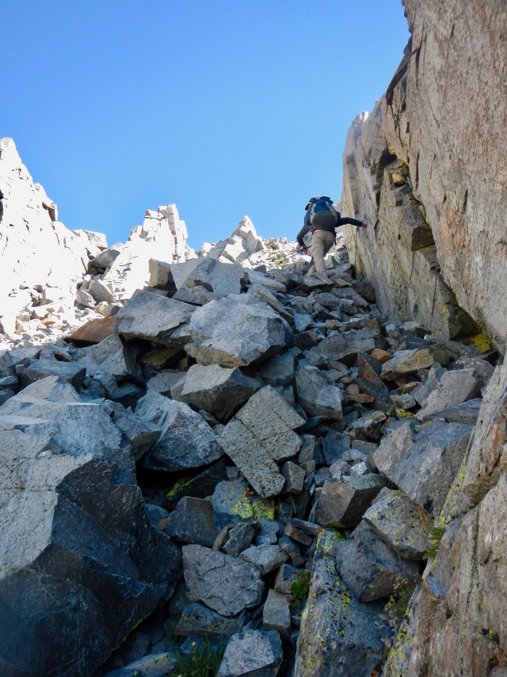
Following the wall
If you are heading west, don't start from the low point of the pass -- you want to climb to the south about 50 feet before descending.
Don't descend here.
View of pass from where we exited the chute
The easier east side
View of east side from below
https://jimmyjamhikingclub.com/2018/09/07/clinch-pass/
I completely agree with Cameron, that the best route is the one just to the south of the large central abutment. I made the mistake of heading up the middle of the talus field, but it was so unstable that I set off a rockslide with each step, taking half my pinky tip in one of them! Once I worked my way over to the right wall, it was easier to ascend, though the wall is pretty crumbly, too.
Clinch Pass from the west. Aim for just right of center.
Extremely unstable here. Head for the low wall on the center right and stick to that all the way to the top.
That's more like it!
Following the wall
If you are heading west, don't start from the low point of the pass -- you want to climb to the south about 50 feet before descending.
Don't descend here.
View of pass from where we exited the chute
The easier east side
View of east side from below
-
erutan

- Topix Expert
- Posts: 492
- Joined: Tue Aug 25, 2015 4:46 pm
- Experience: Level 4 Explorer
Re: Clinch Pass
https://www.summitpost.org/electra-peak/153227 has an interesting wrinkle:
"An alternative to Clinch Pass is provided by Pass 3540+, the next pass to the north. This is class 2-3, but avoids some of the tedious talus found on Clinch Pass. Either pass leads to the valley floor, from where it is an easy hike south to Lake 3060+, due east of the peak."
There’s a TR that briefly mentions this, and confirms the class 3 (there's some more conversation in the comments), but I’m pretty sure that’s better than large talus that collapses onto you: https://pantilat.wordpress.com/2014/10/ ... ced-river/
https://www.snwburd.com/bob/trip_reports/electra_1.html also mentions ‘north clinch pass’, with little written information on the pass itself and more attention given to how he's faster than everyone else, but there's some nicely annotated photos:
https://www.snwburd.com/bob/trip_photos ... 07230.html from the east
https://www.snwburd.com/bob/trip_photos ... 07234.html from the west
https://www.snwburd.com/bob/trip_photos ... 07241.html SW drop lines
https://www.snwburd.com/bob/trip_photos ... 07242.html & https://www.snwburd.com/bob/trip_photos ... 07244.html views to SW side of N. Clinch Pass
admin @ Sierra Nevada Current Conditions group.
Who is online
Users browsing this forum: Google [Bot] and 5 guests