TR: Murphy Creek trail to Glen Aulin (and waterfalls) - July 29-31, 2020

If you've been searching for the best source of information and stimulating discussion related to Spring/Summer/Fall backpacking, hiking and camping in the Sierra Nevada...look no further!
User avatar
grampy
Topix Regular
Posts: 398
Joined: Tue May 15, 2018 10:45 am
Experience: Level 3 Backpacker
Location: Redondo Beach

TR: Murphy Creek trail to Glen Aulin (and waterfalls) - July 29-31, 2020

Post by grampy »

As I tend towards overly long reports, I tried to keep this one short (fittingly, as it was a very short trip). Hopefully, some of the photos will amuse you.

Day “Zero” :
I did the drive from SoCal to the Tioga Pass entrance, and proceeded on to park my car and head to the Tuolumne Meadows backpacker’s camp. After parking, I noticed that all the other cars had little stickers taped inside their windshields - with vehicle number, entry date, etc. Mine did not. Apparently, while waiting in line at the park entrance, I had shown my wilderness permit & I.D. to two different rangers, but failed to stop at the third ranger who would have handed me my parking sticker. So I ended up driving back to the Tioga entrance to get my sticker ... sigh. Drove (again) to the T.M. Store parking lot, walked to the backpacker’s campground, and claimed my site.

Day 1:
It had been a shamefully long time since I had visited Yosemite (and never as a backpacker), so I had been looking forward to hiking just about ANY trail here. I had chosen Murphy Creek because (primarily) it was one of the easiest to reserve, and had seemed to fit the needs of my intended hiking partner - now out with an injury. Some trip reports I’d read mentioned the dullness and lack of views on this trail; I now have to say that I agree with them.

Early on (maybe 1/2 hour into my hike), I took THIS photo:

Imagesome curiously-arranged boulders

Seeing this made me wonder - have the “rock-stackers” now graduated to lining up these larger stones ?

I made a quick detour to visit Polly Dome Lakes, which seemed a pleasant place to stop and camp for someone doing a late-day start. Continuing on, I observed that wildlife seemed to be in short supply (maybe due to Murphy Creek being dry ?). I did take a brief rest stop to watch a mama Mallard and her offspring feeding in a trail-side pond, but that was about it. A few distant views of peaks (to the North) revealed themselves somewhat late in my day’s hike.

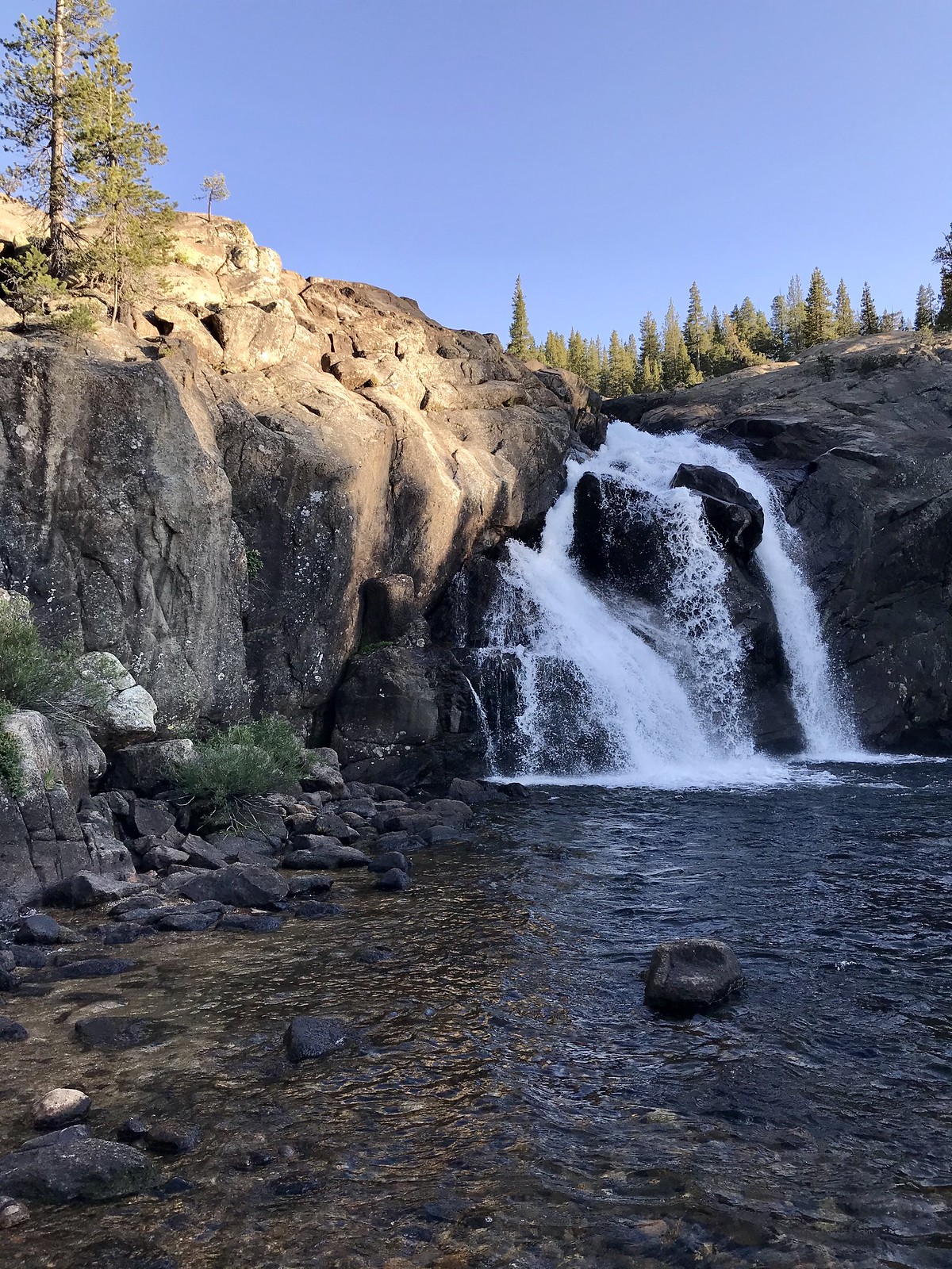
I was relieved to arrive at the two bridges (across the Tuolumne, and then across Conness Creek), where I very much enjoyed the views (and sounds) of White Cascade:

ImageWhite Cascade - at Glen Aulin HSC

I proceeded on through the High Sierra Camp (not open this year) and went on a bit, choosing one of the numbered tent sites in the #16 - 30 group ... not sure which one, as most of the “marker posts” are missing their number plates . I set up my tent, then walked back down to filter water and generally take in the sights, especially the cascade and the river - above and below the bridge.

ImageWhite Cascade - sunset

ImageTuolumne River - sunset


Day 2:
My plan for today was to hike down (and back up) the river to visit three falls: California, LeConte, and Waterwheel. I got this photo just below the Tuolumne bridge:

Imagemorning on the Tuolumne River

... and noted the mileage on this rustic-looking sign:

Imageon my way to visit some falls !

I found walking through Glen Aulin (proper) to be quite pleasant - I found Wildcat Point to be an interesting feature:

ImageFerns and forest of Glen Aulin

... and soon reached California Falls -

Image(a little bit of) California Falls

Some of the stretches of river between the falls are quite beautiful-

Imagethe river takes a breather ...

I reached LeConte Falls; I found it difficult to effectively photograph (though I did get some video). Incidentally, all three “falls” seem more like dramatic “cascades”, but the distinction seems trivial. They are worth seeing, even in a low-water year.

ImageLeConte Falls

I finally reached Waterwheel Falls; due to low(er) water flow, the “wheels” weren’t shooting up as high as photos I’ve seen, but it still felt pretty dramatic standing close to them:

ImageWaterwheel Falls

Imageyeah, okay, so it’s a dry year

After a nice visit (which included the taking of too many photos and videos), I turned around and headed back uphill.

Image
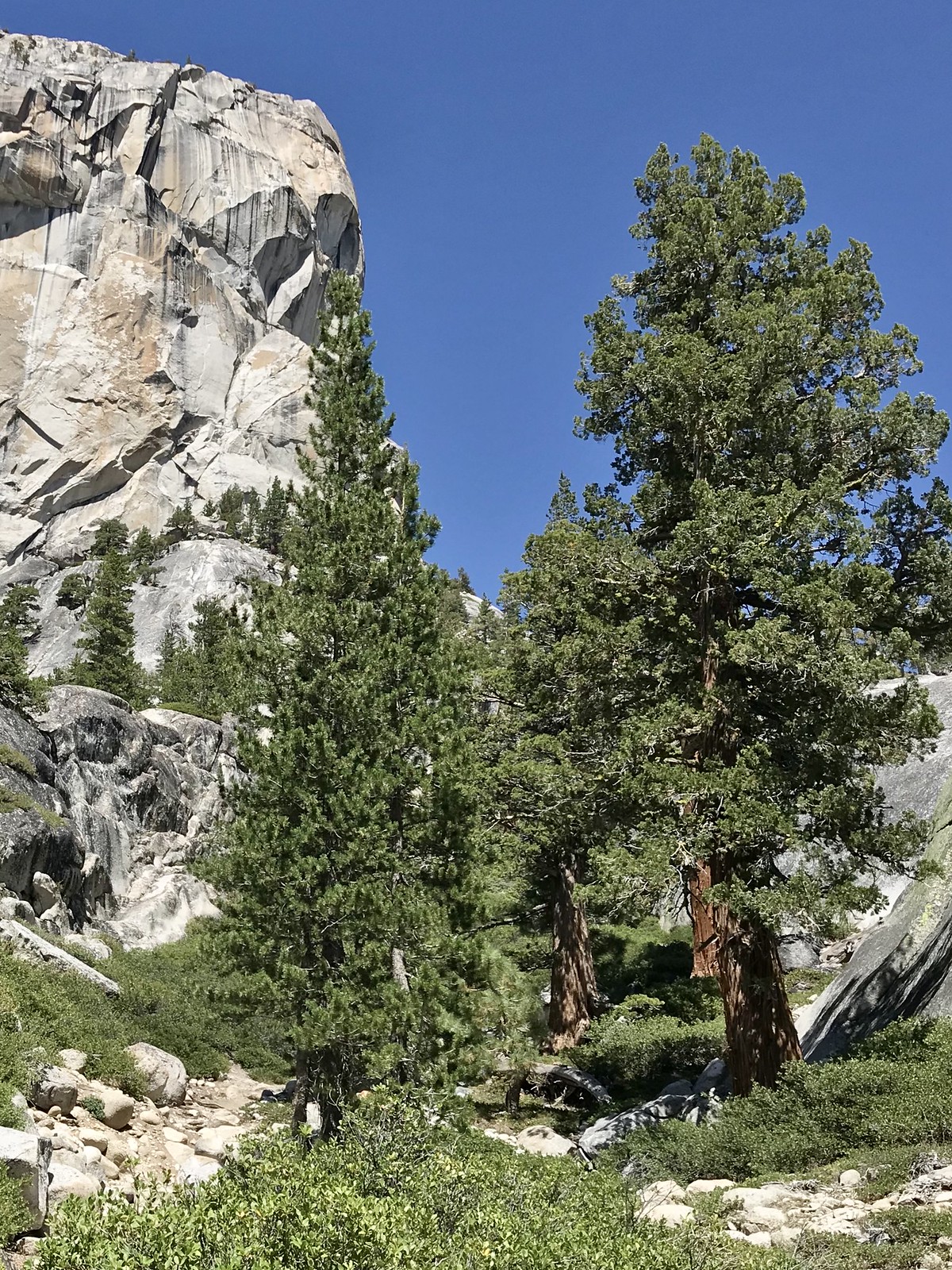
trees ... and granite !

Not far before the end of my hike, I veered off-trail where the river took a lazy bend away from it, and found a nice sand beach to take a quick dip. Back at camp, I filtered some water and had an early dinner, then wandered around taking yet more photos before turning in.

Imagebridge over Conness Creek - sunset

Day 3:
I got packed up early, and made it back to my car in a bit over 3 hours. Funny that I hadn’t much noticed how much downhill travel I experienced on Day 1, but I noticed it now, heading mostly uphill on my return trip.

Leaving Yosemite, I headed back south, taking a nice detour on the June Lakes Loop (and stopping for lunch at June Lakes Brewing Co.) In all, it was a very successful trip.
Last edited by grampy on Wed Aug 12, 2020 9:45 am, edited 1 time in total.
User avatar
windknot
Topix Fanatic
Posts: 1935
Joined: Wed Aug 16, 2006 10:07 pm
Experience: Level 4 Explorer
Contact:

Re: TR: Murphy Creek trail to Glen Aulin (and waterfalls) - July 29-31, 2020

Post by windknot »

Thanks for the report and photos. The views don't look bad to me at all, but then I suppose Yosemite tends to (rightfully) raise expectations in that department.
User avatar
grampy
Topix Regular
Posts: 398
Joined: Tue May 15, 2018 10:45 am
Experience: Level 3 Backpacker
Location: Redondo Beach

Re: TR: Murphy Creek trail to Glen Aulin (and waterfalls) - July 29-31, 2020

Post by grampy »

@windknot -
When I said “dull”, I was referring primarily to the stretch just after my “lined-up stones” photo, up until you climb up from the Cathedral Creek drainage. Quite a bit of this is dense Lodgepole Pine forest, although it eventually transitions (for a while, anyway) to mixed Fir.

Once I got to the Tuolumne, all the views were awesome !
User avatar
SweetSierra
Topix Regular
Posts: 303
Joined: Mon May 16, 2011 12:23 pm
Experience: Level 4 Explorer
Location: Tucson, Arizona

Re: TR: Murphy Creek trail to Glen Aulin (and waterfalls) - July 29-31, 2020

Post by SweetSierra »

Grampy, thanks for the trip report and photos. That's a beautiful trail to Waterwheel Falls. I backpacked it just once. When I lived closer to the Sierra's west side, I backpacked out of Tuolumne Meadows numerous times. At Waterwheel Falls, a bear visited. Even with a low snow year, the falls are gorgeous.
User avatar
The Other Tom
Founding Member
Posts: 970
Joined: Mon Dec 19, 2005 6:06 pm
Experience: N/A
Location: Upstate South Carolina

Re: TR: Murphy Creek trail to Glen Aulin (and waterfalls) - July 29-31, 2020

Post by The Other Tom »

Nice report. Really loved the photos. Thanks for posting
User avatar
Jason
Topix Regular
Posts: 324
Joined: Fri Jun 19, 2009 11:13 am
Experience: N/A

Re: TR: Murphy Creek trail to Glen Aulin (and waterfalls) - July 29-31, 2020

Post by Jason »

Ah! That brings back some good memories. My wife and I backpacked at Glen Aulin about 10 years ago during a high water year, but that came with some flooded trails and mosquitoes. I've always wanted to go back later in the year to swim and fish a bit. Thanks for the report.
User avatar
brianA
Topix Acquainted
Posts: 42
Joined: Sun Jul 10, 2016 4:04 pm
Experience: Level 2 Backpacker

Re: TR: Murphy Creek trail to Glen Aulin (and waterfalls) - July 29-31, 2020

Post by brianA »

Thanks Grampy! Awesome pics! Finally, a pic of the real Waterwheel Falls. Too many people, including rangers, think LeConte is Waterwheel. LeConte has five or six wheels for sure, but the real wheel is beyond that.

For the past two summers I had heard talk of a short cut to Waterwheel/Glen Aulin. I had a free afternoon recently, and decided to try to find it based on the information I had gathered. I did find a short cut, but it was so steep and dangerous, I came to the conclusion that it wasn't worth the risk. While down there exploring near the postpile I surprisingly came across a couple in their mid seventies. My initial thought was how the hell did they make it down that steep, dangerous shoot. And how were they going to get back up? My curiosity got the better of me, so I asked them. It turns out there are two short cuts, a really hard one, and an easy one. They took the easy one. I asked them if I could follow them out, and sure enough, it was so easy. I took some friends down to Tuolumne Falls a few days later laughing all the way at just how easy it is. My educated guess is that it saves about two miles each way, maybe a tad more. Can't wait for the Waterwheel trip next summer.
User avatar
grampy
Topix Regular
Posts: 398
Joined: Tue May 15, 2018 10:45 am
Experience: Level 3 Backpacker
Location: Redondo Beach

Re: TR: Murphy Creek trail to Glen Aulin (and waterfalls) - July 29-31, 2020

Post by grampy »

brianA wrote: Tue Aug 11, 2020 10:49 pm
For the past two summers I had heard talk of a short cut to Waterwheel/Glen Aulin. ... It turns out there are two short cuts, a really hard one, and an easy one. They took the easy one ...
A two-mile shortcut sounds pretty useful if you were doing the trip as a day hike, but getting the actual permit (for Glen Aulin out of T.M. - versus along Murphy Creek) seemed to be more of a challenge than doing the miles. I’m curious if you’re talking about skirting around the east side of Pothole Dome, or something else ?

Anyway, I’m glad some folks enjoyed my TR !
User avatar
balzaccom
Topix Addict
Posts: 2967
Joined: Wed Dec 17, 2008 9:22 pm
Experience: N/A

Re: TR: Murphy Creek trail to Glen Aulin (and waterfalls) - July 29-31, 2020

Post by balzaccom »

grampy wrote: Tue Aug 11, 2020 11:41 pm
brianA wrote: Tue Aug 11, 2020 10:49 pm
For the past two summers I had heard talk of a short cut to Waterwheel/Glen Aulin. ... It turns out there are two short cuts, a really hard one, and an easy one. They took the easy one ...
A two-mile shortcut sounds pretty useful if you were doing the trip as a day hike, but getting the actual permit (for Glen Aulin out of T.M. - versus along Murphy Creek) seemed to be more of a challenge than doing the miles. I’m curious if you’re talking about skirting around the east side of Pothole Dome, or something else ?

Anyway, I’m glad some folks enjoyed my TR !
That's the one I know...it cuts two miles off because you don't have to hike all the way to the Dog Lake/Tuolumne Meadows parking areas
Check our our website: http://www.backpackthesierra.com/
Or just read a good mystery novel set in the Sierra; https://www.amazon.com/Danger-Falling-R ... 0984884963
User avatar
SSSdave
Topix Addict
Posts: 3524
Joined: Thu Nov 17, 2005 11:18 pm
Experience: N/A
Location: Silicon Valley
Contact:

Re: TR: Murphy Creek trail to Glen Aulin (and waterfalls) - July 29-31, 2020

Post by SSSdave »

Thanks enjoyed the photo tour. Nice photo down river from the east end of Glen Aulin.

Supposedly LeConte Falls was the original "waterwheel falls" but somehow the USGS got it wrong. As one of the few that have cross countried down Cathedral Creek and crossed Falls Ridge to view the set of falls from the west versus the east trailside views during early season of a big water year, my own opinion is LeConte is the more photographically aesthetic. During that era I was shooting 35mm Kodachrome film and most of that whitewater work was overexposed or too dark due to the limited exposure latitude. Shooting whitewater landscapes requires experienced strategy even with digital gear that I more recently became successful at.

https://www.davidsenesac.com/2017_Trip_ ... html#jun16

Routes across Falls Ridge are protected by walls of class 3 slabs and considerable chinquapin and manzanita, however I found a class 2 route I've made twice. Traveling between California and Waterwheel Falls early season on that west side is also difficult with bushwhacking because the river overflows into multiple channels not shown on the topo. The reason one sees all those vehicles parked roadside west of the paved Pothole Dome parking is not because people are using such to visit Pothole. Have also backpacked up to Wildcat Point twice from Glen Aulin that is another epic maze to limit bushwhacking.
Post Reply

Who is online

Users browsing this forum: AaronRDavis, jmherrell and 360 guests