Hey there,
My bf and I are planning an east side backpacking trip, that can only happen June 11-15, though now with the late spring/snow levels (and the Tioga rd. not opening anytime soon), I'm wondering what might be possible so early in June... here's what we're looking for:
-4-5 day trip (approx 6-10 miles/day)
-a loop would be preferable but we can park our car at a trailhead and hitch (if necessary) or do some other orchestration car-wise
-a trip that hopefully doesn't require snowshoes?
We've had such a late spring--and I know there's still so much snow--but I'd love to hear any recommendations you might have.
Thanks!
Advice for east side backpacking June 11-15
-
zeta

- Topix Newbie
- Posts: 2
- Joined: Thu May 27, 2010 1:20 pm
- Experience: N/A
-
The Other Tom
- Founding Member
- Posts: 970
- Joined: Mon Dec 19, 2005 6:06 pm
- Experience: N/A
- Location: Upstate South Carolina
Re: Advice for east side backpacking June 11-15
High, Zeta, and welcome to HST 
There's a sticky at the top of the forum.."Rules for requesting trip advice". Read that and then tell us a little more about your abilities, etc. Then you'll get a lot of answers !
There's a sticky at the top of the forum.."Rules for requesting trip advice". Read that and then tell us a little more about your abilities, etc. Then you'll get a lot of answers !
-
zeta
- Topix Newbie
- Posts: 2
- Joined: Thu May 27, 2010 1:20 pm
- Experience: N/A
Re: Advice for east side backpacking June 11-15
oh thanks, guess i posted this too quickly! Here's more info:
Level backpacking: 3-4
Terrain: class 3
Main Interest? big mountain scenery, lakes, forests
I'd love to do a trip that offered easy peak scrambles (class 3, 4) along the way. I do a lot of climbing but my bf is new to climbing, so the trip is strictly backpacking, no climbing.
How many days/nights is your trip, not including travel to trailhead? 5 days (could be 4)
How many miles did you want to do a day, any layovers?
Miles per day? preferably 8-10...prefer no layovers
Did you prefer a loop or out and back trip?
Prefer a loop if possible
Is there a particular area in the Sierra that your most interested in(Yosemite, SEKI
western sierra start or eastern start ect.)?
Not Yosemite (been there a bunch lately); would like to do east side b/c my bf has never been there. Thoughts were northern east side loops (near Mammoth area) but worried that it'll be too early with snow.
Will you be hiking with a dog? Nope
-
Mike M.
- Topix Expert
- Posts: 647
- Joined: Fri May 25, 2007 10:50 pm
- Experience: Level 4 Explorer
- Location: Portland, Oregon
Re: Advice for east side backpacking June 11-15
June 11-15 is very early in the season; most passes will still be snowbound this year well after the July 4th weekend. But if you are willing to struggle through sun-cupped snow (and you enjoy solitude and awesome scenery), it's a great time to go.
Dusy Basin (out of South Lake) would be a good choice, although it's not a loop trip. I'm sure you'll run into lots of snow above 9,500 feet (if not lower), but it is a beautiful area that will not be crowded this year early in the season because of the heavier-than-normal snowpack. That makes it an ideal time to visit in my book. Once in the basin, you could do a loop over Thunderbolt and Knapsack Passes, or just kick back and explore the basin.
A more ambitious and more challenging loop trip (out of North Lake) would be Lamarck Col, Darwin Basin, Alpine Col (or The Keyhole), and out via Piute Pass. This route is sure to get you in a lot of snow, but if you're up for the challenge, it is stunning country and you'll see very few people. I wonder if the road to North Lake will be open by then??
Another option is Mosquito Flat, west of Tom's Place, which has trail heads leading to Ruby Lake (and Mono Pass) or Little Lakes Valley.
Mike
-
gary c.
- Topix Fanatic
- Posts: 1479
- Joined: Tue Jan 24, 2006 4:56 pm
- Experience: N/A
- Location: Lancaster, CA
Re: Advice for east side backpacking June 11-15
Mike M., here is a pic of Mosquito Flat taken Tuesday. The road has only been plowed as far as the horse corrals next to Rock Creek Lake.

It was worth the hike just to see the LLV.
It was worth the hike just to see the LLV.
"On this proud and beautiful mountain we have lived hours of fraternal, warm and exalting nobility. Here for a few days we have ceased to be slaves and have really been men. It is hard to return to servitude."
-- Lionel Terray
-- Lionel Terray
-
quentinc
- Topix Expert
- Posts: 890
- Joined: Tue Nov 01, 2005 10:28 pm
- Experience: N/A
- Location: Los Angeles
Re: Advice for east side backpacking June 11-15
Mike M:
What kind of equipment would you recommend for such a trip? Snowshoes, crampon, ice axe? All of the above or none of the above? As much as I've tromped through the Sierra, I'm sort of a fair weather hiker, so have limited experience with major snow.
Actually, scratch my original idea -- looks like the Horseshoe Meadow Road won't be open for a while
[ I was considering a trip next weekend, but probably would head to Cottonwood Pass, since there would be less snow there than further north. I'm also wondering if enough PCTers have already come through that the trail (once over the pass) would be navigable.]
-
Mike M.
- Topix Expert
- Posts: 647
- Joined: Fri May 25, 2007 10:50 pm
- Experience: Level 4 Explorer
- Location: Portland, Oregon
Re: Advice for east side backpacking June 11-15
Quentinc, I'm up in Portland where it's been a miserable spring, so I can only guess at the conditions on the east side of the Sierras. The Inyo National Forest website had a conditions report it posted last week indicating the snow level was about 9500 feet in the south Sierra, much lower in Yosemite (about 6000 feet, if I remember). I think that report was published around May 20th.
The trailheads at Mosquito Flat are at about 9500 feet. Check with the ranger station -- I think you will find the road will be open there by next weekend. My guess is you'll see lots of snow in shaded areas beginning at about 9500 feet, less in exposed areas.
Hiking in these conditions is much harder than normal trail hiking, but snow adds drama to the landscape and you won't run into hordes of people. Plus it's probably early enough to avoid bad mosquito conditions.
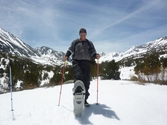
For the original poster who asked about hiking around the middle of June, I would not recommend snowshoes. They are wonderful in fresh snow, but not much use with sun cups and the kind of rutted snow conditions I usually associate with late spring/early summer snowpacks. In open areas (as opposed to shady areas), if you do come across extensive snowfields that are not sun cupped or rutted, you should be able to walk on them without postholing. Footing will be firmer in morning than in the afternoon. That's good to keep in mind if you have to make your way down a steep slope that's covered with snow -- it'll be a lot softer (and safer because you can get a good purchase with each footstep) once the sun has warmed it up.
I usually don't carry an ice axe or ski poles, but both would be worth taking this year.
Q, if you can get your car up there next weekend, I'd give it a try. Let us know what you find!
Mike
The trailheads at Mosquito Flat are at about 9500 feet. Check with the ranger station -- I think you will find the road will be open there by next weekend. My guess is you'll see lots of snow in shaded areas beginning at about 9500 feet, less in exposed areas.
Hiking in these conditions is much harder than normal trail hiking, but snow adds drama to the landscape and you won't run into hordes of people. Plus it's probably early enough to avoid bad mosquito conditions.
For the original poster who asked about hiking around the middle of June, I would not recommend snowshoes. They are wonderful in fresh snow, but not much use with sun cups and the kind of rutted snow conditions I usually associate with late spring/early summer snowpacks. In open areas (as opposed to shady areas), if you do come across extensive snowfields that are not sun cupped or rutted, you should be able to walk on them without postholing. Footing will be firmer in morning than in the afternoon. That's good to keep in mind if you have to make your way down a steep slope that's covered with snow -- it'll be a lot softer (and safer because you can get a good purchase with each footstep) once the sun has warmed it up.
I usually don't carry an ice axe or ski poles, but both would be worth taking this year.
Q, if you can get your car up there next weekend, I'd give it a try. Let us know what you find!
Mike
-
quentinc
- Topix Expert
- Posts: 890
- Joined: Tue Nov 01, 2005 10:28 pm
- Experience: N/A
- Location: Los Angeles
Re: Advice for east side backpacking June 11-15
Thanks Mike. I am far more familiar than I wish I were with sun cups, so I get the picture. (And speaking of fresh snow, I just did a weekend backpack near Big Bear -- around 7000 feet in Southern California -- and we had 3 inches of snow on Sunday!)
Per the Inyo National Forest website, snow level is at 8500 as far south as Horseshoe Meadow, and the road is currently closed. I'll call the Ranger Station mid-week to get a more current report. The Onion Valley road is open, so that's a possibility, but I'm not sure about handling the steep slope on either side of the pass.
Per the Inyo National Forest website, snow level is at 8500 as far south as Horseshoe Meadow, and the road is currently closed. I'll call the Ranger Station mid-week to get a more current report. The Onion Valley road is open, so that's a possibility, but I'm not sure about handling the steep slope on either side of the pass.
-
SSSdave
- Topix Addict
- Posts: 3525
- Joined: Thu Nov 17, 2005 11:18 pm
- Experience: N/A
- Location: Silicon Valley
- Contact:
Re: Advice for east side backpacking June 11-15
On this holiday's recreatation report, every trail listed on the Inyo NF site says "snow above 5000 feet". They also won't be opening the Postpile road until June 18. So the best you and your bf can do is change plans away from the Eastern Sierra. Way toooo early. Instead do some car camping along the Pacific Coast. Easy to do lots of day hiking at places like Sonoma Coast State Beach or Salt Point State Park or further north north at any of the big redwood parks.
-
Wandering Daisy
- Topix Docent
- Posts: 6700
- Joined: Sun Jan 24, 2010 8:19 pm
- Experience: N/A
- Location: Fair Oaks CA (Sacramento area)
- Contact:
Re: Advice for east side backpacking June 11-15
Best coastal backpack is the Lost Coast. There are two parts - about 3 day walk north of Shelter Cove and 3 days south of Shelter Cover. Best to have mid-day low tides so you can walk on the inter-tide zone. Otherwise, walking on dry beach sand is difficult. The north part is nearly all walking on the beach - about 25 miles. There is a shuttle service (expensive but good) that will take you back to your car.
The part to the south is on trails, at times overgrown and with lots of ups and downs, a lot tougher than the northern part - more woodsy rainforest environment with peeks at coast far below. You go through Sinkione Wilderness - come out at Usel Campground -- then walk dirt road to Hwy 1. You start at the top of the hill above Shelter Cover. The logistics of getting back to your car is more difficult.
You are now required to have a permit and take a bear cannister for the Lost Coast north of Shelter Cove. The north part is BLM Kings River Preserve.
Who is online
Users browsing this forum: No registered users and 16 guests