
I'd also like to apologize to the forum members for the extreme lateness of this Trip Report. It's taken me over seven months to get this together! I've had a busy year, I guess. Anyway, this report will have to be made almost entirely of photos with captions, or else I'm never going to get this thing posted!
Day 0: Robinson Lake from Onion Valley
We spent the first day (Day Zero, sort of) picking up our permit in Lone Pine and car-camping in the Onion Valley Campground. We wanted to spend a night at high altitude before the main hike, and figured that a day-hike to Robinson Lake would be fun, since we'd never been there.

Looking northwest over the Onion Valley Parking area from the Robinson Lake Trail, with Kearsarge Peak on the right

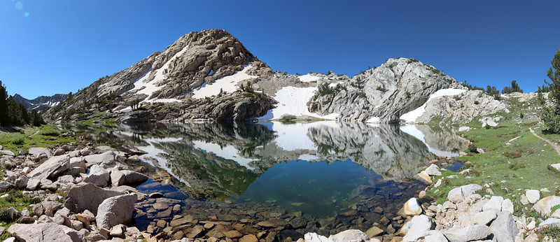
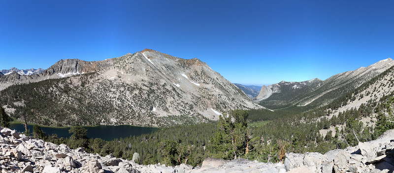
Panorama shot of Robinson Lake. The water was clear and the bottom was blue.
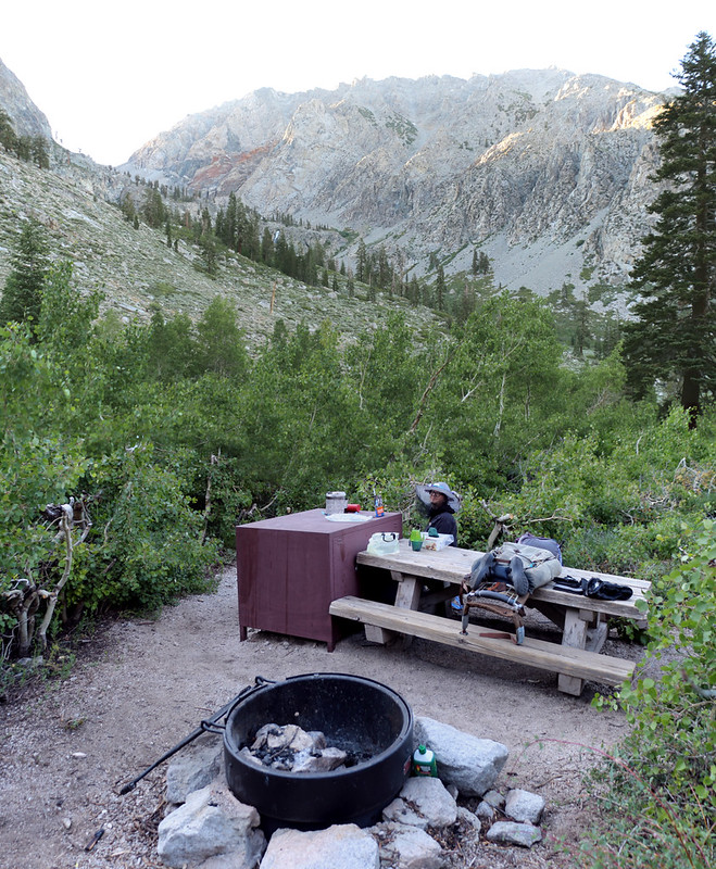
Walk-In Campsite 24 in the Onion Valley Campground - a good way to get acclimated to the hike tomorrow
Day 1: Onion Valley to Flower Lake
My wife, Vicki, is NOT a mighty hiker. She has trouble breathing up high the first few days of a trek, so we planned to take things easy. Thats why we backpacked to Flower Lake the first day. It was only three miles, so we were able to set up camp early. That way we also had time to visit Matlock Lake. It was a very mellow day.
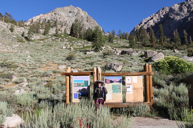
Vicki at the Kearsarge Pass Trail trailhead sign in Onion Valley - ready for seven days of hiking

Looking back toward Onion Valley from the Kearsarge Pass Trail below Gilbert Lake - last chance for Cell Service!

The iconic panorama shot of Gilbert Lake from the big boulder on the western shore

We headed for the south side of Flower Lake to find a secluded campsite, with Mount Gould, center

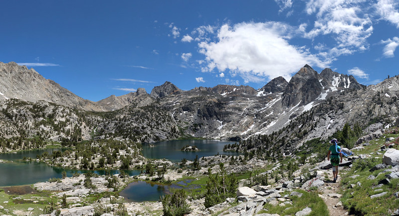
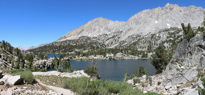
Panorama view of Matlock Lake with University Peak behind it
Day 2: Kearsarge Pass to Glen Pass
We planned a long day of hiking (long for us, only 7 miles, wimps that we are) so we started hiking before dawn in order to get over Kearsarge Pass in the cool of the morning. Then we continued west to the PCT/JMT via the high trail through the Kearsarge Basin, which provided great views the entire way. We headed north on the PCT above Charlotte Lake, with more great views, and continued uphill toward Glen Pass, but stopped to camp at one of the small lakes just south of the pass.

Dawn Alpenglow panorama over Flower Lake

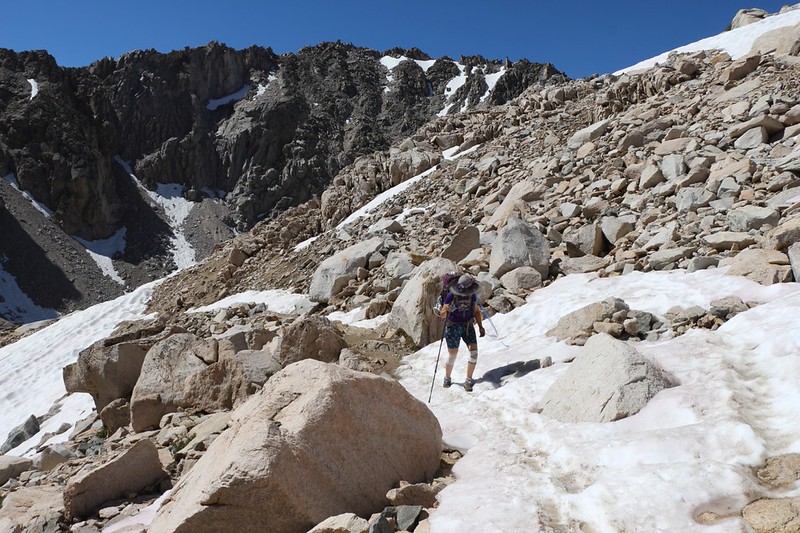
Traversing some icy residual snow on the Kearsarge Pass Trail at 11,000 feet elevation

Heart Lake was far below us as we climbed higher

Big Pothole Lake still had ice left over from last Winter, and it was the end of July!

Vicki entering Kings Canyon National Park at Kearsarge Pass, 11760 feet elevation

View of Bullfrog Lake from the high trail

Timer shot using my phone camera of the two of us posing with Bullfrog Lake

Panorama view of Charlotte Lake, Mount Bago, and Charlotte Dome from the PCT
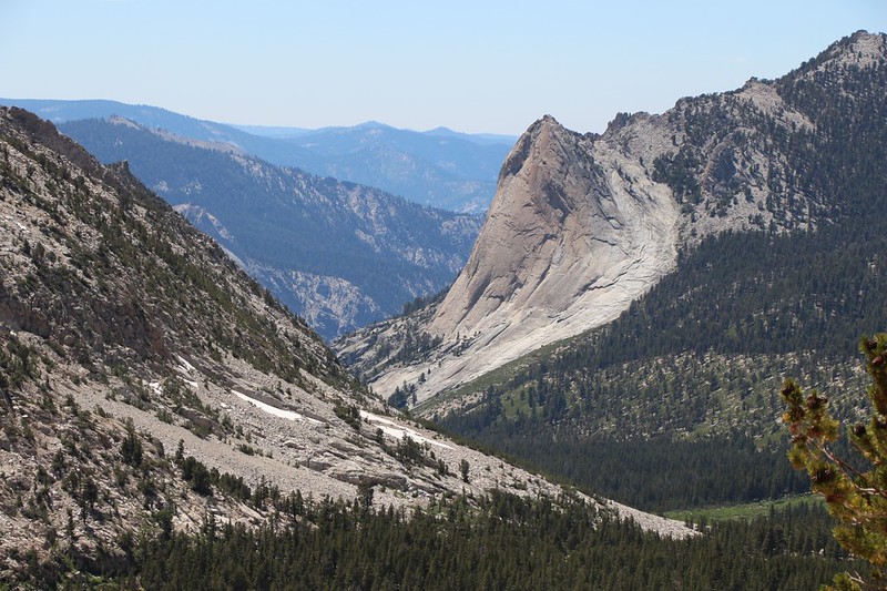
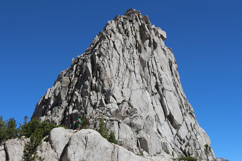
Zoomed-in view of Charlotte Dome. Good old Glaciated Granite.
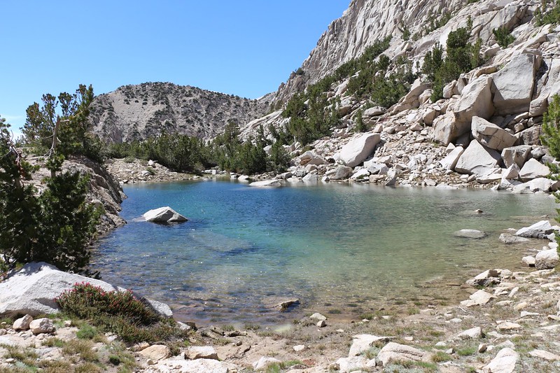
A tarn on the PCT south of Glen Pass. We found a good campsite not far away
Day 3: Glen Pass to Rae Lakes
This was planned to be another short and easy day, less than four miles, up and over Glen Pass, then down to lower Rae Lake, where we hiked along the seldom-visited western shore and discovered a perfectly secluded camping spot on a peninsula jutting out into the lake. We planned to camp there for two nights, which is the maximum allowed. This would be our base camp.

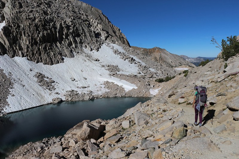
View of the lower lake south of Glen Pass, which still had melting ice

Glen Pass is on the left, and below us is the higher lake, at 11,500 feet
It was 9am and the snow was already soft and melting. The trail crossed the snow several times.

Panorama looking south at the upper lake as we got closer to Glen Pass

The final approach to Glen Pass on the northbound PCT

Panorama view north toward Rae Lakes from Glen Pass

The residual snow on the north slope at the end of July in 2019 - it was a big snow year

So many people hike this trail over Glen Pass that the snow traverse was almost a snow trench!

Looking west at the unnamed lakes in the basin below Glen Pass as we continued downhill
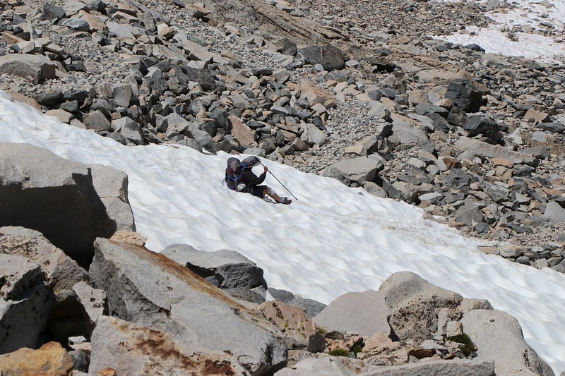
Vicki decided to do a short glissade on the slushy snow to save herself some tedious scrambling

Looking back behind us, south toward Glen Pass

We arrived at Upper Rae Lake, with Black Mountain (left) and Painted Lady (right)

A small lake with Dragon Peak (left) and Painted Lady (right) reflecting on its surface, from the Sixty Lakes Trail

Dragon Peak (with the red streak) from the western peninsula of lower Rae Lake near our campsite
Day 4: Rae Lakes to Sixty Lakes
This was our lay-over day, so we decided to hike up the Sixty Lakes Trail. The original plan (that morning) was to go up and over the pass, then down into the Sixty Lakes Basin. But my wife wimped out once we got up to the pass, and didn't want to go down. Why? Because she'd have to climb back up! The logic was inescapable, I know. So we aborted the downhill part of the plan and made do with viewing the basin from up on high. We decided to head cross-country along the ridge toward Fin Dome, instead. Which we did. But we didn't dare climb on the fin, as we aren't rock climbers, so we admired it up close. Then we hiked over to a parallel ridge to the east and got some great views into the Rae Lakes Basin to the south, as well as Arrowhead and Dollar Lakes to the north. It turned out to be a fun day after all.
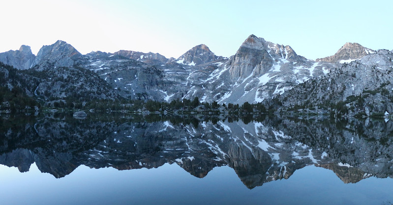
Dawn alpenglow reflection over the Rae Lakes, with Painted Lady right of center
View looking over Upper Rae Lake as we began climbing westward on the Sixty Lakes Trail
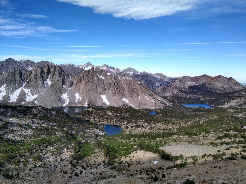
Panorama view of the high lake near the pass on the Sixty Lakes Trail

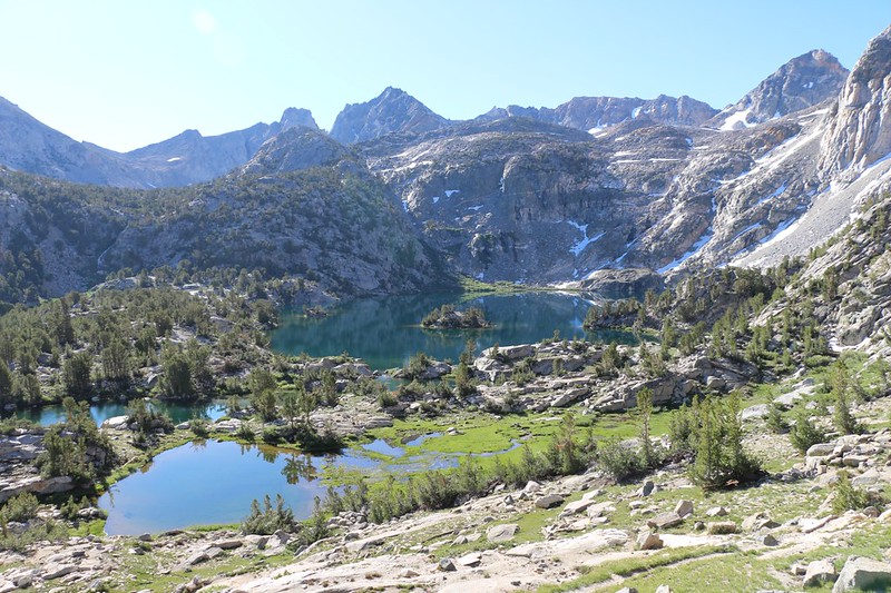
Panorama view looking down into the Sixty Lakes Basin

Panorama of the Smiling Lake (or so we named it), looking east
Vicki standing at the base of Fin Dome on its southern face

Panorama shot of Fin Dome, Arrowhead Lake, Dollar Lake, the lowest Rae Lake, and Diamond Peak

Panorama shot of the Rae Lakes Basin from the high ridge near Fin Dome
Hiking down toward the Rae Lakes on the Sixty Lakes Trail

Painted Lady blushing in the evening alpenglow from our campsite
Day 5: Rae Lakes to Dragon Lake
Technically, we were only allowed to camp at the Rae Lakes for two nights, but we really wanted to explore the area more, so we figured out a way to bend the rules a bit. We decided to day-hike to Dragon Lake, then when we came back to the campsite, we'd pack up everything and hike another mile or so south on the PCT to set up camp just this side of Glen Pass.
The only thing we hadn't counted on was that the trail to Dragon Lake was utterly unmarked and unmaintained! Using the GPS, we almost got cliffed-out at a waterfall, but we eventually managed to ignore the USGS track and find the actual trail, which was faint but much easier hiking. And Dragon Lake turned out to be a beautiful spot, with good campsites and a lot of fish in the lake.

Dawn light reflecting on lower Rae Lake as Vicki cooked breakfast - we wished this was the view from our kitchen!

Reflection of Painted Lady in upper Rae Lake with a small rocky island, from the PCT/JMT
Looking northwest into the Rae Lakes Basin from the Dragon Lake Trail, Fin Dome right of center

Panorama view of Dragon Lake and Dragon Peak
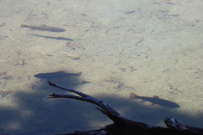
Several trout swimming along the shore of Dragon Lake - if you came here you'd have the lake to yourself

Painted Lady (left), Glen Pass (center) and upper Rae Lake from the Dragon Lake Trail

It was just after noon when we arrived back in camp and finished packing - time to leave Rae Lakes
Heading south on the PCT as we leave the Rae Lakes Basin, with Diamond Peak and Black Mountain

Our tent and campsite at 11300 feet elevation, just to the north of Glen Pass - yes, that is Glen Pass, center
Day 6: Glen Pass to Kearsarge Lakes
This was another long day for us, so we got up in the dark and started hiking before dawn. We wanted to climb it when the air was cool, but it turned out to be freezing cold that morning. The snow was solid ice. After climbing to Glen Pass, we continued south on the PCT past Charlotte Lake, and eventually headed east on the Bullfrog Lake Trail. Then we continued onward to the Kearsarge Lakes, where we spent our last night on the trail. We explored the lakes, and ended up having a really fun day.

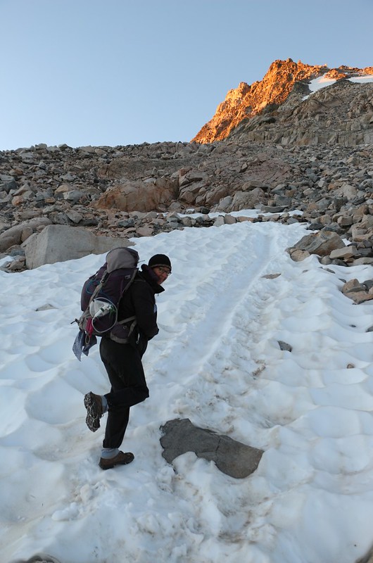
We finished packing up before 5am and started hiking up and over Glen Pass
Three days ago Vicki glissaded down this slushy chute, but now she climbs the solid ice with her Microspikes

Panorama view from the trail to Glen Pass, with Diamond Pk, Black Mtn, Painted Lady, and Mt Rixford

Looking back down the icy snow on the final traverse to the pass

Polemonium (Sky Pilot) flowers in the morning sunshine on top of Glen Pass

Our final view of the Rae Lakes Basin from Glen Pass - Good-bye Rae Lakes! You were beautiful!

Looking south from Glen Pass at the high lake - the PCT crosses the snow patches on the right side, below
We arrived at the lower lake south of Glen Pass - four days ago there were still large floating icebergs, all melted now
Panorama view of Charlotte Lake, Mount Bago, and Charlotte Dome

Looking south into the Bubbs Creek Valley, with Center Peak (left) and East Vidette (right) just before leaving the PCT

Vicki gets into the prone position for serious photo shooting over a small pond near Bullfrog Lake

Bullfrog Lake panorama from the northeast corner

View from our campsite at the Kearsarge Lakes, with Kearsarge Pass (far left) and Peak 12423 (right of center)

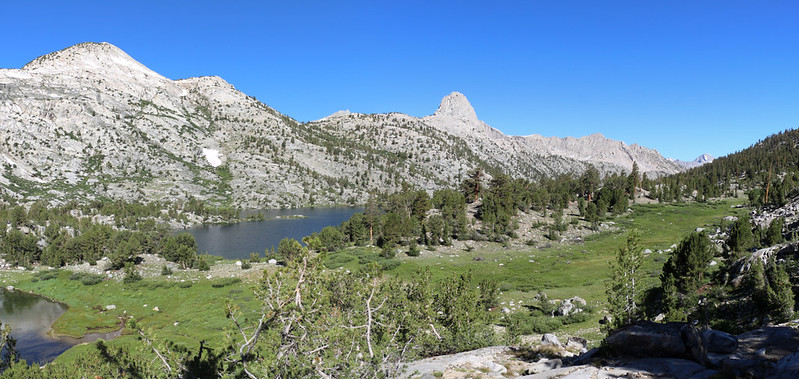
Kearsarge Lakes (Lake 10896) and the Kearsarge Pinnacles

View west down the Kearsarge Basin with Bullfrog Lake in the distance and Mount Rixford on the far right
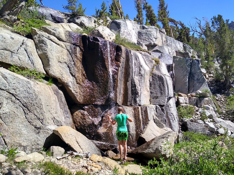
Vicki thought that she might want to try taking a shower under this small waterfall - but it was way too cold! Brrr!
Day 7: Kearsarge Lakes to Onion Valley
This was our final day of hiking. All we had to do was climb up and over Kearsarge Pass, then continue downhill another five miles until we were back at the car in Onion Valley. In case you hadn't noticed, Vicki prefers to hike uphill in cooler weather, to avoid overheating, so we tend to start early when there's a lot of climbing to do. And today was no exception.

We woke up extra early, at 4am, in order to climb over Kearsarge Pass while it was still cool

Looking back down at the Kearsarge Lakes from the trail, with the alpenglow on the Kearsarge Pinnacles

Hiking east on the Kearsarge Pass Trail, with Kearsarge Pass (notch on the upper left) and Peak 12423 (right)
One more view of the Kearsarge Basin as we prepare to head east over Kearsarge Pass and down to the car
View south along the rocky ridge at Kearsarge Pass, with University Peak and Peak 12423

Big Pothole Lake (11257 feet elevation) still has floating ice and it's already August

Vicki and Big Pothole Lake as we continue down the switchbacks

Heart Lake and University Peak
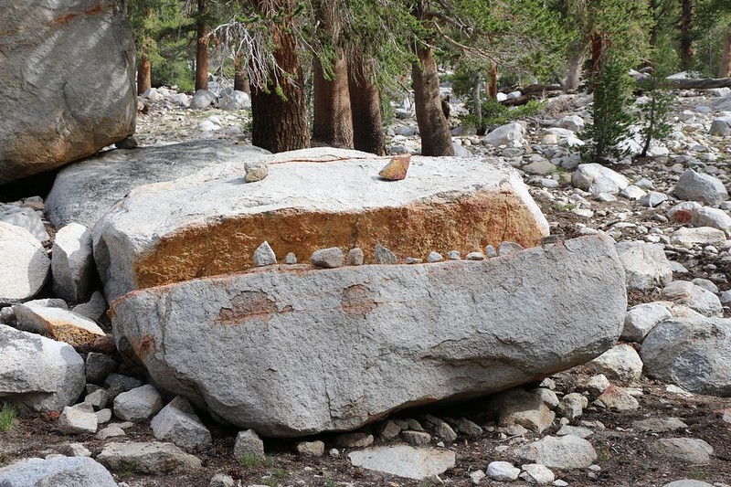
Whimsical Rock Monster on the northern shore of Flower Lake, just below the main trail

Gilbert Lake, always a joy to visit
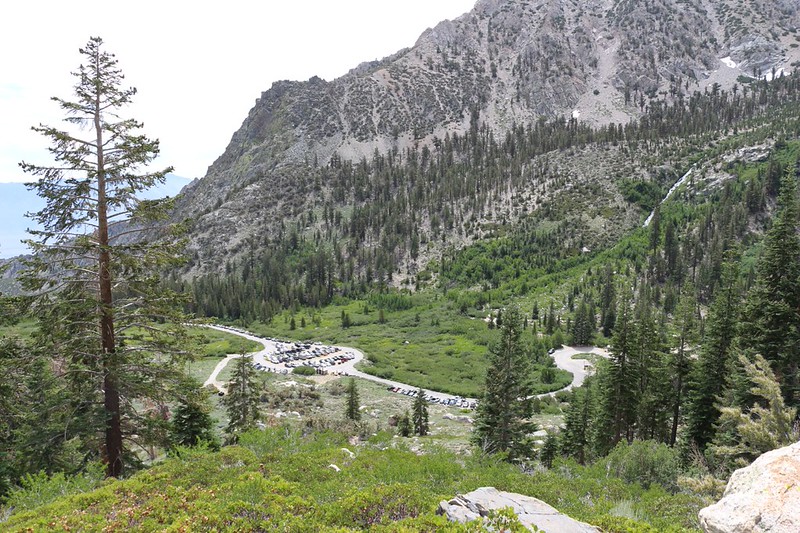
We can see our car near the trailhead in Onion Valley. A great week of hiking is over.
All in all, it was a lot of fun. And I have come to realize, from reading many other trip reports on this site, that most forum members consider the Rae Lakes area to be exceptionally pretty, but also too crowded, over-visited, etc. and therefore not worth it in the end. But how was I to discover the truth for myself? In the only way possible, by going there at least once in my life. So I did, and I'm really glad I did. All it took, in order to retain all of the beauty and none of the downsides was to camp where no one else goes. Namely: The far side of the lake. So simple, really. This strategy worked out great, and we had an excellent time in the wilderness.
Thanks for reading!
For a topographic map of the hike see my CalTopo Page
For LOTS more photos (and videos) of the trek see my Flickr Page
.


